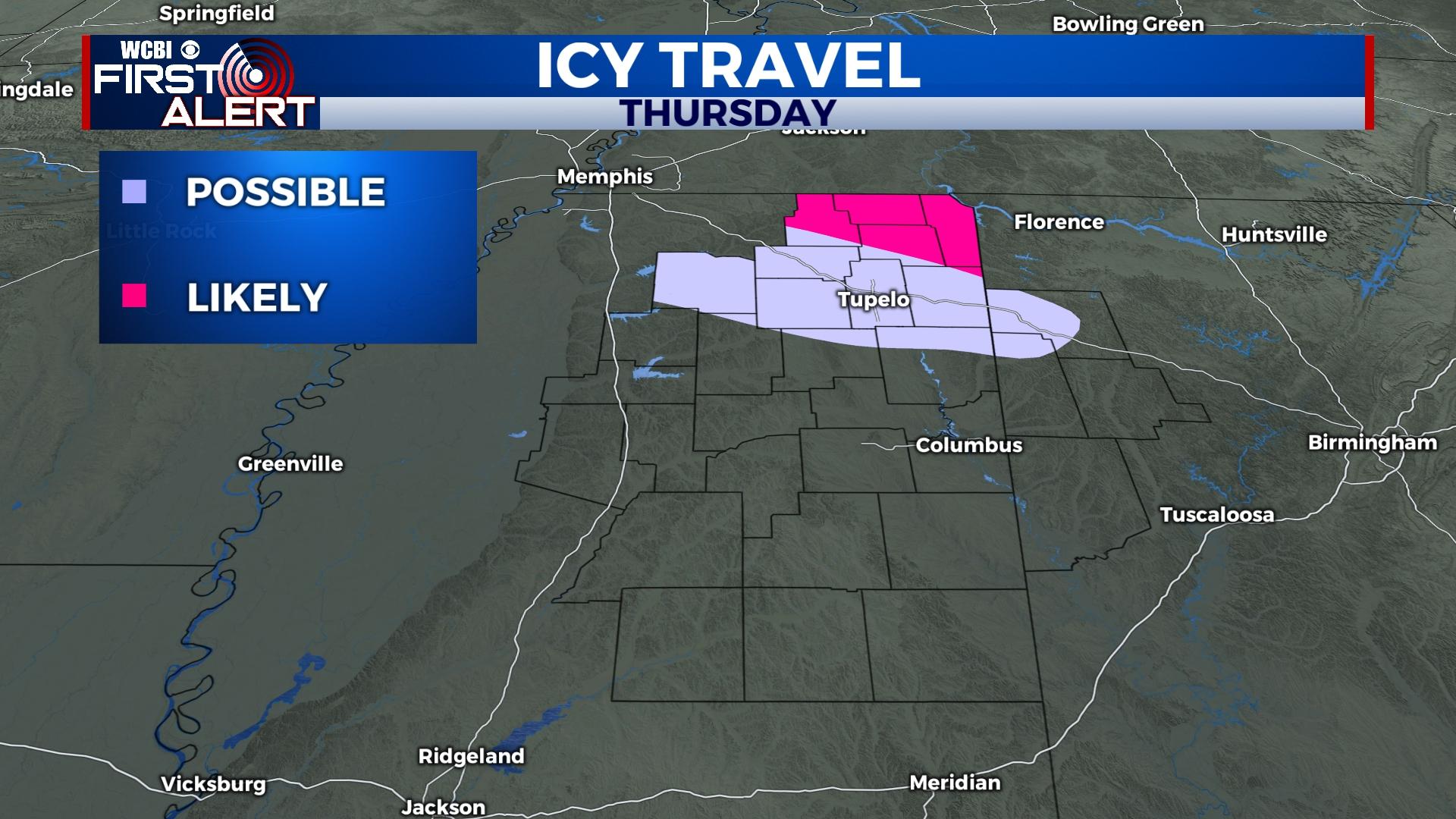
Wintry precip threat for far northern MS as bitter cold air arrives
COLUMBUS, Mississippi (WCBI) – A threat for wintry precip, including freezing rain and sleet, continues for far northern MS Thursday as bitter cold air moves into the region.
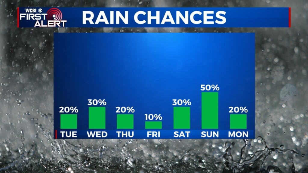
THURSDAY: Rain is likely for much of the area during the morning hours. As colder air arrives, showers could change over to freezing rain or sleet for areas along/north of US 278 before midday. Precip. intensity should remain fairly light and should end this afternoon; however, temperatures will be plunging toward and below freezing, creating a threat for slick roads in the winter weather advisory area. A few snowflakes could fly as precip. ends as well, but no accumulating snow is expected.
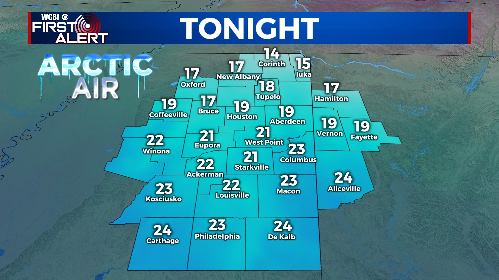
THURSDAY NIGHT: Mostly clear and bitterly cold. Temperatures will likely reach the teens and low 20s with wind chills ranging from 5-19 degrees.
FRIDAY: Mostly sunny and chilly with highs staying in the upper 30s.
WEEKEND: Saturday should be a decent day with temperatures in the 50s and a partly cloudy sky. It turns warmer Sunday with highs back in the 60s, but scattered to numerous showers and storms are expected. The good news is no severe storms are currently anticipated.
NEXT WEEK: Another shot of cold air arrives by Monday with highs back in the 40s and lows in the 20s. Gradual warming is expected through mid-week.