2 rounds of cold fronts bring us into low 70s
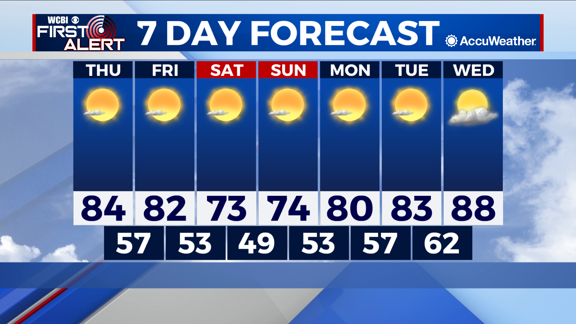
COLUMBUS – SUMMARY: Highs drop from the mid 80s to low 70s over the weekend thanks to two rounds of cold fronts. Plentiful sunshine throughout the next 7 days however means that any cooling will be short-lived. Highs return to the upper 80s by next Wednesday.
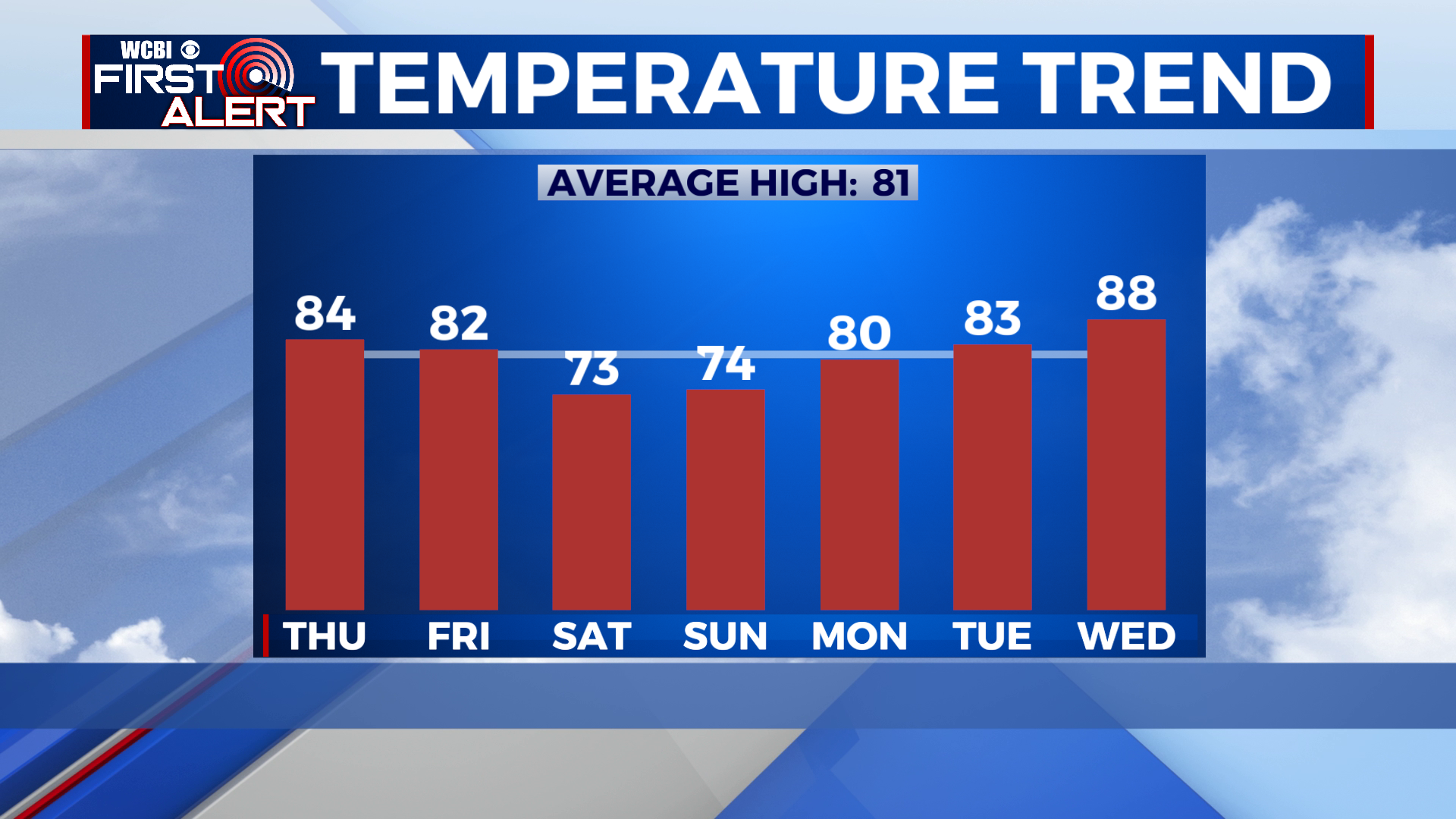
THURSDAY: Highs in the mid 80s accompany mostly sunny skies as our warming trend continues. Our first cold front of the week will arrive around midday, and prevent will prevent any further warming Thursday. Lows bottom out in the upper 50s overnight.
FRIDAY: A slight improvement in temperature brings us into the low 80s Friday afternoon, thanks to Thursday’s cold front. Plentiful sunshine and no rain chance define the skies. Lows hit the low 50s overnight.
WEEKEND: A second, more robust cold front awaits Saturday morning. Highs take a big hit as a result, warming only into the low 70s during the day. Lows likewise will be knocked into the upper 40s by overnight Saturday. Mostly clear skies and no rain chance is expected this weekend.
NEXT WEEK: The respite will be brief, as the clearing pattern along with dry conditions means that highs will rocket back into the upper 80s by next Wednesday. Lows will also slowly climb into the low 60s by overnight Tuesday.