Clouds move back in Thursday ahead of Friday’s rain chances
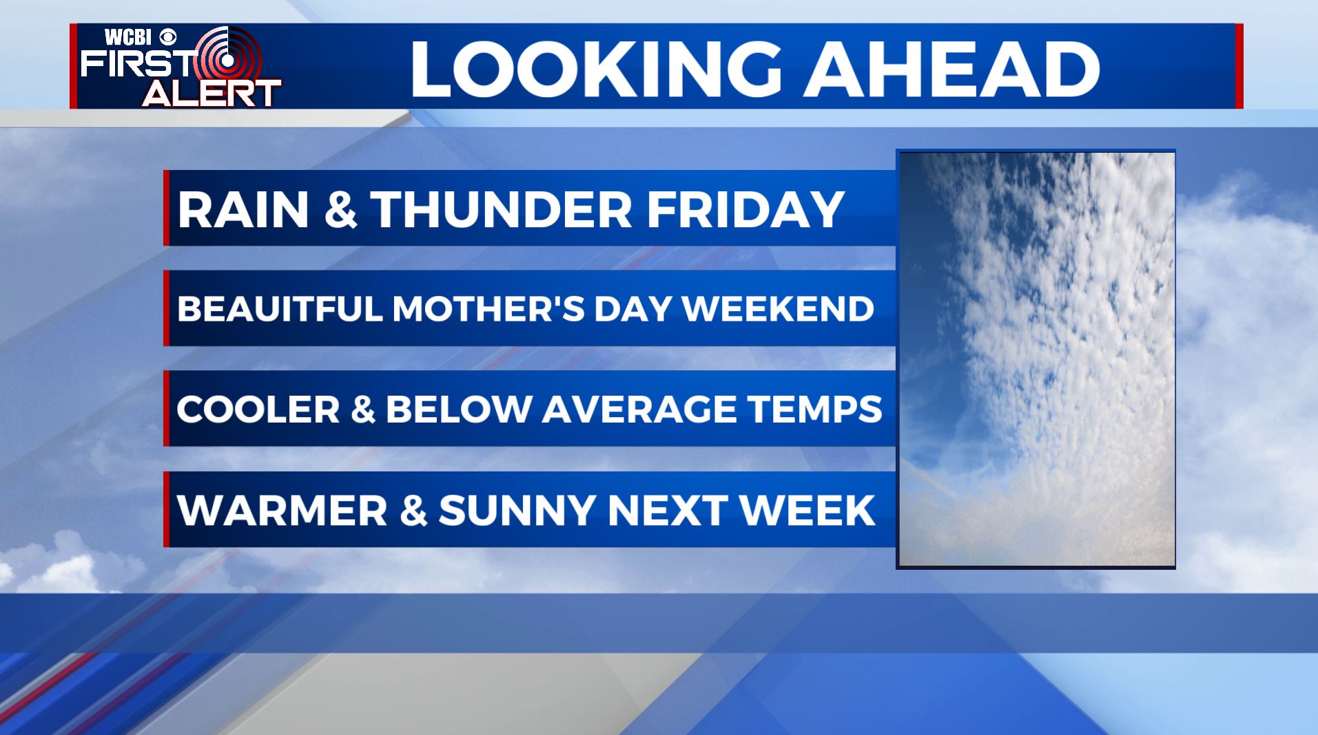
SUMMARY: Sunny and pleasant weather continues for Thursday. The one exception of this quiet weather pattern will come Friday with our next cold front, bringing the return of showers & thunderstorms. Mother’s Day weekend will be cooler but beautiful with lots of sunshine.
THURSDAY: We’re waking up to mostly sunny skies & chilly temperatures this Thursday morning. Clouds will start moving in by the afternoon & evening ahead of our next storm system that will bring rain & storm chances on Friday. Highs a bit warmer in the lower to mid 70s thanks to a light NW to SW wind.
THURSDAY NIGHT: Cloud cover continues to increase. Not as chilly with lows in the 50s. Winds S 5-10 mph.
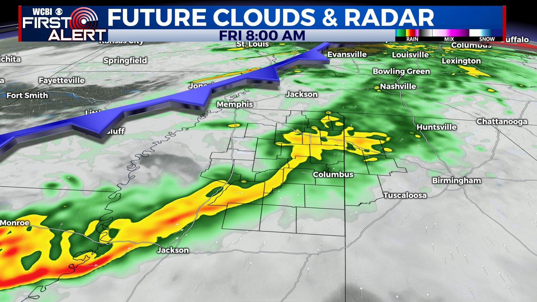
FRIDAY: Areas of rain and thunder. No severe weather is expected. Rainfall during the day may range from 1/2″ to 3/4″. Another shot of cooler air filters in with highs only topping out in the upper 60s.
FRIDAY NIGHT: Clearing skies. Chilly overnight lows in the upper 30s to lower 40s.
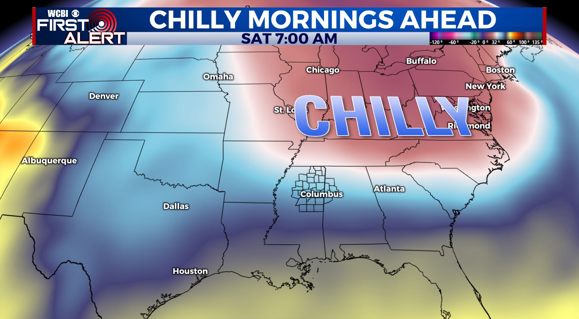
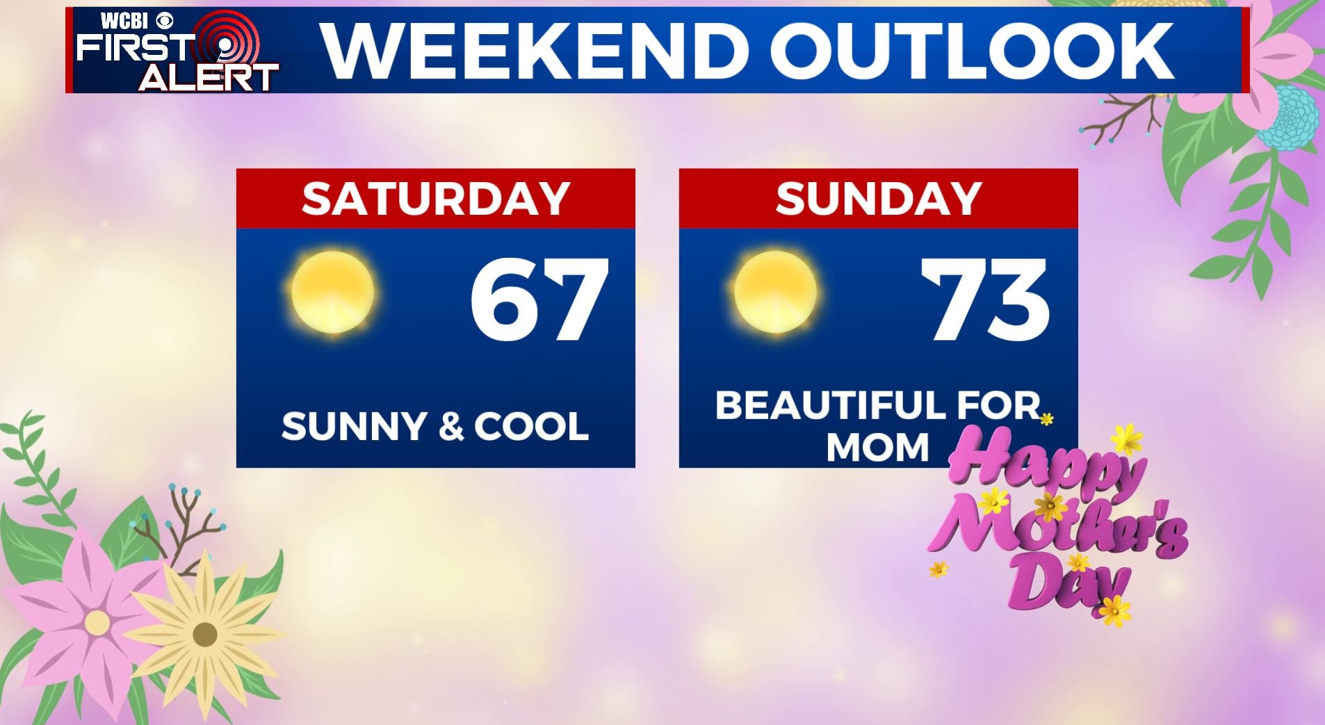
SATURDAY: Sunny and cool. Highs mainly in the mid to upper 60s.
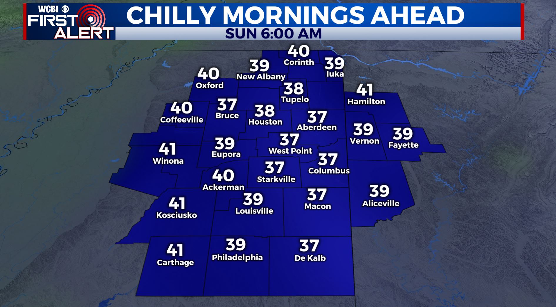
SATURDAY NIGHT: Clear and chilly. Lows in the upper 30s to around 40. New record lows could be established.
MOTHER’S DAY SUNDAY: Sunny skies. Pleasant and beautiful for mom. Highs in the lower to mid 70s.
EARLY NEXT WEEK: Staying quiet as we begin a new week. Mostly sunny skies on Monday followed by partly sunny skies on Tuesday. Temperatures slowly warming back up to the mid 70s.
WEDNESDAY: Continued sunshine with a return to the 80s for high temperatures.
Stay connected with @WCBIWEATHER on Facebook, Twitter, Instagram, and the WCBI News App


Leave a Reply