Severe Storms Thursday
SUMMARY: Storms will develop tonight and continue during the day Thursday. The greatest risk of severe weather will be from late Thursday morning through the afternoon and into the early evening. All modes of severe weather, including tornadoes, remain on the table.
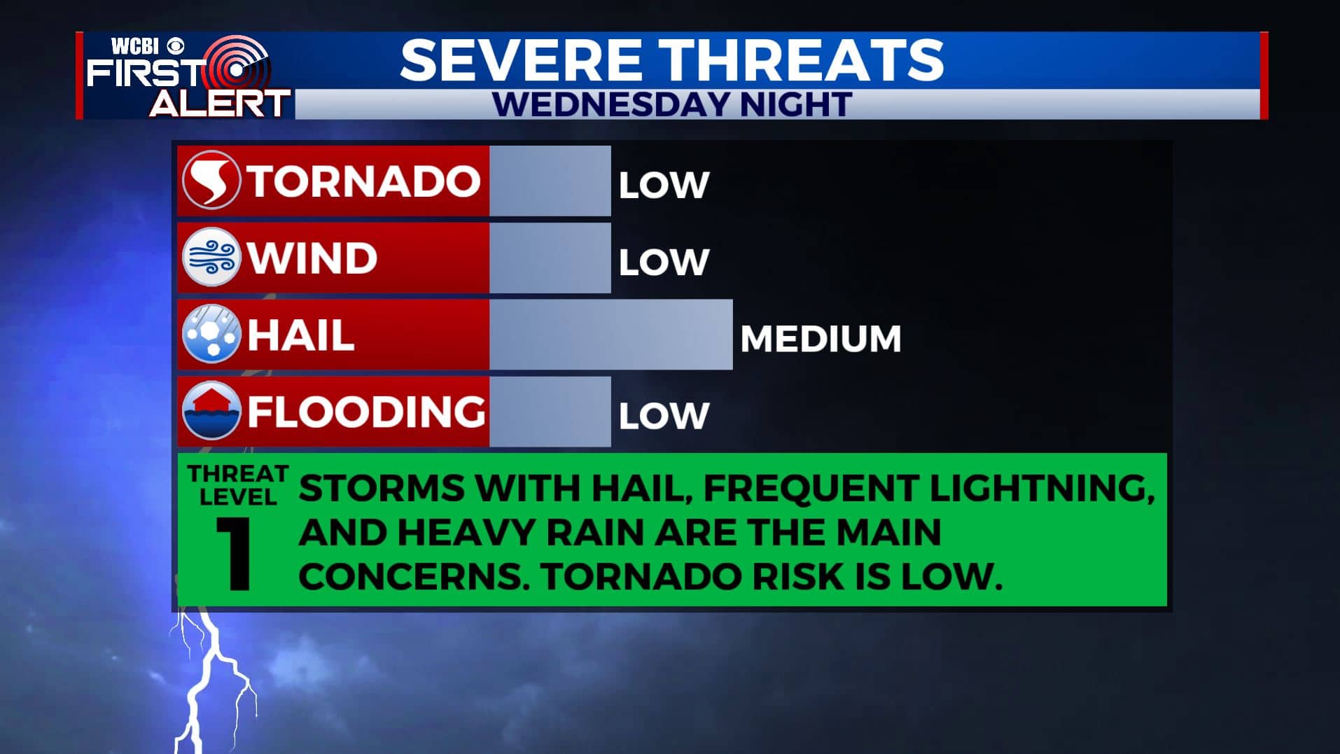
WEDNESDAY NIGHT: A band of rain and storms will develop along a warm front that will push from south to north across our region. The activity should really blossom after midnight. The strongest storms may contain hail and gusty winds. The tornado risk will remain low but it’s never zero in this setup. Lows will be in the low 60s with increasing southerly winds.
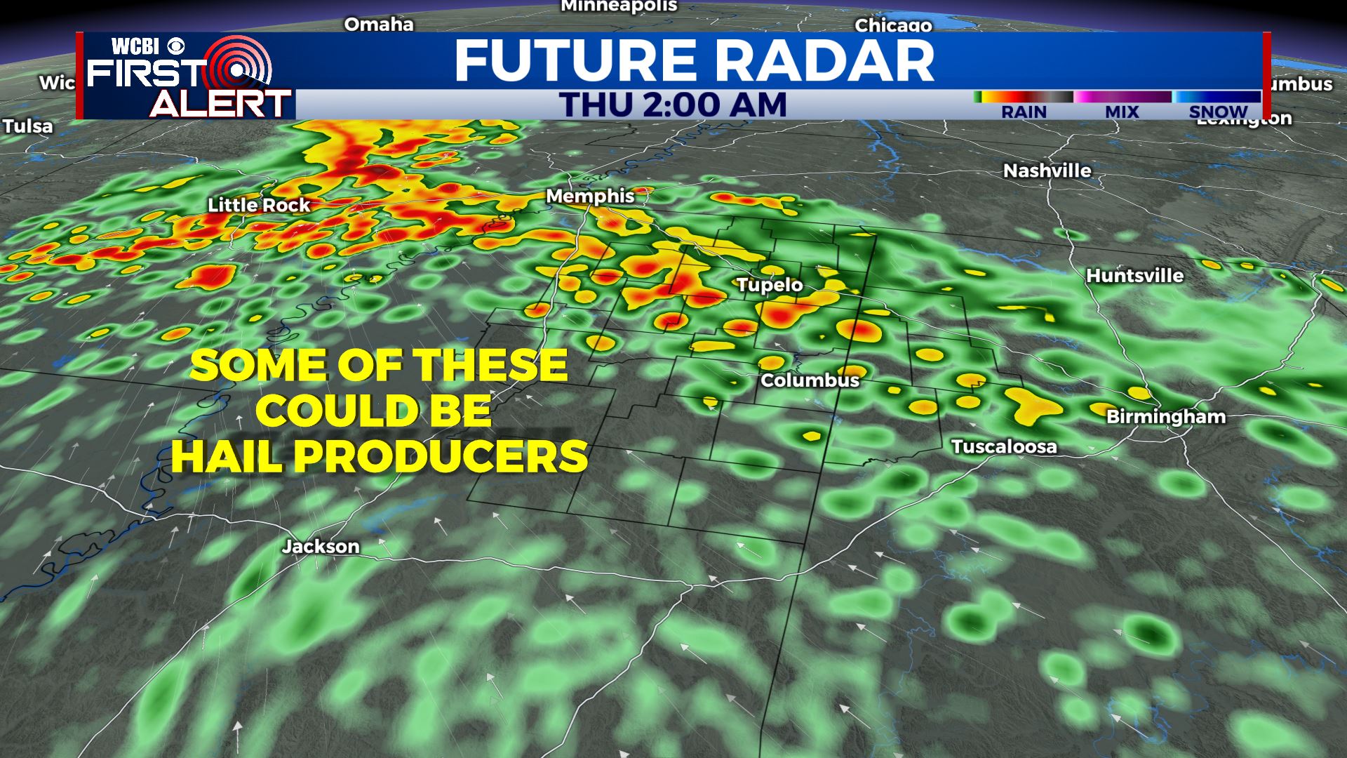
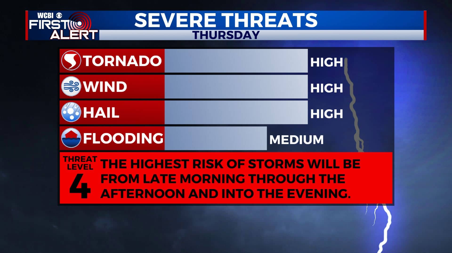
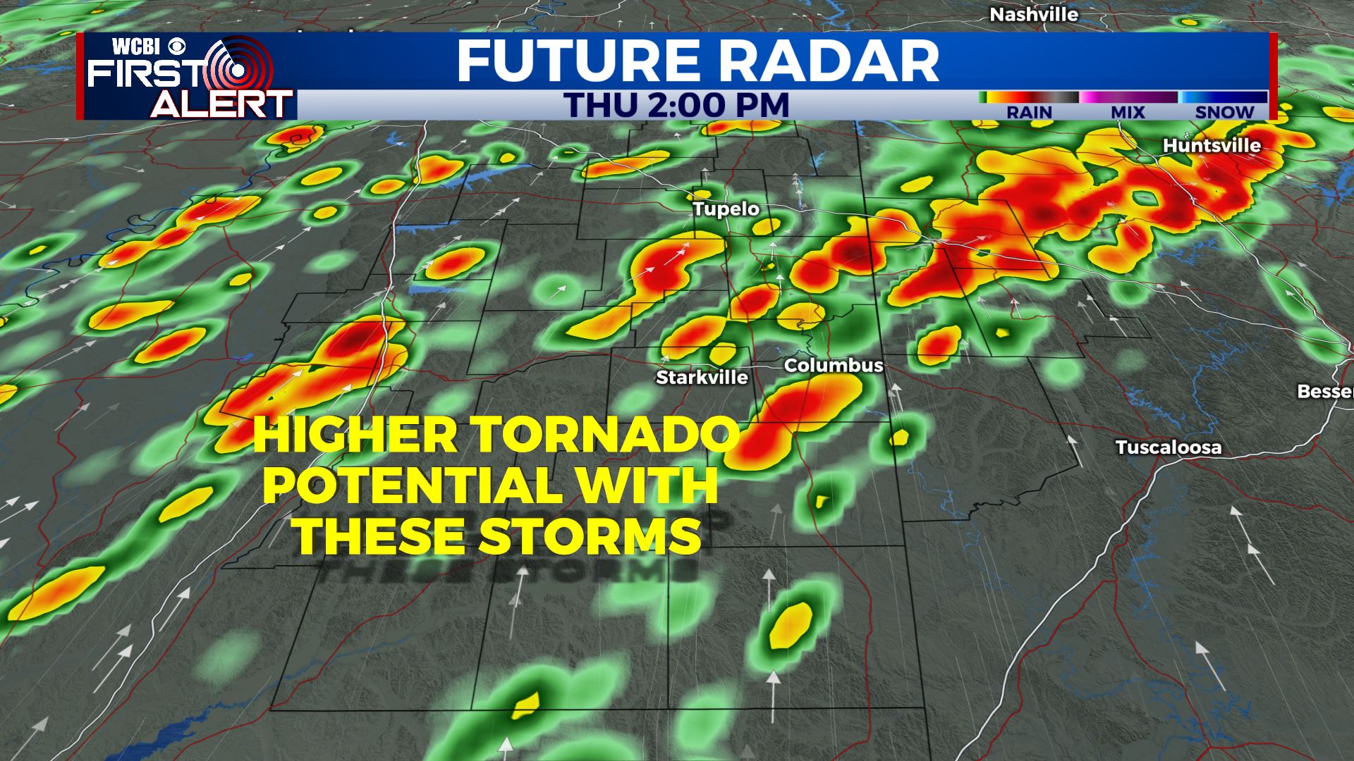
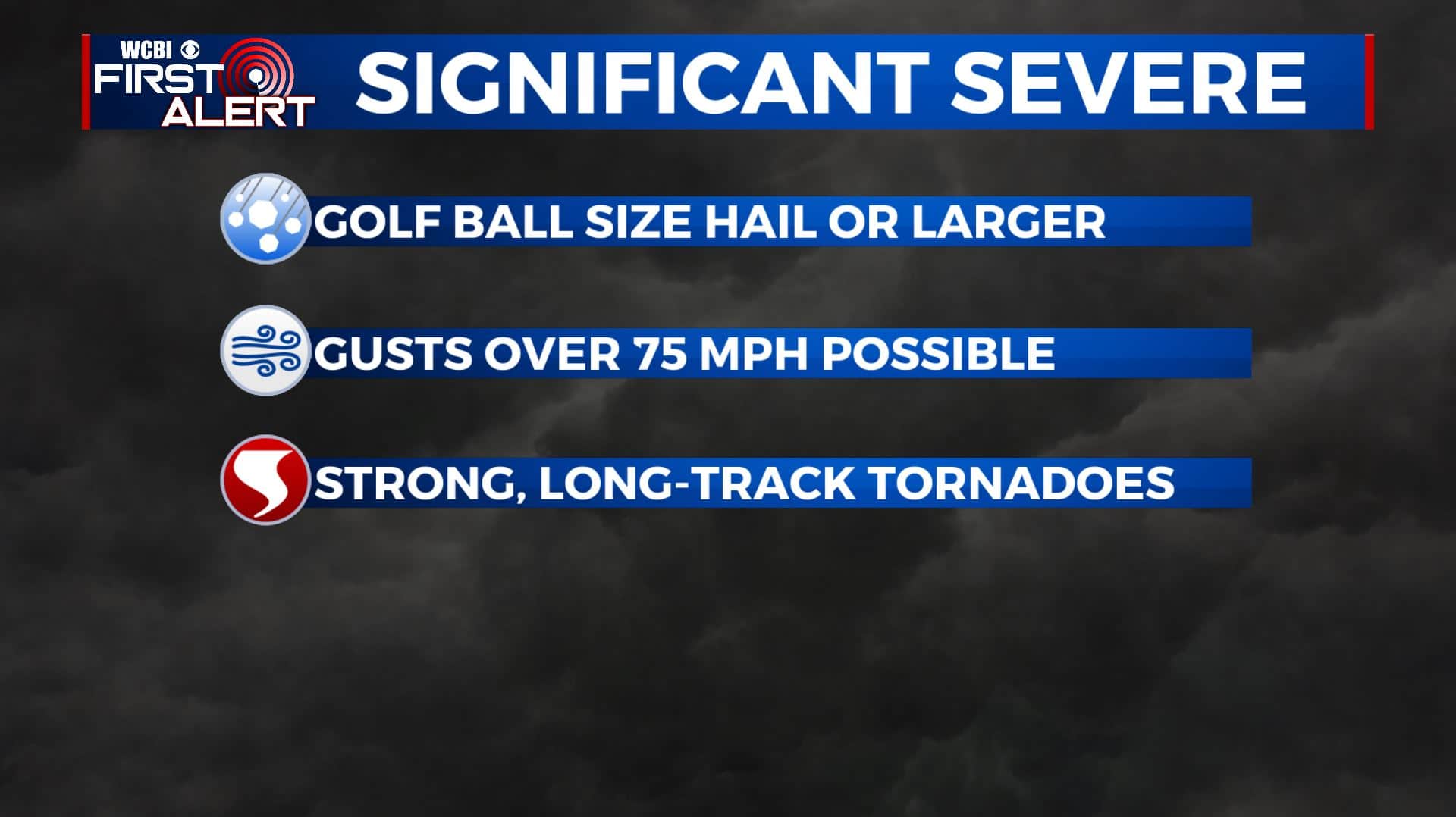
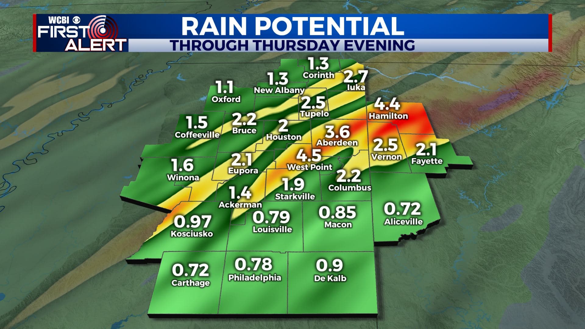
THURSDAY: Widespread rain and storms are likely. The greatest severe threat will be from about 10 or 10:30 AM through 7 or 8 PM. All modes of severe weather are possible, including tornadoes. There could be some significant severe weather including golf ball size hail or larger, wind gusts over 75 mph, and strong, long-track tornadoes. Rainfall between 1-3″ with higher amounts could also lead to flooding. Southerly winds 15-25 with gusts over 30 mph are possible all day, even outside of any storm. Look for highs in the upper 70s.
THURSDAY NIGHT: Partly cloudy and quiet. Lows in the upper 40s to low 50s by sunrise Friday. Winds gradually relax.
FRIDAY: A pretty nice and sunny day overall with a few friendly clouds. Highs in the mid to upper 70s.
FRIDAY NIGHT: Some storms are possible late in the evening through the week hours of Saturday morning. Some isolated strong storms with hail could once again be an issue. Lows in the upper 50s.
WEEKEND: We’re keeping rain and storms in the forecast. Look for highs around 80 Saturday with cooler low 70s on Sunday. Clearing skies should take place during the 2nd part of Sunday.
Follow @WCBIWEATHER on Facebook, Twitter, Instagram, and the WCBI News App. We’ll provide LIVE tornado warning coverage on TV and ONLINE if it occurs in our coverage area.


Leave a Reply