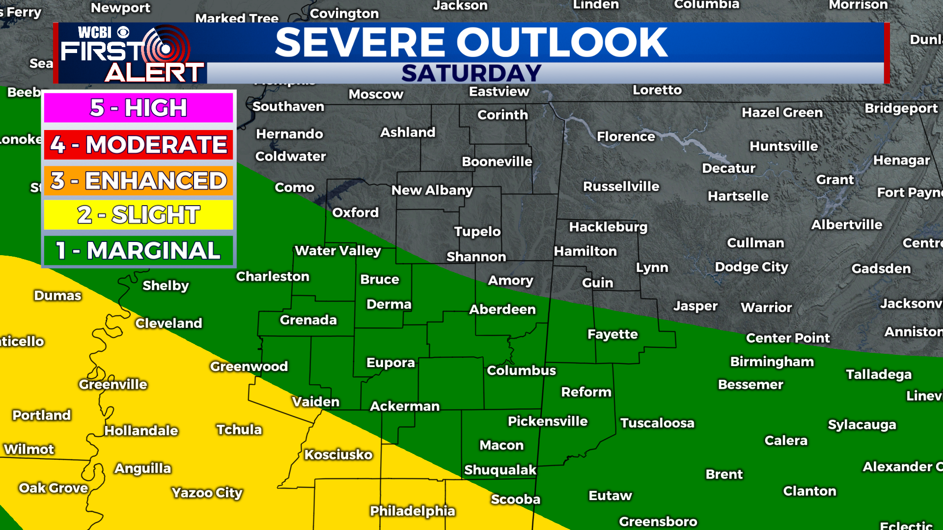
Storms arrive tonight then increase across the region this weekend
COLUMBUS, Mississippi (WCBI) – SUMMARY: It was another beautiful day with a partly cloudy sky and highs in the mid-70s. Rain chances increase tonight and last through the weekend.
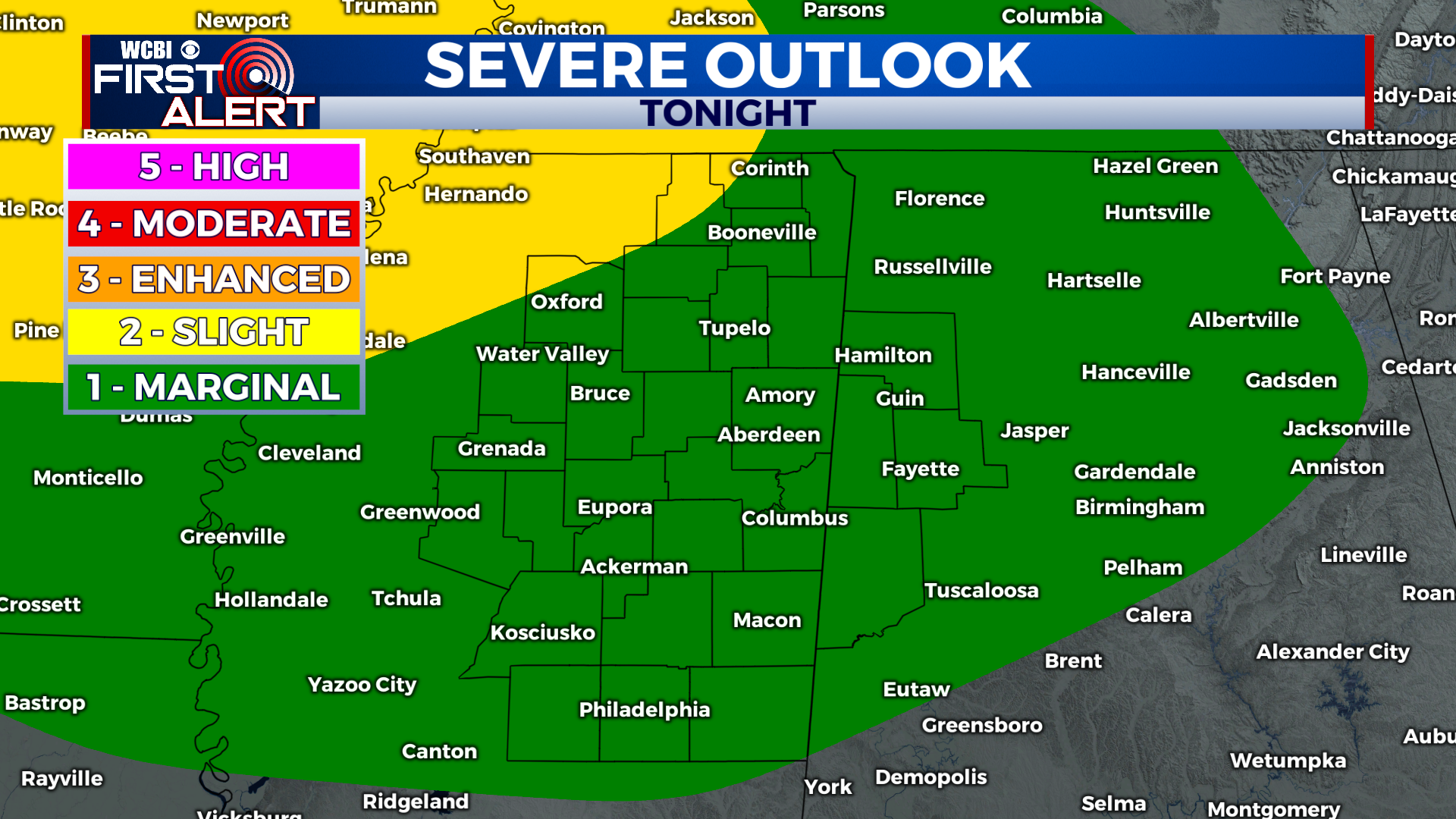
TONIGHT: Scattered showers and thunderstorms, especially after midnight. Lows in the mid-50s. Chance of rain: 40% early, then 60% after midnight.
SATURDAY: Scattered afternoon showers and thunderstorms. Highs in the upper-70s. South winds 5-10 mph. Chance of rain: 60%.
SATURDAY NIGHT: Variable clouds with thunderstorms ending early. Lows in the upper-50s. Calm winds. Chance of rain: 70%.

SUNDAY: Scattered afternoon showers and thunderstorms. Highs in the low-70s. South winds 5-10 mph. Chance of rain: 70%.
SUNDAY NIGHT: Showers and thunderstorms likely. Lows in the low-50s. Variable winds 5-10 mph. Chance of rain: 60%.
EXTENDED FORECAST: Scattered showers and thunderstorms will persist through the weekend, but we will replace the active weather pattern with cooler and drier air next week. Monday’s high temperatures will be in the mid-60s with decreasing clouds through the afternoon. Cooler temperatures will continue on Tuesday, then we begin a warming trend the second half of the week.