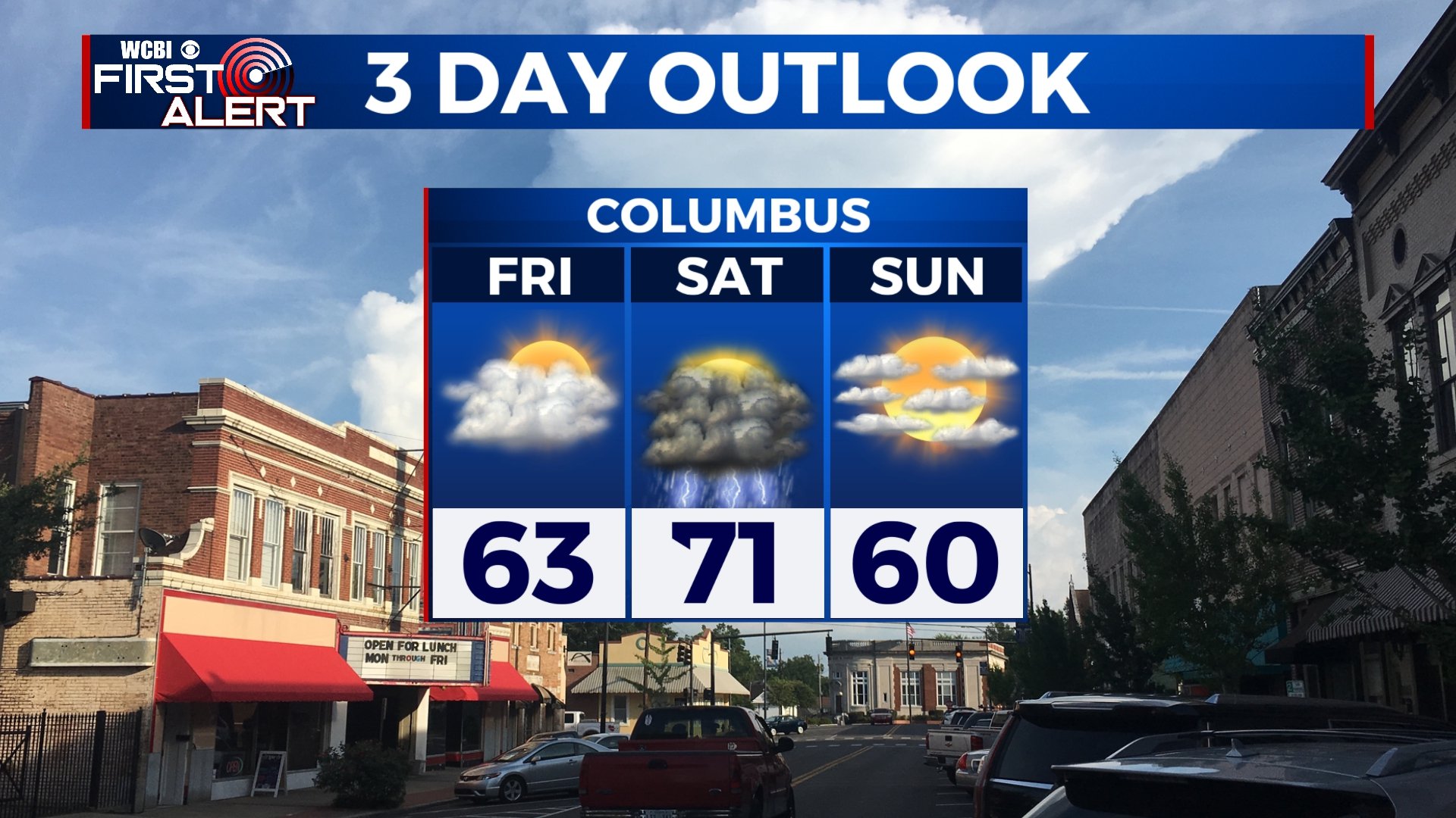
Cloudy Friday, Strong Storms Saturday
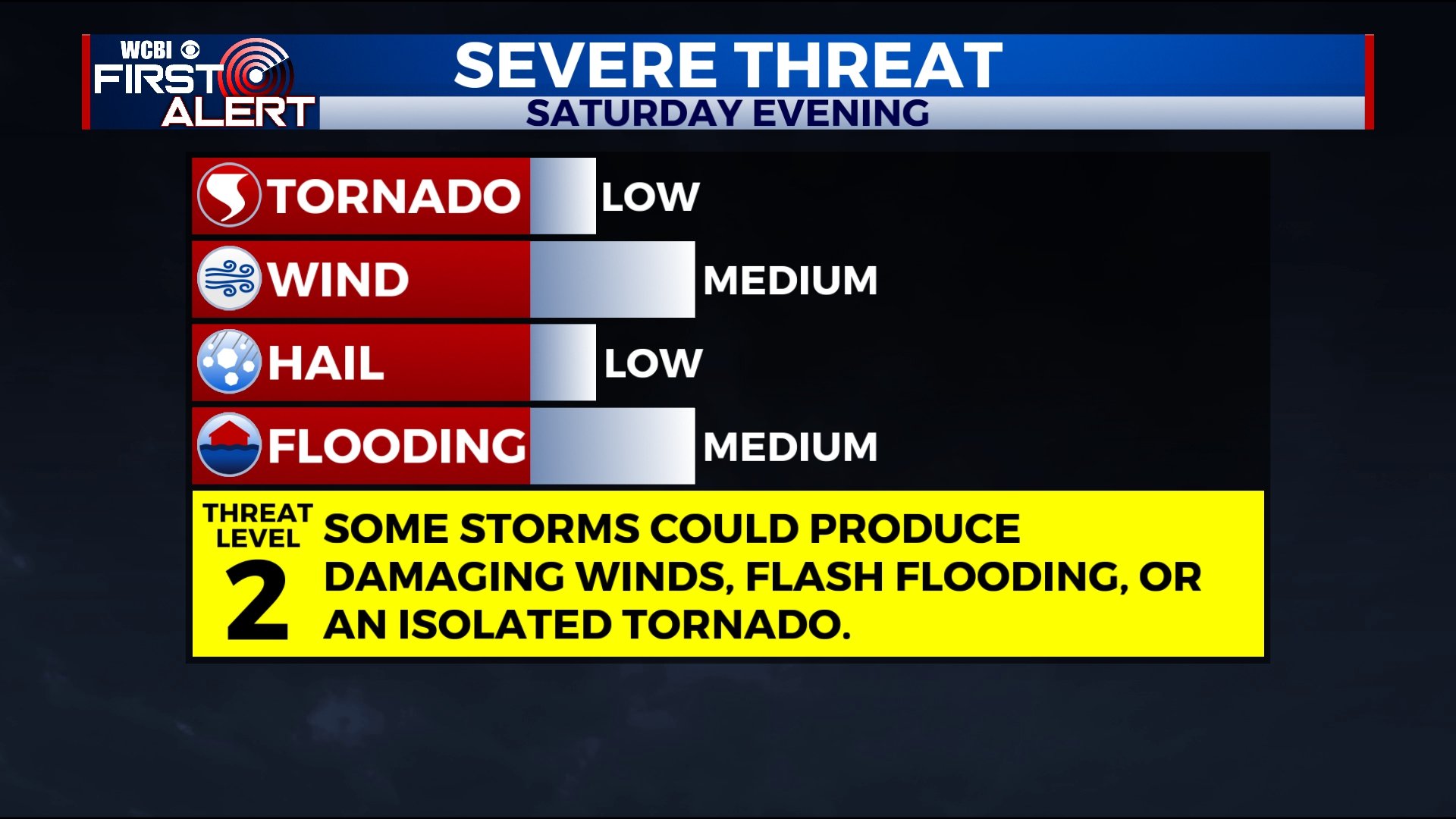
Storms will return to the forecast on Saturday, and some of them could be on the strong to severe side. After that, drier and cooler weather will return to the area.
THURSDAY NIGHT: Mostly cloudy and cool. Lows in the mid 40s.
FRIDAY: Mostly cloudy, but we could see a few peeks of sun. It’ll be a little warmer with highs in the mid 60s.
SATURDAY: We’ll be much warmer on Saturday as a cold front approaches the area. Highs will be in the low 70s. The day will start off dry and mostly cloudy. Strong to severe storms are possible anytime after lunchtime and will last into the evening hours. Some storms could produce gusty winds, flash flooding, and an isolated tornado.
SUNDAY-THURSDAY: We’ll see a mix of sun and clouds through the week. Highs will be in the 40s on Monday and will rise back into the mid and upper 50s by Thursday. A freeze is possible early Tuesday morning with forecast lows in the upper 20s.


Leave a Reply