Isolated storms Monday, pleasant weather mid-week
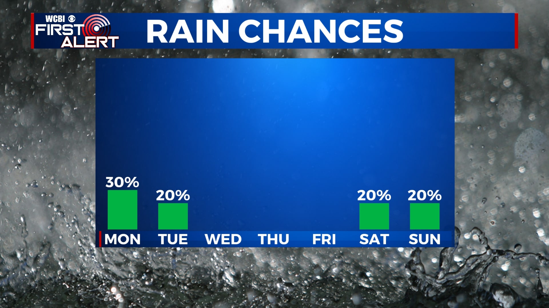
Overall, the weather for the next week looks fairly nice. Aside from the chance of some pop-up storms on Monday, the remainder of the week looks to be dry. Highs will stay in the upper 80s to near 90, but lower humidity will help to make things feel less muggy and more comfortable.
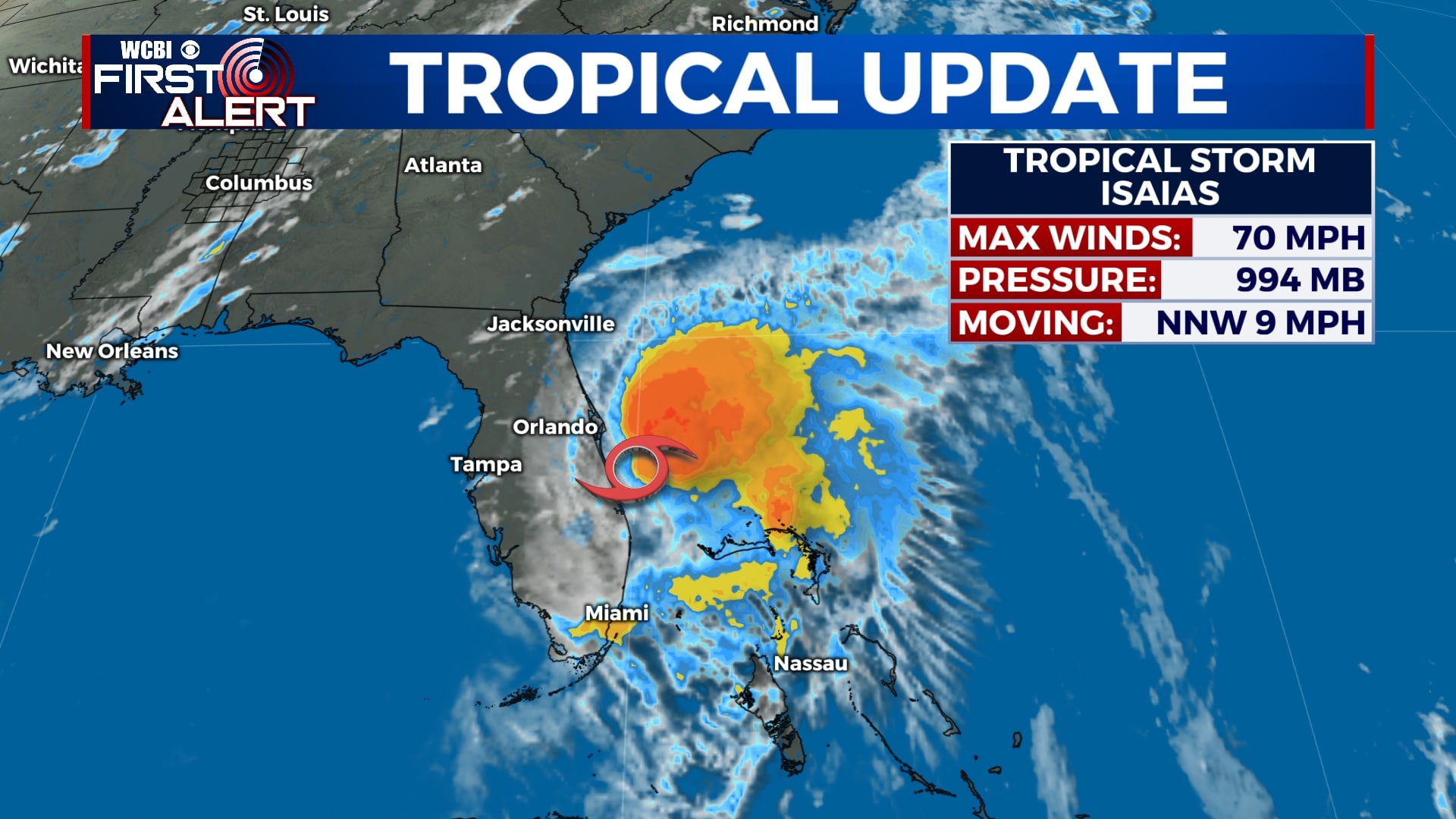
TROPICAL UPDATE: At 3 pm Sunday, Tropical Storm Isaías was just east of Port St. Lucie, Florida and had winds of 70 mph. While Florida has been spared most of the impacts, the storm will continue northward and is expected to make landfall in the Carolinas early on Tuesday. No impacts will be felt locally from Isaías.
SUNDAY NIGHT: Mostly clear and pleasant. Winds will remain light out of the northwest as temperatures fall to the mid and upper 60s by early Monday.
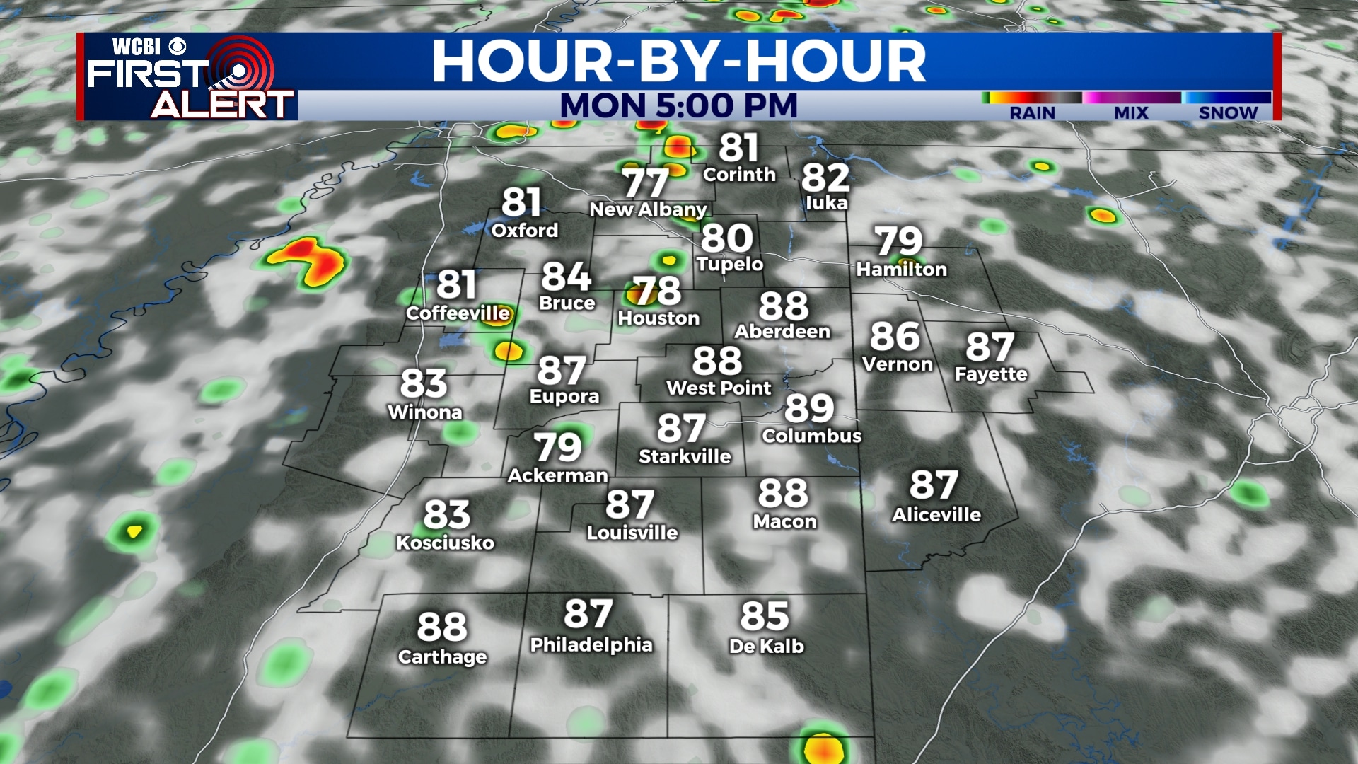
MONDAY-TUESDAY: A few afternoon pop-up storms are possible on Monday, otherwise we’ll see a mix of sun and clouds. An isolated storm will also be possible on Tuesday, but rain chances will diminish to only 20%. Temperatures will top out in the low 90s on Monday, with highs only in the mid 80s on Tuesday. Drier air will also start to filter in Monday night, setting us up for a stretch of very comfortable weather. Overnight lows will be in the 60s.
WEDNESDAY-FRIDAY: The middle and end of this week looks very pleasant with plenty of sunshine and highs in the upper 80s to near 90. While temperatures will still be warm, we won’t be as muggy as we usually are in the summertime. However, heat and humidity will start to creep back in by Friday. Morning lows will remain in the mid to upper 60s.
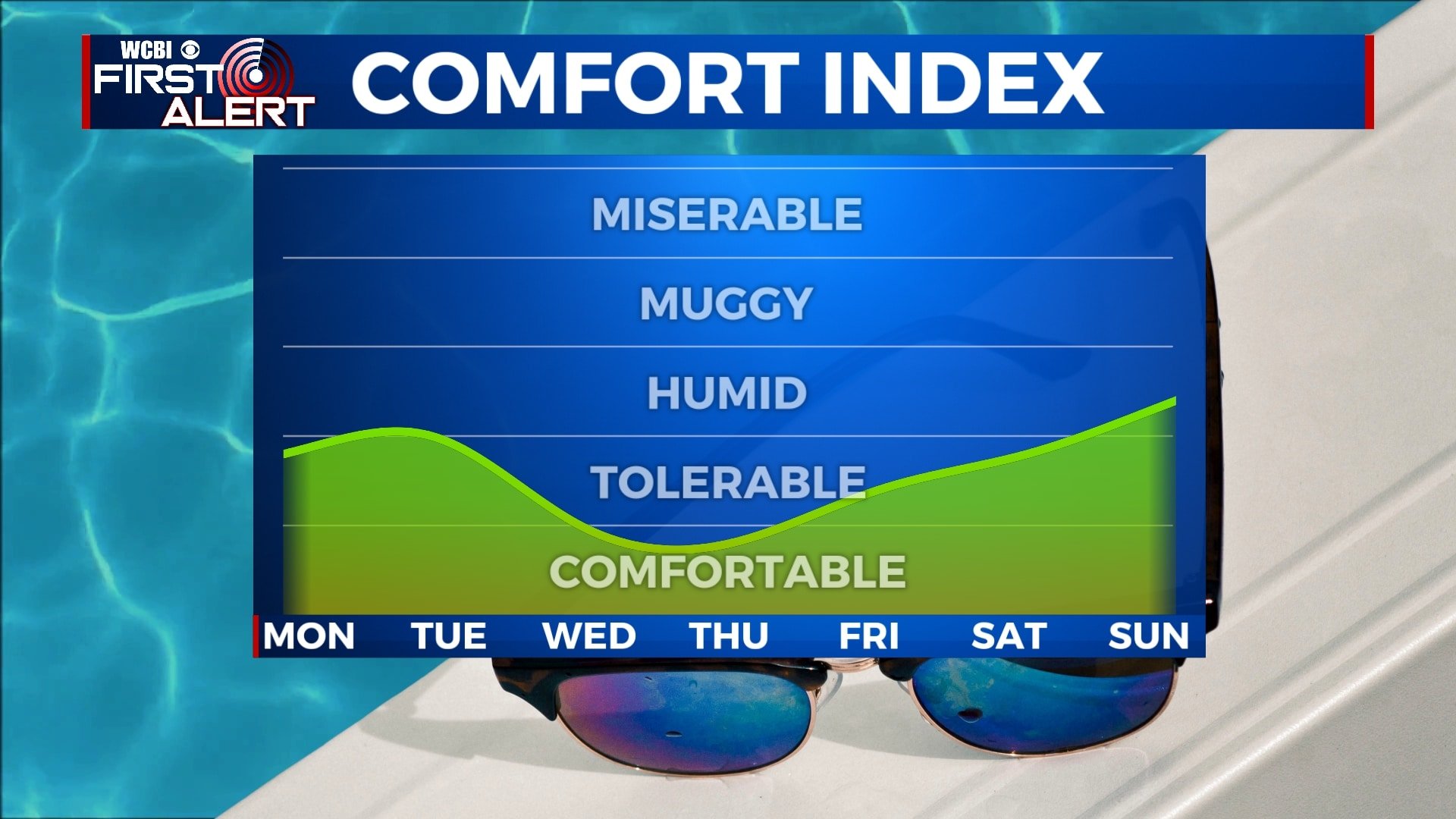
SATURDAY-SUNDAY: Unfortunately, our stretch of comfortable weather won’t last long, as highs return to the mid 90s by the weekend with increasing mugginess. There will also be the chance of some isolated pop-up storms on Saturday and Sunday.


Leave a Reply