Slightly warmer by Wednesday, rain on the way
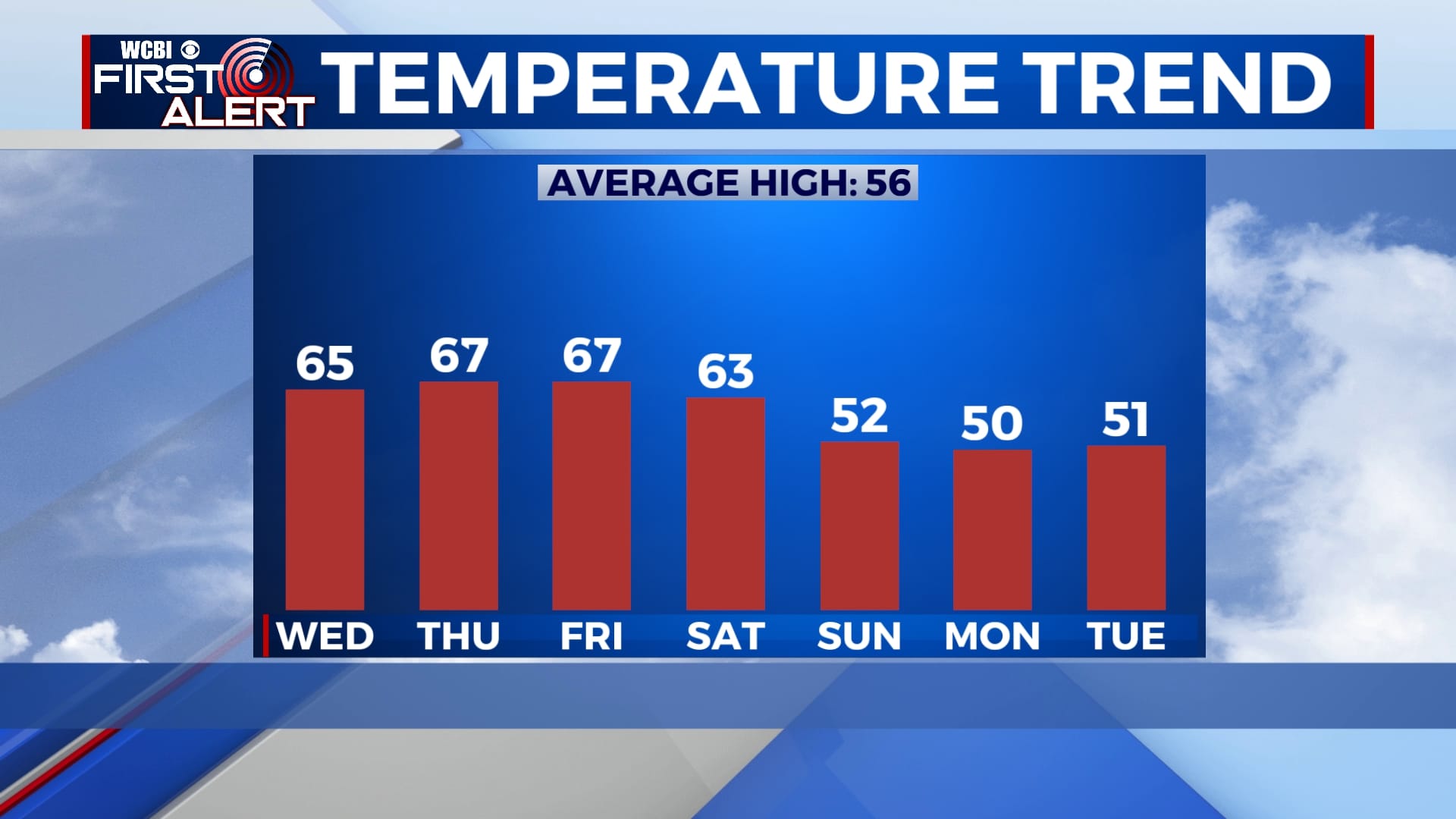
Temperatures will slowly warm up over the next several days with highs back into the mid 60s for the second half of the week. Sunshine will continue for now, but showers are likely Friday night into Saturday before another cool-down.
TUESDAY NIGHT: Mostly clear and cold once again. Temperatures will fall to the low 30s with a light southerly wind.
WEDNESDAY-THURSDAY: Sunshine will continue for Wednesday and Thursday as temperatures continue to warm up. Highs will be in the mid 60s, but overnight lows will remain cold with temperatures in the 30s each morning.
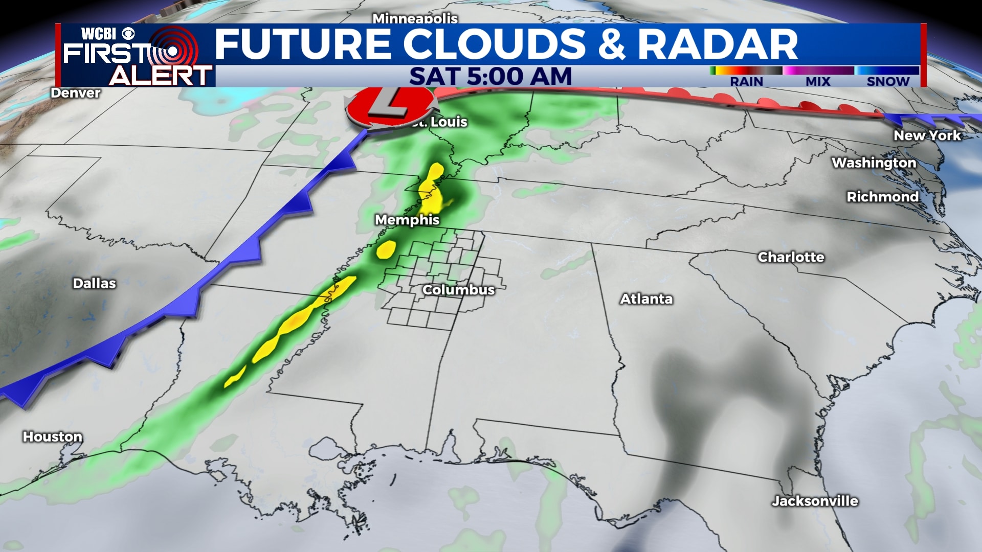
FRIDAY-SATURDAY: While most of Friday will be dry, showers will begin to move in after sunset and continue overnight Friday into Saturday. Most indications are that the bulk of the rain will be gone by lunchtime Saturday, but some showers are possible through the rest of the day. Highs will be in the mid 60s each afternoon with morning lows in the 40s and 50s.
SUNDAY-TUESDAY: The forecast is still a bit up in the air for the second half of the weekend and early next week. While most models have us dry for Sunday, Monday, and Tuesday, there are some indications that we could see some leftover rain on those days. For now, we’re going to bet on being dry, but the forecast could change. We will see cooler air move in regardless with highs back into the low 50s.
Follow WCBI Weather on Facebook, Twitter, and Instagram
Follow Meteorologist Trevor Birchett on Facebook and Twitter


Leave a Reply