A Very Stormy Day Due To Arthur!
COLUMBUS, Mississippi (WCBI)- Post Tropical Cyclone Arthur will bring showers and thunderstorms into the area with damaging winds and flash flooding being the main concerns.

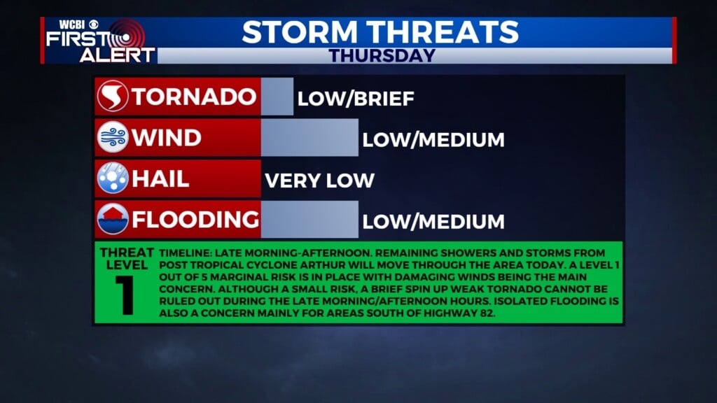
TODAY: A Marginal Risk (1/5) is in place for the entire viewing area as showers and storms continue to move in from the south from what remains of Post Tropical Cyclone Arthur. The main concern is flash flooding especially for areas south of the Golden Triangle as well as damaging winds. A small but not zero tornado risk applies as well, mainly during the late morning/afternoon hours. Highs are a little cooler in response to the rain and cloud cover, only reaching into the low to mid 80s.


TONIGHT: Rain coverage decreases rapidly heading into midnight as what remains of Arthur continues to move to the east. This is a short break however as rain chances increase back a few hours prior to sunrise. Lows dropping down to around 73.
TOMORROW: A cold front will push through the area from the north on Friday morning. This will once again bring in a good coverage of rain and storm activity through the day. A little bit warmer for Friday as highs are expected to reach the upper 80s.