One last dry day, heat and humidity on the way
SUMMARY: One last cool night in the low 50s, followed by a beautiful, dry, and warm Memorial day holiday. The heat is back on by Tuesday, and storm chances return Wednesday, with widespread showers and storms possible Thursday and Friday. More isolated to scattered activity by next weekend.
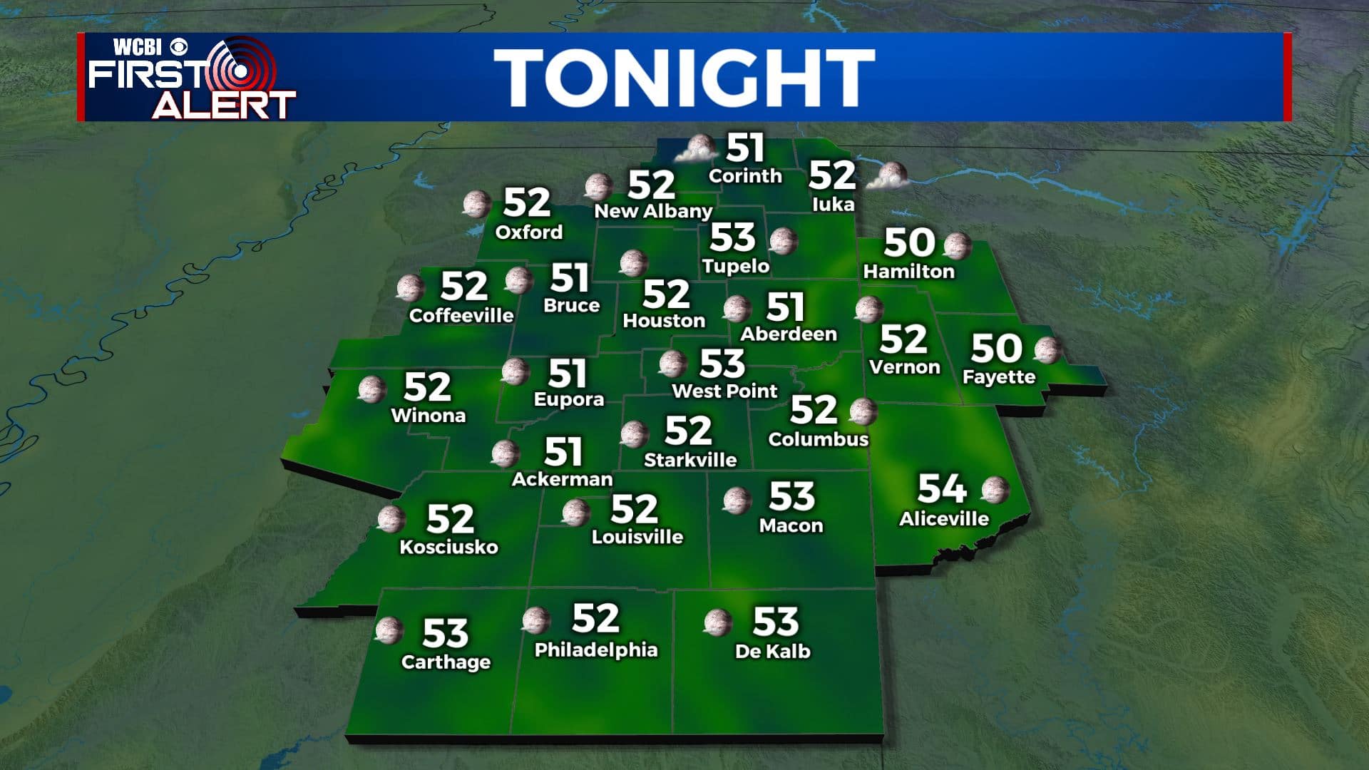
TONIGHT: Another very pleasant evening across the region, very similar to Saturday night, but without those low clouds. The NNE wind we have been seeing will die down quickly as the sun sets, and calm winds and clear skies will allow our temperatures to drop into the low 50s. 40s possible across northern areas.
MEMORIAL DAY: A beautiful Memorial day holiday in store if you are planning on attending any Memorial day services. Dry air will remain in place, and even though we’ll top out in the mid 80s, it will still be quite comfortable. Lots of sunshine as well, with very few clouds.
MONDAY NIGHT: Moisture begins to flow into the region Monday night, and more clouds will develop as well. It will still be quite comfortable, with temperatures in the upper 50s to low 60s.
TUESDAY: The summertime heat is back right on schedule for the first day of June, and meteorological summer. With increasing moisture it will feel pretty hot out there on Tuesday afternoon. Expect partly cloudy skies and a high near 90 degrees.
TUESDAY NIGHT: With the moisture back in the area, lows will be much more seasonable on Tuesday night. Expect partly cloudy skies, with temperatures dipping down to the mid-60s by Wednesday morning.
WEDNESDAY TO SUNDAY: Rain returns to the forecast for Wednesday, as a typical summertime pattern moves into place across the region. A chance for scattered storms on Wednesday afternoon. A disturbance moves through Thursday and Friday, bringing increased rain chances and more widespread showers and storms, along with slightly cooler temps in the mid 80s. Rain chances diminish somewhat by next weekend, but there will still be a chance of afternoon showers and T-storms. Highs will stay in the mid to upper 80s.
CONNECT WITH @WCBIWEATHER ON TWITTER, FACEBOOK AND INSTAGRAM


Leave a Reply