Typical August weather for the week ahead
SUMMARY: We’re in for quite a hot week ahead across NE MS and West Alabama. Nothing unexpected this time of year, but the heat can still take its toll. Highs will be in the mid 90s for the work week, dropping a bit to the low 90s for the weekend, and around 90 to start next week. Rain chances stay pretty low for the work week, with only isolated storms possible each afternoon. Most of us will stay dry under partly cloudy skies. As we get to the weekend, rain chances look to increase a bit, with more scattered activity in the afternoons. By the time we begin next week, we could see a bump in rain chances as a tropical disturbance moves into the southeast. It’s too early to know what form it will take or how strong it will be, or what the impacts here will be. Just a reminder we are about to get to the most active part of hurricane season! MONDAY NIGHT: A warm, steamy, and calm night in store, any showers will dissipate quickly. Lows will be in the low to mid 70s under partly cloudy skies. TUESDAY: Another very hot day in store, highs reach the mid 90s under partly cloudy skies. A few stray afternoon storms are possible, which will help anyone who gets one to cool down a bit. Take heat precautions, feels like temps will be 105+ in the afternoon. 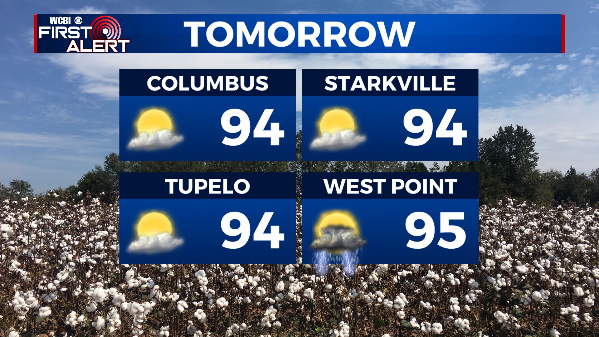 TUESDAY NIGHT: Stray storms quickly end into the evening. Another warm and muggy night in store, with lows in the mid 70s under partly cloudy skies. WEDNESDAY: Hot and partly cloudy again with highs in the mid 90s. Heat indexes from 100-105+ in the afternoon, with isolated storms dotting the area once again. THURSDAY TO MONDAY: Thursday and Friday look to bring more of the same weather we saw earlier in the week. Mid 90s, partly cloudy and isolated afternoon storms. By the weekend, a disturbance moving through the SE will increase rain chances a bit, and lower high temps slightly as well. Scattered storms are possible Saturday and Sunday afternoons with highs in the low 90s. A tropical system may move into the southeast beginning early next week bringing an influx of moisture to the region and higher rain chances, with more widespread showers and storms possible Monday. We’ll keep you updated on any tropical threats! Stay connected with @WCBIWEATHER on Facebook, Twitter, Instagram and the WCBI News App


Leave a Reply