A cool start to the week turns mild by Friday
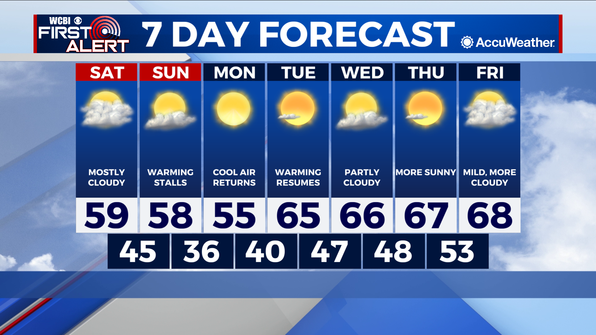
COLUMBUS – SUMMARY: Temperatures look to become much more mild by next weekend. Our weekend starts cool and stays cool with a cold front moving through early Sunday. Temperatures in the 50s this weekend warm up throughout the week into the high 60s by Friday.
SATURDAY: High temperatures maximize in the high 50s and possibly break 60 for some areas. Clear skies in the morning will be replaced by mostly cloudy skies as a cold front moves into the area later tonight. Lows drop into the mid 40s overnight as dry conditions continue to prevail.
SUNDAY: A cold front passing through early Sunday morning means that temperatures stall in the high 50s. A stray sprinkle or two cannot be ruled out with this cold front but any rain that does fall should fall in the early morning hours. Look for the front to be out of the area by around lunch time, with skies beginning to clear out shortly after. Overnight lows become considerably colder, dropping down into the mid to high 30s.
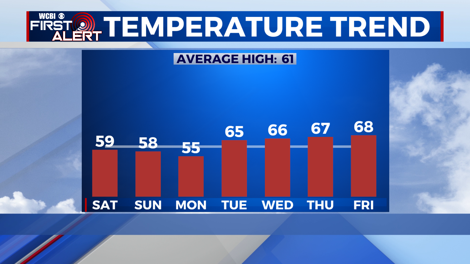
NEXT WEEK: Sunday’s cold front leaves us with temperatures in the mid 50s to start our Monday, but look for steady warming to occur thereafter. Highs are forecast to climb into the high 60s by Friday, with lows increasing into the low 50s. Other than a small rain chance on Sunday the rest of our week looks dry with decreasing cloud cover early next week.