A few storms Friday evening before much cooler weekend
COLUMBUS, Mississippi (WCBI) – SUMMARY: Above normal temperatures will continue through Friday, then a true taste of fall is in store for north Mississippi and west Alabama!
THURSDAY: Variably cloudy and warm with highs in the mid to upper 80s.
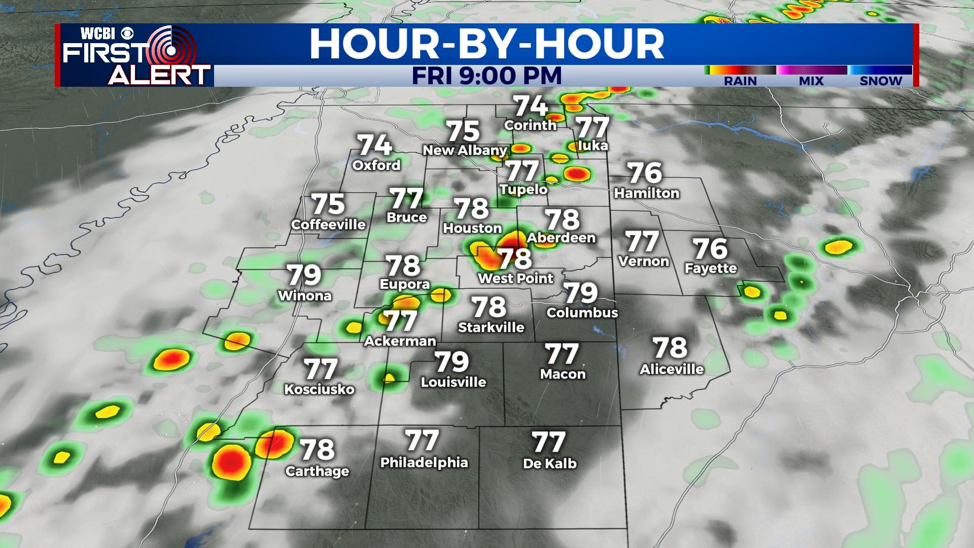
FRIDAY: Expect intervals of sun through the day with spotty showers possible. Highs will reach the upper 80s ahead of an approaching cold front. This front may trigger stronger storms over the northwestern third of the region during the evening, and these could become locally strong with gusty winds. The good news is these storms should be weakening as they move east of the Natchez Trace.
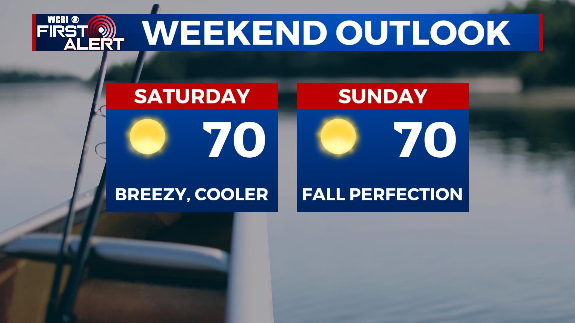
SATURDAY: Temperatures will have sharply fallen overnight, and the day will start with temperatures in the 50s. Expect full sun through the day with highs struggling to reach 70 degrees with a fresh northwest breeze – fall perfection!
SUNDAY: Expect the coolest air so far this season in the morning with temperatures in the lower to middle 40s. Highs will reach 70 degrees later in the day with full sun.
NEXT WEEK: Sun and clouds will be the rule as dry, fall-like weather continues. Expect highs in the 70s each day and morning lows in the upper 40s to lower 50s.