A nice preview to fall is on our way
SUMMARY: Breezy conditions will continue into Thursday along with a slight chance of showers. Drier and less humid air will build in starting Friday as a cold front will push through, giving us some awesome, more fall-like weather this weekend into early next week as high pressure takes control.
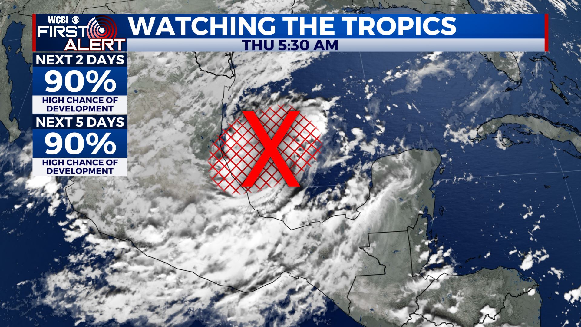
TROPICS: Another tropical wave could form into Wilfred over the next few days in the southwestern Gulf of Mexico. Recent data suggest that whatever comes of it will likely stay away from our region but it certainly bears watching.
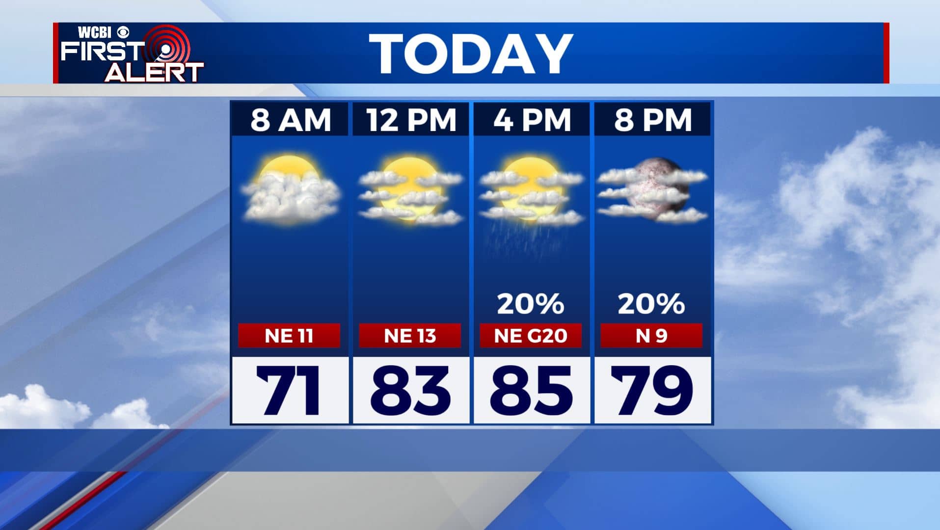
THURSDAY: We’re seeing more sunshine this Thursday, but still expect some clouds at times as Sally continues to move out to the east. An isolated shower or two can’t be ruled out. A bit warmer with highs in the mid 80s. We’ll still have a breezy NE winds 10-20 mph.
THURSDAY NIGHT: Mostly clear skies and cooler as a cold front pushes through the region. Overnight lows in the lower 60s.
FRIDAY: Mostly sunny skies and seasonably warm with highs in the lower 80s.
FRIDAY NIGHT: It’ll be cooler for high school football Friday evening with temperatures in the 70s and 60s, but looking great. A few clouds and cooler. Overnight lows in the upper 50s.
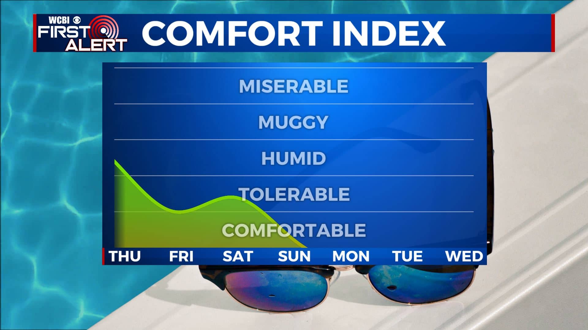
SATURDAY-WEDNESDAY: A big area of high pressure centered to our north should keep dry air flowing our way. Lots of sunshine and pretty nice fall-like weather. Lower humidity levels will make it feel amazing to be outside with highs in the upper 70s to near 80 and comfortable overnight lows in the upper 50s. Any unsettled weather looks to stay closer to the Gulf Coast and into the Gulf of Mexico.
Stay connected with @WCBIWEATHER on Facebook, Twitter, Instagram, and the WCBI News App


Leave a Reply