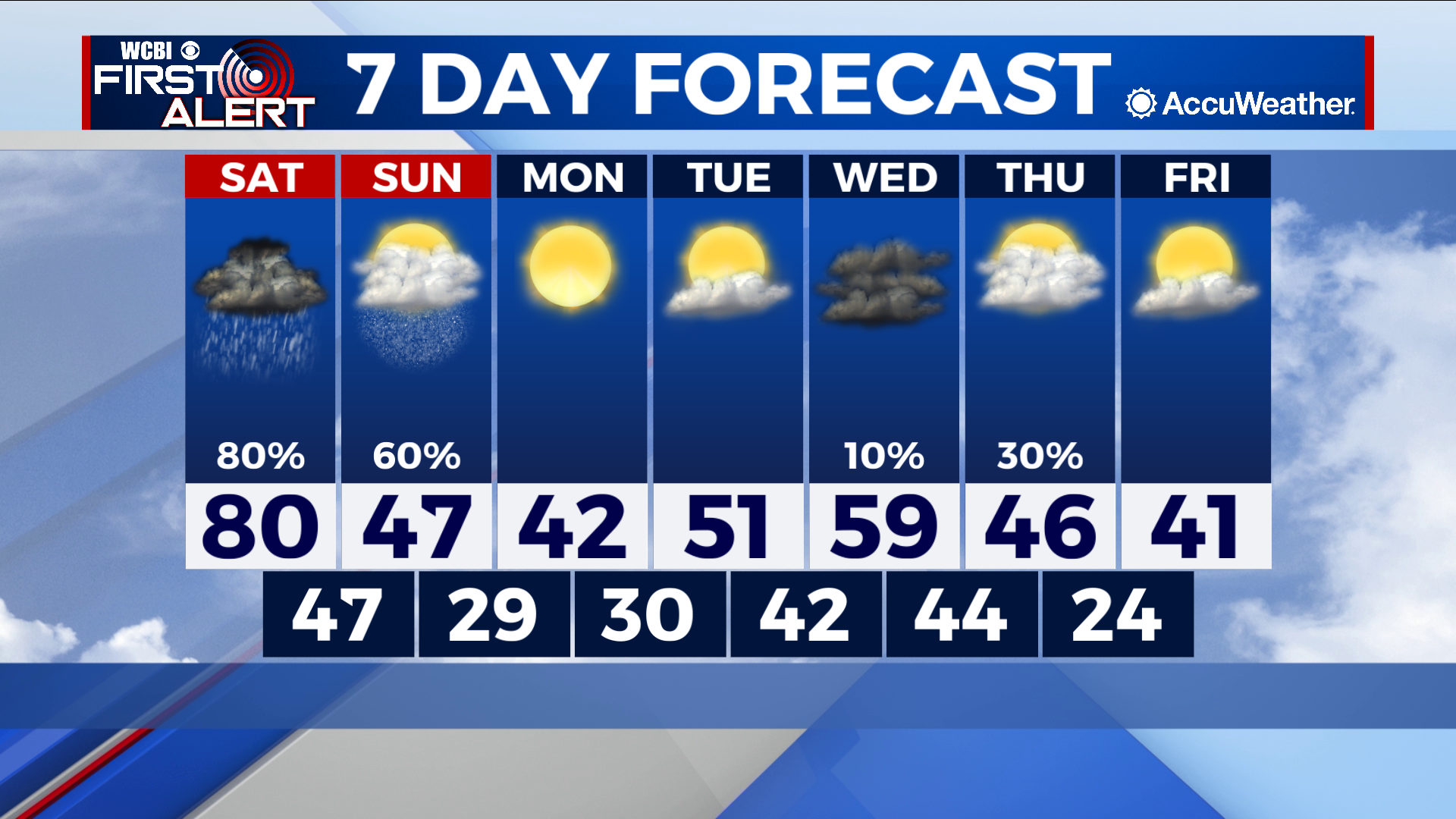
A severe Saturday and potentially snowy Sunday ahead
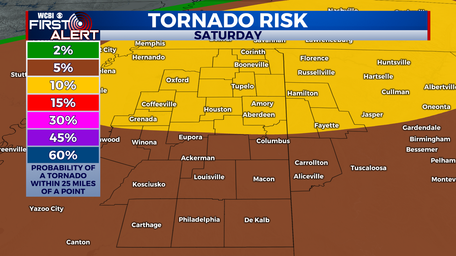
COLUMBUS – SUMMARY: The threat for severe weather Saturday has been ramping up, with strong winds, hail and tornadoes being the primary hazards. Mother Nature flips the switch on Sunday as cold air from Saturday’s cold front drops temperatures low enough for some potential snow to fall. The cold pattern will continue into early next week as clouds make a comeback.
SATURDAY: Time for the severe event Wednesday will be primarily confined to the afternoon and early evening hours. Wind and possibly some tornadoes will be the main hazards, although large hail is a possibility as well. Tornado-wise it is looking like any that do form will more likely form right along the cold-front associated squall line, or less likely ahead of the front. We will continue to monitor the situation as it develops.
SUNDAY: Round two of our wacky weekend begins with rain showers in the morning, accompanied by temperatures in the 50s. Throughout the day the temperature will continue to drop lower and lower, eventually reaching below freezing. There is some uncertainty with this but there is a small possibility that some snow showers could mix in during the afternoon. Overnight lows will be in the mid to high 20s.
REST OF THE WEEK: Moving onto next week, the cold pattern remains, and the clouds return. Another cold front Thursday brings some rain chance to the area, but mainly brings lows back down into the mid-20s. The rest of the week remains otherwise dry and far more seasonable for this time of year.