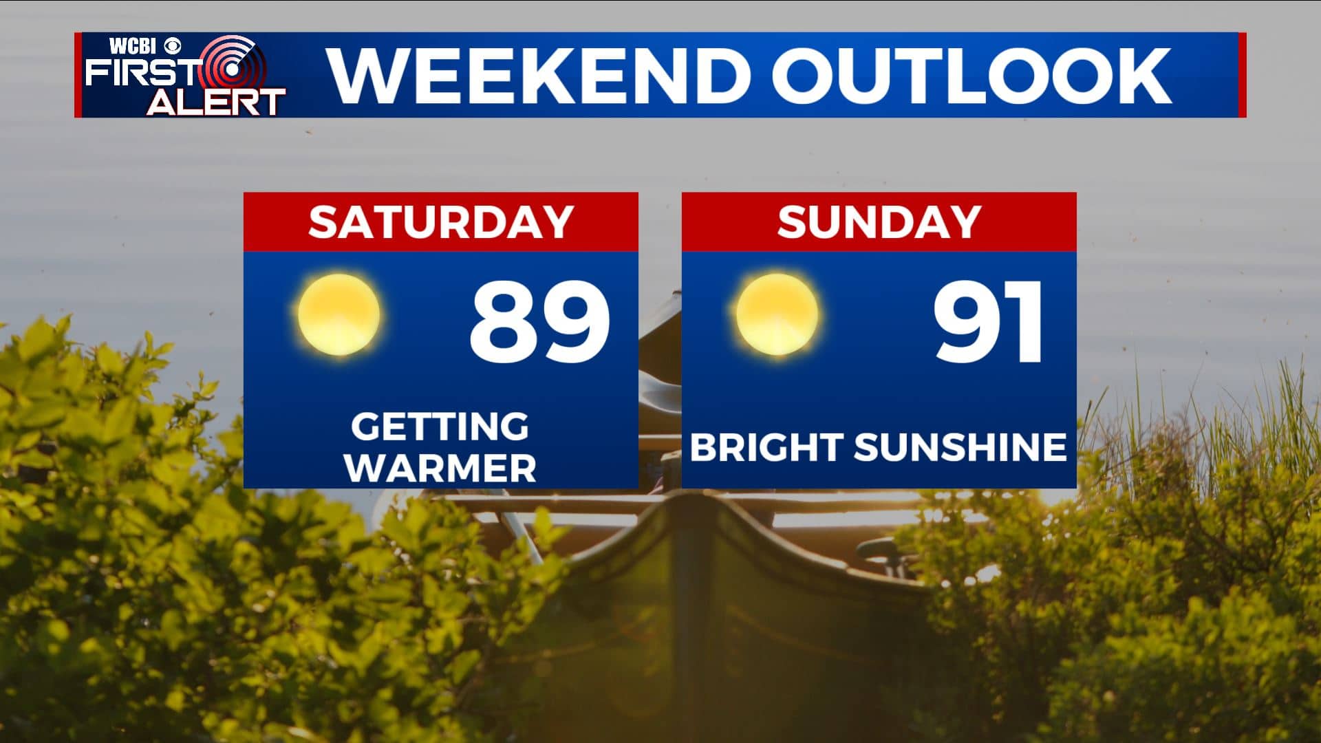
A sunny but warm weekend is ahead for us
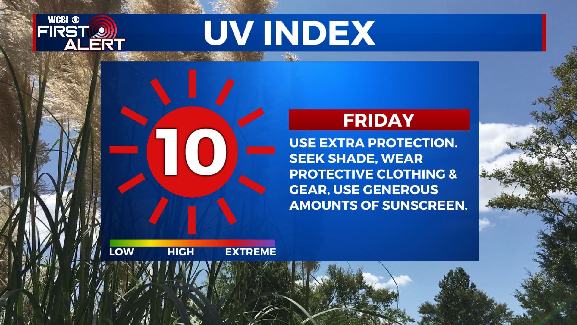
SUMMARY: A huge ridge of high pressure will give the Deep South a lot of sunshine, but very warm temperatures through the weekend into nearly next week. Humidity levels are going to remain tolerable. Use lots of sunscreen and drink plenty of water. Some isolated to scattered daytime heating afternoon storms could return by the midweek.
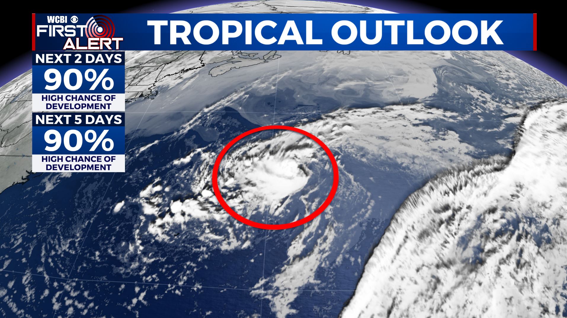
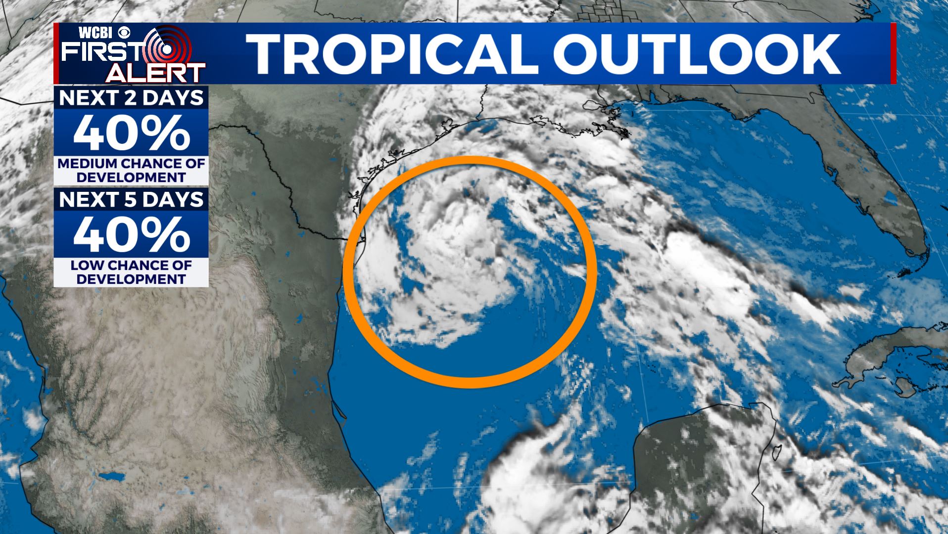
TROPICS: NOAA released their Atlantic Hurricane Season 2021 Forecast on Thursday. They are calling for an above average season once again with 13-20 named storms, 6-10 of them could become hurricanes. 3-5 of those could become major Category 3 or higher hurricanes. This comes as no surprise as they recently updated their average hurricane season numbers based off the data from 1991-2020. A tropical disturbance out in the Atlantic has a 90% chance of development over the next few days. It will most likely become Ana, the first named storm of the 2021 Hurricane Season. No concern for the U.S. with this one. There is also another tropical wave over the Gulf of Mexico that has only a 40% chance of development. High pressure will keep that wave away from us and only bring more rain to Texas and Louisiana. The season officially begins June 1.
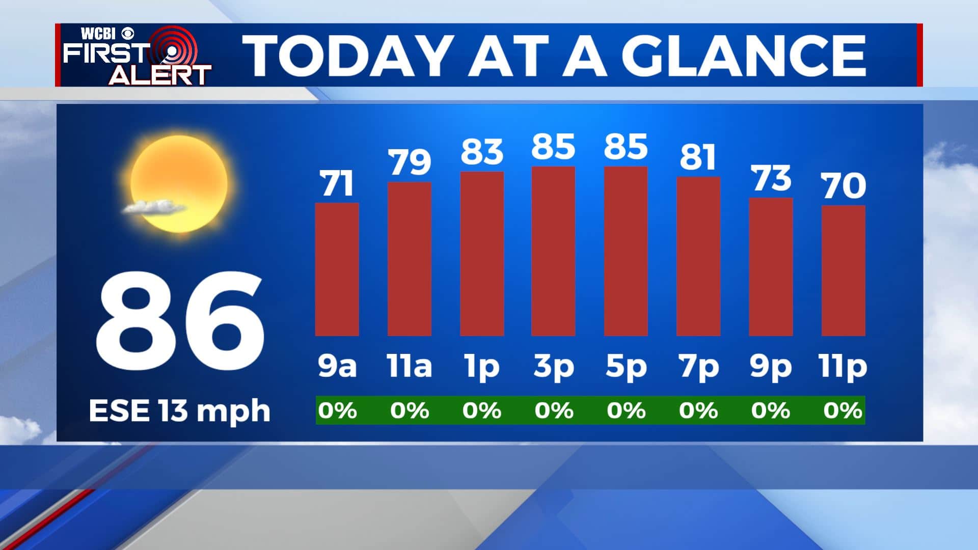
FRIDAY: Mostly sunny skies for the end of the workweek. Continuing to get warmer with highs in the mid to upper 80s. Breezy SE winds 10-20 mph.
FRIDAY NIGHT: Mostly clear skies. Overnight lows in the low 60s.
WEEKEND: Bright sunshine and very warm. Highs ranging from the upper 80s to the lower 90s. Overnight lows in the 60s.
MONDAY-TUESDAY: Staying sunny and warm. Highs in the lower 90s.
WEDNESDAY & THURSDAY: A few clouds will start building back in with the sunshine. Could see a stray shower or two with the daytime heating as the humidity and moisture levels start going up a bit. Highs around 90 with lows around 70.
Stay connected with @WCBIWEATHER on Facebook, Twitter, Instagram, and the WCBI News App.


Leave a Reply