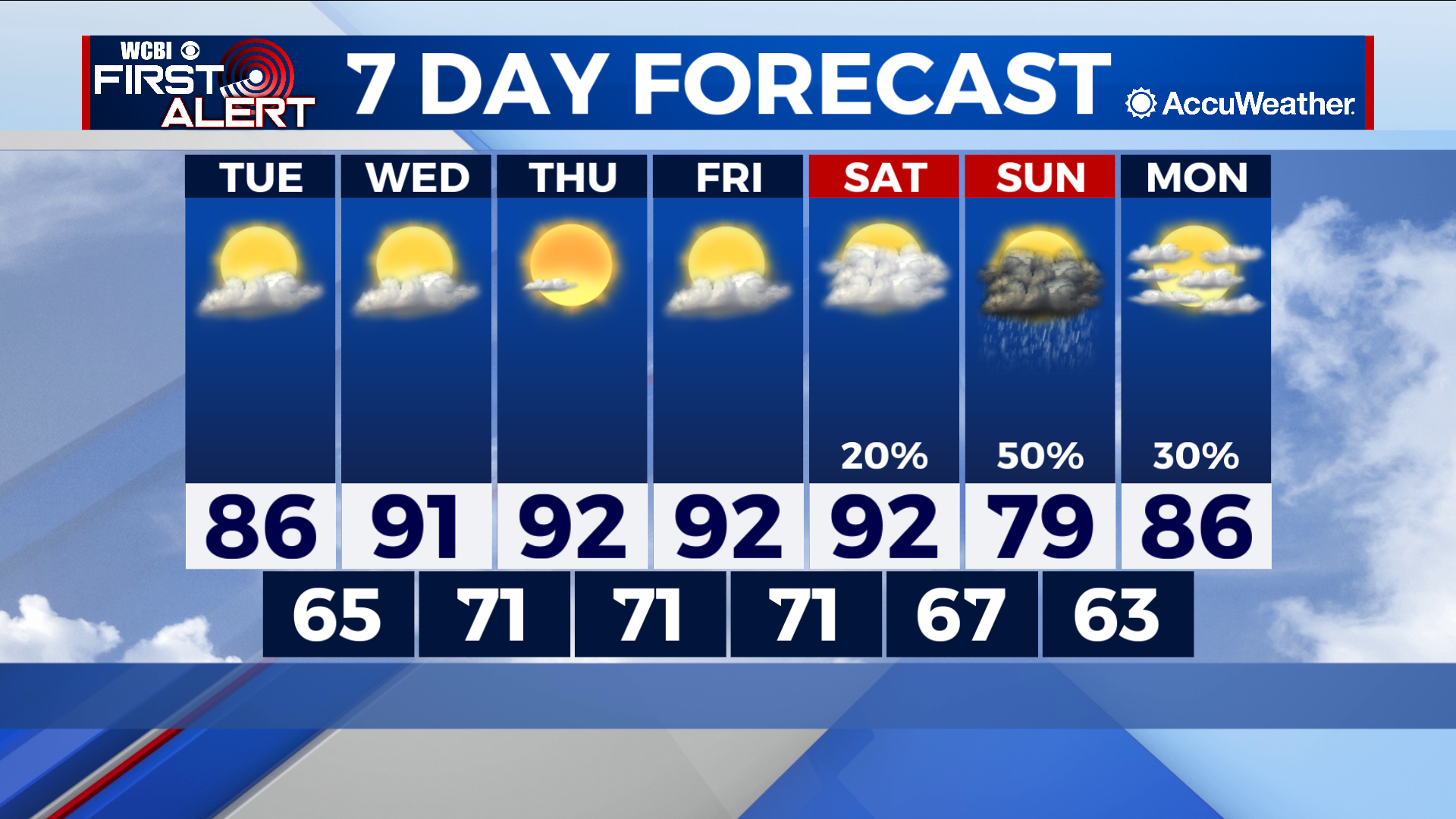
Above-average week ends with some relief
COLUMBUS – SUMMARY: Afternoon temperatures continue to climb over the next few days, thanks to some high pressure and relatively clear skies. A late week system brings cooler temperatures to the region, in addition to elevated chances for rain throughout the weekend.
TUESDAY: An afternoon temperature peak in the mid to upper 80s signals the continued warming of afternoon highs. Partly cloudy skies tag along, but no rain is expected. Overnight lows stick with a mid 60s temperature range.
WEDNESDAY: Our potentially first 90 degree day of the week may look no different that the day prior. Partly cloudy skies with dry conditions will make up the overhead conditions Wednesday. Overnight temperatures increase significantly into the low 70s.
REST OF THE WEEK: While temperatures reach into the 90s by Wednesday, not much more in the way of warming is expected. The warming trend is likely to stall out, leaving us with afternoon conditions in the low 90s through Saturday. Some relief is on the way however, and by Sunday highs will have dropped into the upper 70s. Lows will also dive into the lower 60s by overnight Sunday. This drop comes off the back of a late-week system that will also bring some much appreciated rain to the region. At the moment, scattered showers and thunderstorms Saturday, along with some showers next Monday are what the expected product are at this time. We will continue to update you on the situation as we get closer to the weekend.