Accumulating snow, gusty winds likely late Friday night
COLUMBUS, Mississippi (WCBI) – After a brief stretch of nice weather, winter is set to return Friday night and last through the weekend.
FRIDAY: The weather stays nice during the day with a mix of sun and clouds and highs in the upper 60s to low 70s. This taste of spring will come to a quick end after sunset.
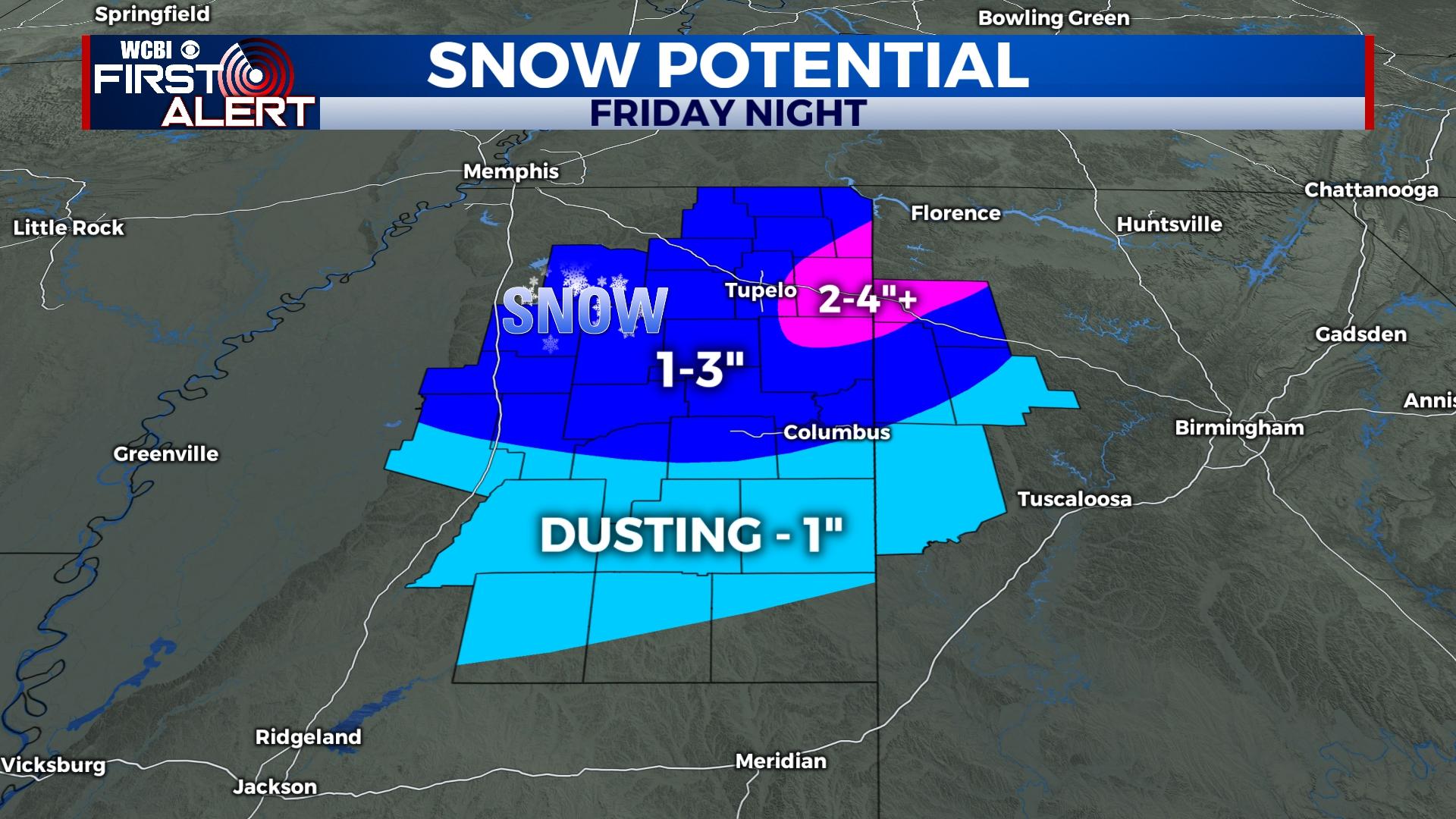
FRIDAY NIGHT: Rain develops for most after sunset but should quickly begin changing to snow northwest of the Natchez Trace. The changeover is set to spread across the rest of the region from 8p – midnight, becoming all snow for most after midnight. Due to the briefly heavy nature of the snow expected, quick accumulations of a dusting to 3″ are expected with the higher totals (2-3″) expected north of Highway 82. 2-4″ totals are possible in Prentiss, Tishomingo, Itawamba, and Lee counties where a winter storm warning is in effect. Windy conditions are also expected with wind gusts over 30-35 mph for most of the region. Temperatures are likely to fall into the upper 20s after the snow ends toward daybreak. This could cause several travel issues, mainly on the bridges and overpasses.
SATURDAY: Even as snow ends after sunrise, temperatures will struggle to climb out of the mid 30s despite sunshine returning. Gusty north to northwest winds will continue, and wind chills are likely to remain below freezing all day. Those winds quickly relax after sunset, and temperatures are likely to plunge into the lower 20s or even upper teens.
SUNDAY: Sunshine continues with high pressure – highs will rebound into the mid and upper 50s after a frigid start to the day!
NEXT WEEK: Monday starts the week dry, but showers and storms are back in the forecast for Tuesday. Locally stronger storms are possible with potentially small hail, but the severe weather threat remains quite low at this time. The middle of the week looks dry, but another system could bring more rain and storms by Friday.