Active Friday storm threat
COLUMBUS, Mississippi (WCBI) – Building the moisture back in ahead of Friday’s storm risk. Strong to severe storms are possible. Be sure to have several ways of receiving any watches or warnings for your area!
THURSDAY NIGHT: Extra moisture showing up as heavier cloud coverage filing in tonight! Calm before the end of the week storms. Temperatures tonight will be mild, in the upper 50s. Might feel a bit muggy for any late night walks around the neighborhood.
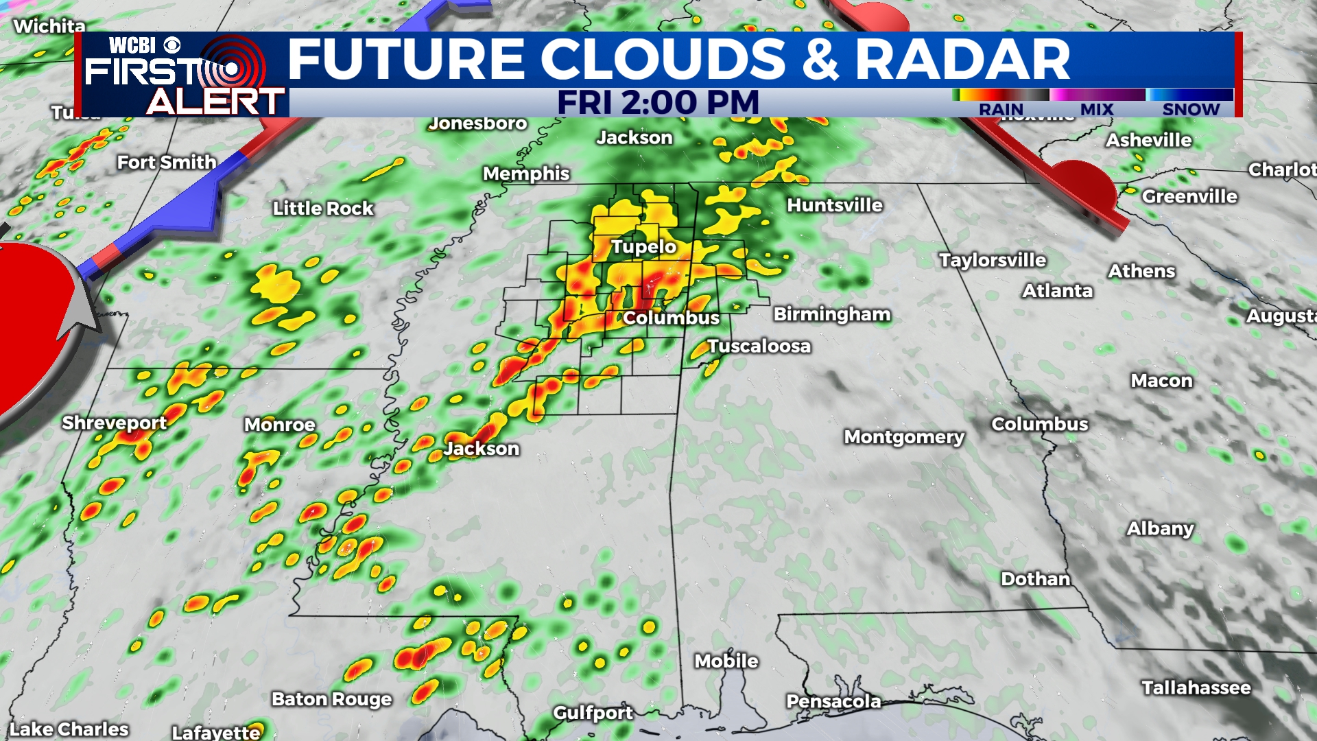
FRIDAY: The understanding of present active weather and awareness need to become besties on Friday! Rain and storms are likely to start in our western and NW counties Friday morning, lasting into the afternoon. The severe threat with this round should be limited, though some hail is possible as storms will be elevated. Warmer, more unstable air could then build in behind initial round of storms, causing a few strong to severe storms to develop Friday night, as the actual front & low pressure move through the area. Confidence in the evening severe potential remains low, but the Storm Prediction Center has shifted the Level 2 – Slight Risk northward. Stick with us all day for updated details!
WEEKEND: Leftover rain showers could continue into Saturday morning and clear by the afternoon. Cloud coverage will be slower to move out, but the chance for sun will definitely increase! Temperatures will continue in the 60s both days of the weekend, thanks to some of the cooler air behind the passing cold front Friday. Sunday will be a nice day to get outdoors!


