Active pattern remains this week, more storms likely
COLUMBUS, Mississippi (WCBI) – Monday brings a continuation of the tranquil weekend weather, but rain and storms arrive early Tuesday morning. Another round of storms is likely Wednesday.
MONDAY: The weather trends warmer with highs approaching 80 degrees with a mix of sun and clouds.
MONDAY NIGHT: The evening stays dry, but rain and thunderstorms are likely to spread across the state late in the night, likely toward daybreak Tuesday. While heavy rain and possible flooding are the primary risks, a low-end severe weather risk also exists…particularly for areas along and south of 82.
TUESDAY: Early morning showers and storms should clear well before lunch, leaving a clearing sky in the afternoon. Increasingly warm, humid, and unstable air moves in as well, and if any storms can redevelop in the late afternoon hours, some severe risk would also exist.
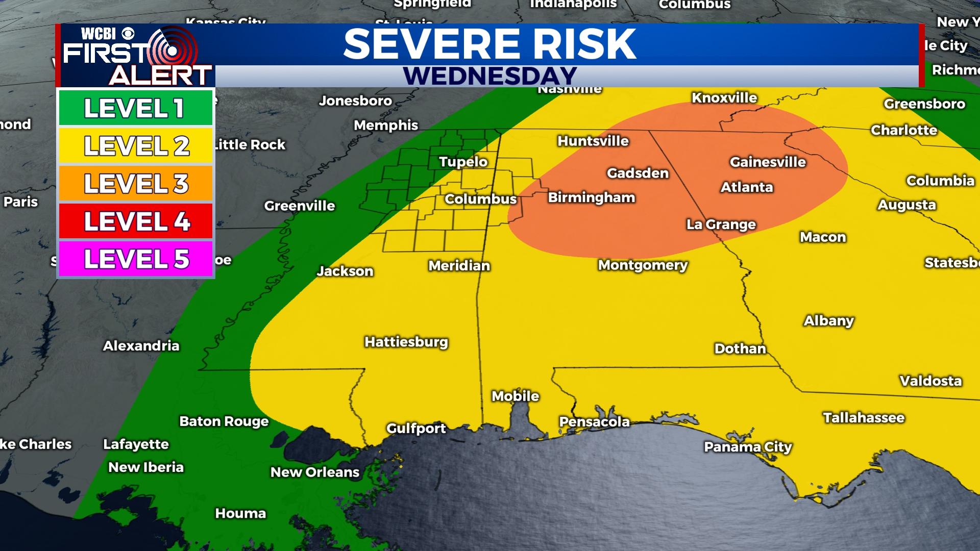
WEDNESDAY: One final round of showers and storms is possible as a strong front moves through the region. While the best overlap of ingredients looks to set up just east of the region, developing storms around midday across northeast MS could be severe with all hazards (wind, hail, tornado) possible.
REST OF WEEK: Well below average temperatures are expected Thursday and Friday. Daytime highs Friday may drop into the 50s with overnight lows in the 30s possible as well.
WEEKEND: Cooler than usual weather continues Saturday, but a nice recovery should occur by Sunday as highs return to the 70s.


