Active weather pattern to return the second half of this week
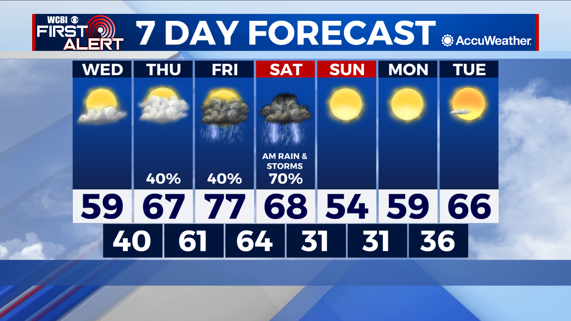
COLUMBUS, Mississippi (WCBI) – SUMMARY: Below average temperatures remained in place today, but a warming trend begins tomorrow with highs reaching into the upper 70s by Friday.

TONIGHT: Overcast with lows in the low-40s. Calm wind.
WEDNESDAY: Morning clouds followed by afternoon sun. More seasonable with with highs in the upper-50s. Calm wind.
WEDNESDAY NIGHT: Increasing clouds with lows in the low-40s. Calm wind.
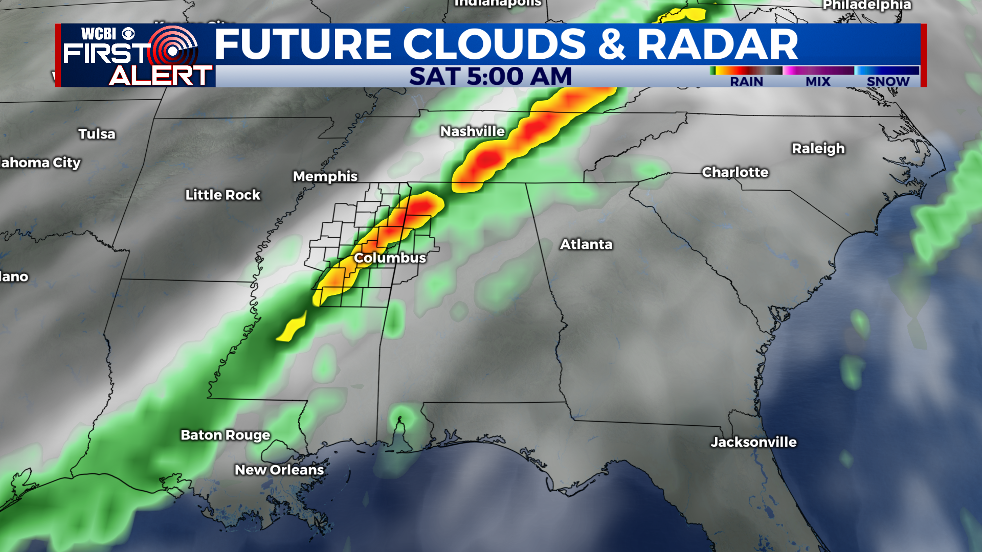
THIS WEEK: A quick pattern change will occur this week as a southerly breeze aids moisture return to the region. Thursday afternoon and evening will feature an overcast sky with scattered light showers. Highs will be in the upper-60s. By Friday, we will warm into the upper-70s with another round of showers and thunderstorms possible. A strong cold front will move into the area by Friday night with widespread showers and thunderstorms expected overnight. An isolated strong thunderstorm or two is also possible. By Saturday morning, most of this activity will be pushing into central Alabama and we will quickly clear out behind the front with colder weather ahead this weekend.