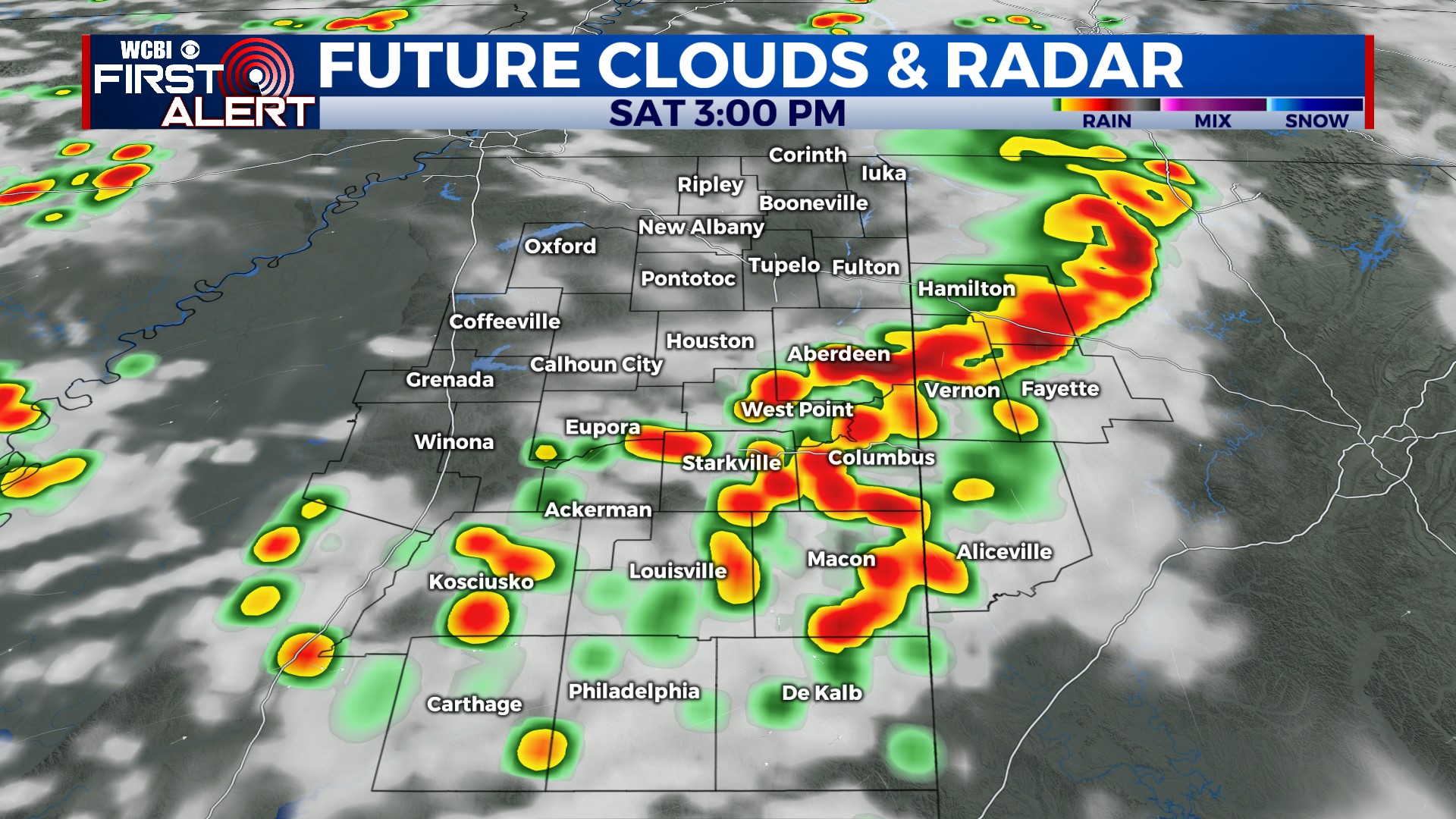
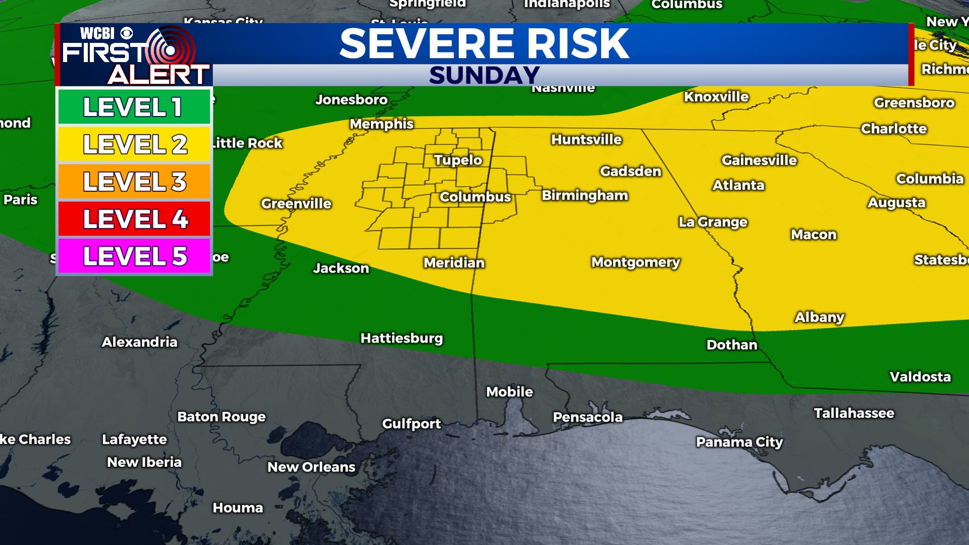
Afternoon storms continue, some possibly severe for weekend
COLUMBUS, Mississippi (WCBI) – Unsettled afternoons will continue as storms potentially become stronger for the weekend. Somewhat quieter weather starts next week.
FRIDAY: Variably cloudy with highs in the upper 80s. Once again, scattered afternoon storms appear likely with the main concerns being heavy rain, frequent lightning, and gusty winds up to 40-50 mph. Most of these should weaken around sunset, leaving a mostly dry overnight.
WEEKEND: Stronger upper-air flow is expected both days, so this will likely for more storm organization and possibly a chance of severe storms each afternoon. Saturday morning looks mostly dry, but increased storm fuel/energy will build through the day. Scattered, locally strong to severe storms should form in the early afternoon and begin pressing east/southeast across the region. Any storm mergers/organization will favor increased damaging wind potential. Most storms will die down after sunset. Sunday brings another round of possible severe storms, this time potentially a little later in the day into the evening hours. Again, any storm mergers will promote wind damage potential.
NEXT WEEK: The unsettled stretch temporarily looks to break Monday & Tuesday. This means much lower rain chances and near average temperatures. For mid-week, we look to remain on the periphery of a ridge centered over Texas…and this could lead to increasingly unsettled afternoons once again.


