All eyes on the tropics, impacts likely next week
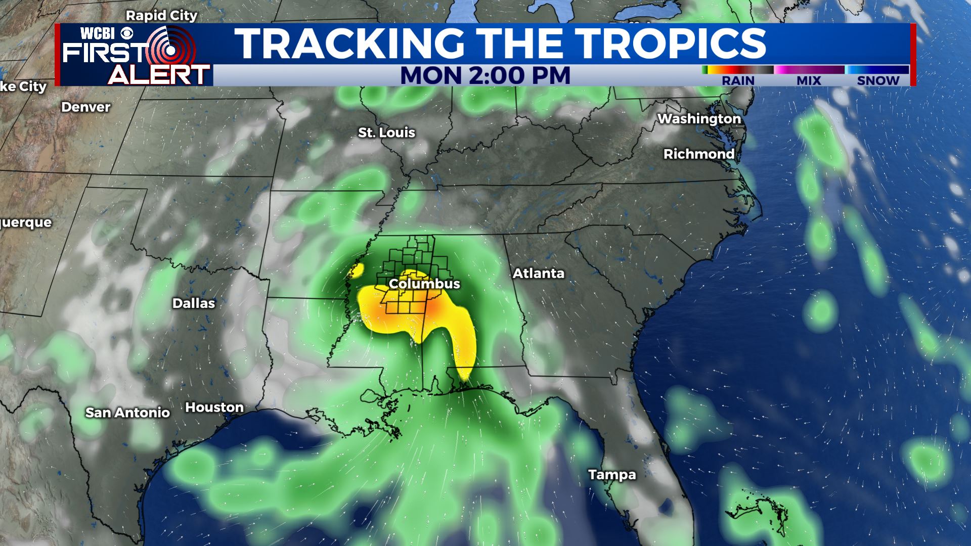
SUMMARY: By now you’ve probably heard of tropical depression 9 brewing in the gulf. Models have been very bullish and consistent for days with the depression entering the gulf and becoming a strong hurricane. Eventual landfall will likely be in Louisiana, potentially as a major hurricane, with the name Ida. The current forecast has us on the eastern side of the system, which could mean substantial impacts as we start next week. Tornadoes, strong winds, and flooding rains are all potential threats. This is a storm to watch very closely, even far inland here in MS and west AL.

TONIGHT: Any isolated showers and storms will quickly end after sunset. Lows in the low 70s tonight under partly cloudy skies.
FRIDAY: Another calm, hot and dry day in store for Friday, with very low rain chances. Most of the day should be sunny with highs topping out in the low to mid 90s.
FRIDAY NIGHT: Calm and clear for Friday night. lows in the low 70s.
SATURDAY: A bit cooler on Saturday, highs in the low 90s across the area. Skies will be partly cloudy, but there is a chance of afternoon showers and storms across the area. Most of us likely stay dry.
SUNDAY, MONDAY AND TUESDAY TROPICAL IMPACTS: A major hurricane will likely be approaching landfall on the gulf coast by Sunday night. Impacts could begin in our area beginning late Sunday and continuing through Tuesday. Since the storm will be moving somewhat slowly over land, it could prolong impacts here a bit. Rain chances really ramp up by Monday morning, and Monday and Tuesday look to be complete washouts with the threat for flash flooding and tornadoes as well. Highs will be right around 80 degrees. Too soon yet to know when the threats will be highest, but we’ll be able to fine tune by the weekend. Stay tuned to the forecast, it can and likely will change! This is definitely a storm to take seriously, especially if you have interests along the MS/LA coasts.
BEYOND THE STORM: After Tuesday, things should calm down and dry out. A few lingering showers may stick around for Wednesday, but Thursday looks fully dry across the area with highs returning to the mid 80s.