An active pattern arrives and will remain through Thursday
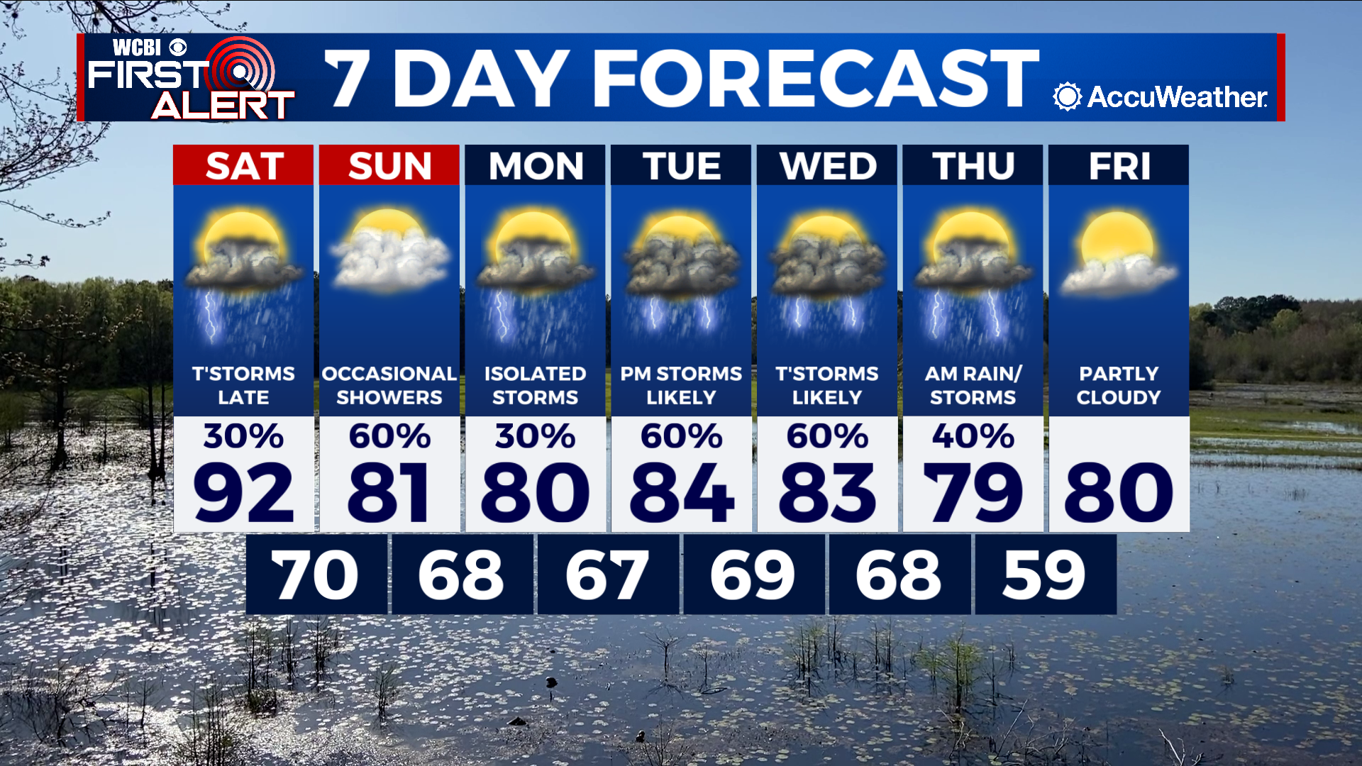
COLUMBUS, Mississippi (WCBI) – SUMMARY: Warm conditions remained in place today, but significant changes arrive to the region this weekend. Rain will become likely tomorrow night ahead of a strong cold front that will drop our temperatures by 10-15° by Sunday.
TONIGHT: Mostly clear with lows in the low-70s. South wind around 5 mph.

SATURDAY: Increasing clouds with a few afternoon showers and thunderstorms possible. Highs in the low-90s. South winds 5-10 mph with gusts up to 20 mph. Chance of rain: 30%.
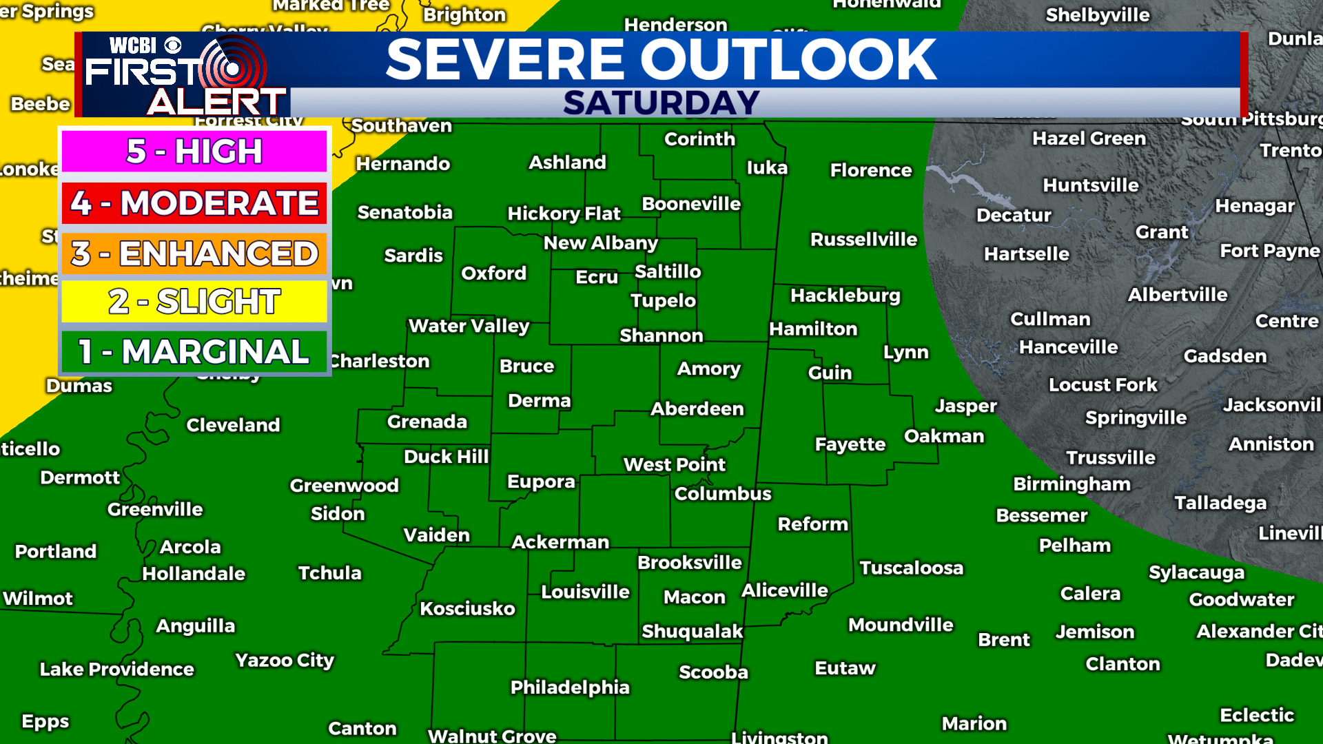
SATURDAY NIGHT: Showers and thunderstorms likely. A few storms may be strong with heavy rain and frequent lightning. Lows in the upper-60s. Chance of rain: 70%. South winds 5-10 mph, with higher gusts in thunderstorms.
SUNDAY: Showers with a few isolated thunderstorms. A few storms may be strong with heavy rain and frequent lightning. Highs in the low-80s. Chance of rain: 70%. Calm wind.
SUNDAY NIGHT: Scattered showers becoming less numerous overnight. Lows in the low-60s. Chance of rain: 40%.
EXTENDED FORECAST: A rainy pattern will continue through next week as several more disturbances move across the region. Highs will top out in the low-80s with scattered showers and storms possible. By the end of the week, we expect 1-2.5” across much of the region.