Another unsettled rainy day ahead for our Thursday
SUMMARY: We have been dealing with a few rounds of rain overnight and another round is moving in this Thursday morning. It’s just the beginning of another unsettled day across the region. We will continue seeing widespread chances of showers & storms as we end of the workweek. The summer heat and humidity will be making a comeback this weekend into next week as we dry out.
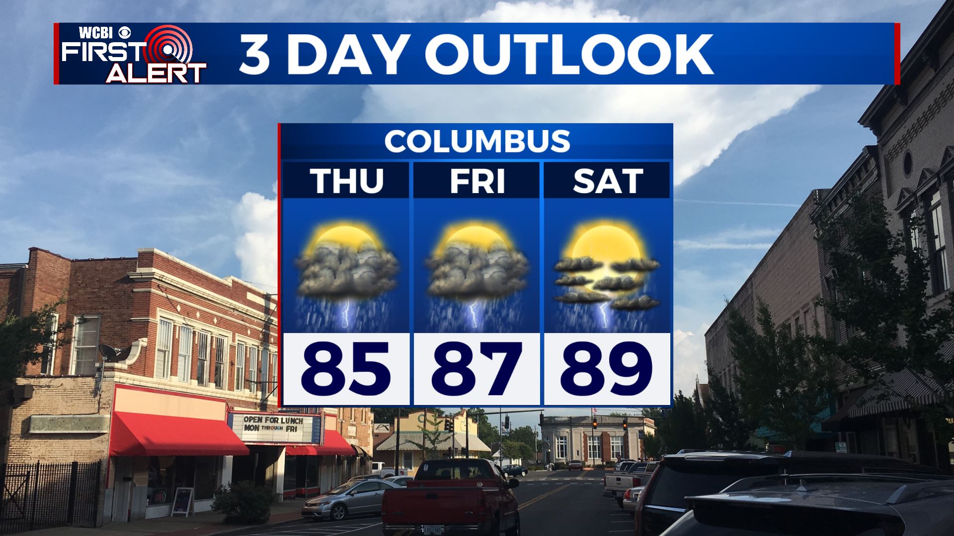
THURSDAY: Another rainy day is ahead for our Thursday, with widespread showers and storms throughout the day. Rain could be heavy at times. Cloud cover and the rain cooed air will hold our highs down into the mid 80s. Keep the rain gear handy!
THURSDAY NIGHT: Showers and storms could linger early evening, but should dissipate for the overnight hours. Mostly cloudy skies. Overnight lows in the 70s.
FRIDAY: More scattered to widespread showers and storms expected as we end the workweek. Cloudy skies. Highs in the mid to upper 80s.
WEEKEND: Slightly drier weather looks to build in, especially toward Sunday. Daytime highs will reach back in the upper 80s and lower 90s.
NEXT WEEK: Summer heat and humidity returns, but rain chances will be low. Highs will be in the 90s with heat indices likely 100+ degrees. Take precautions to stay cool and hydrated.
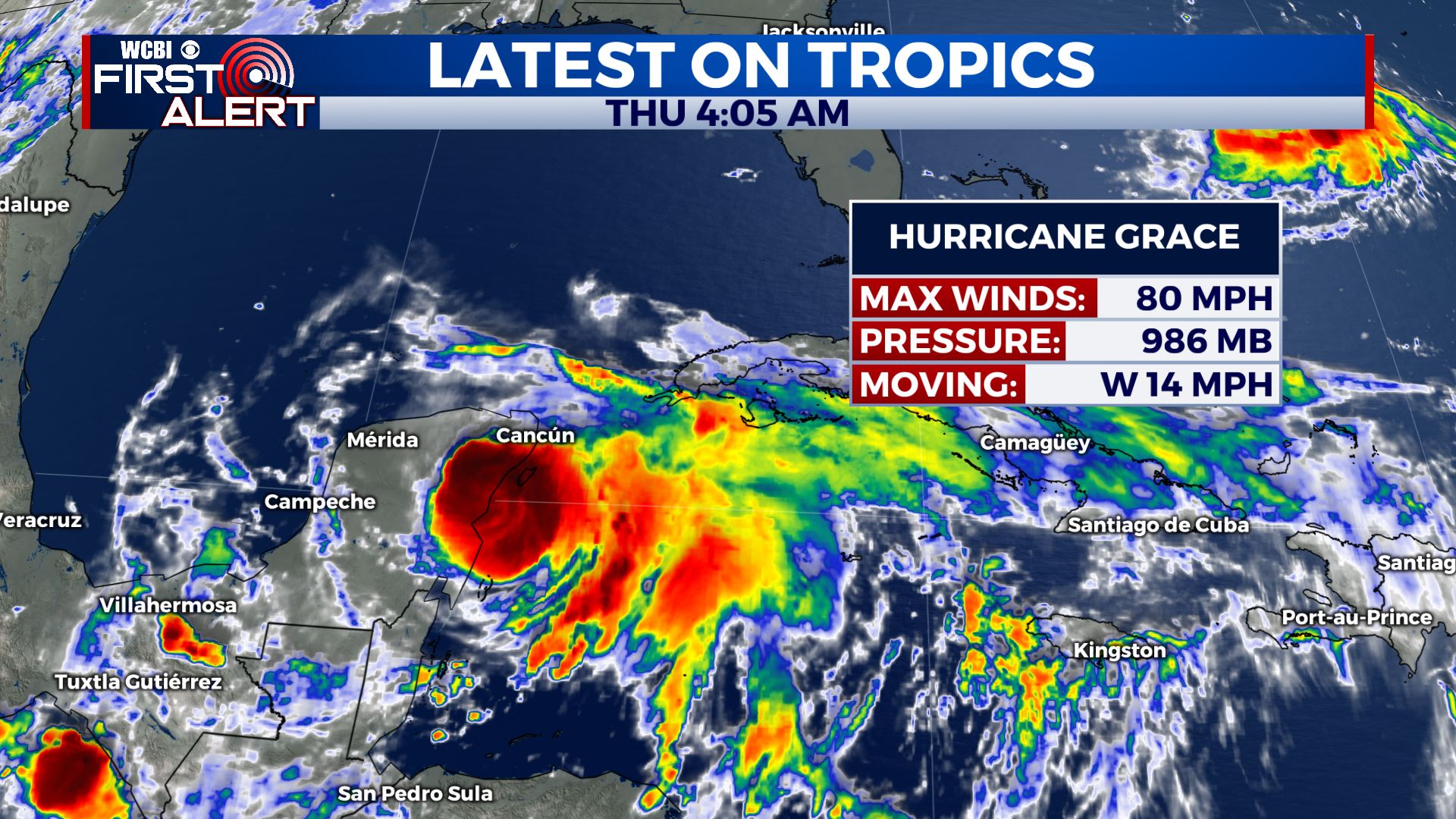
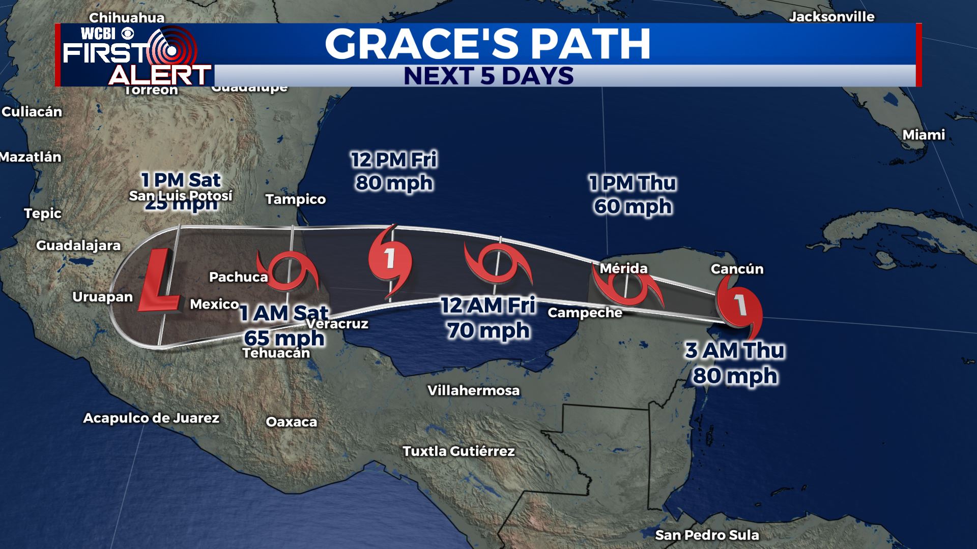
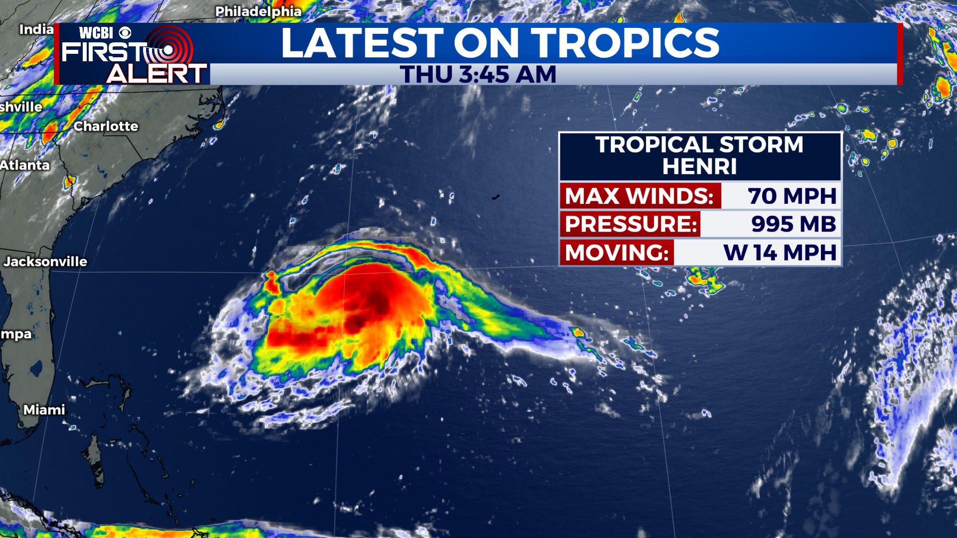
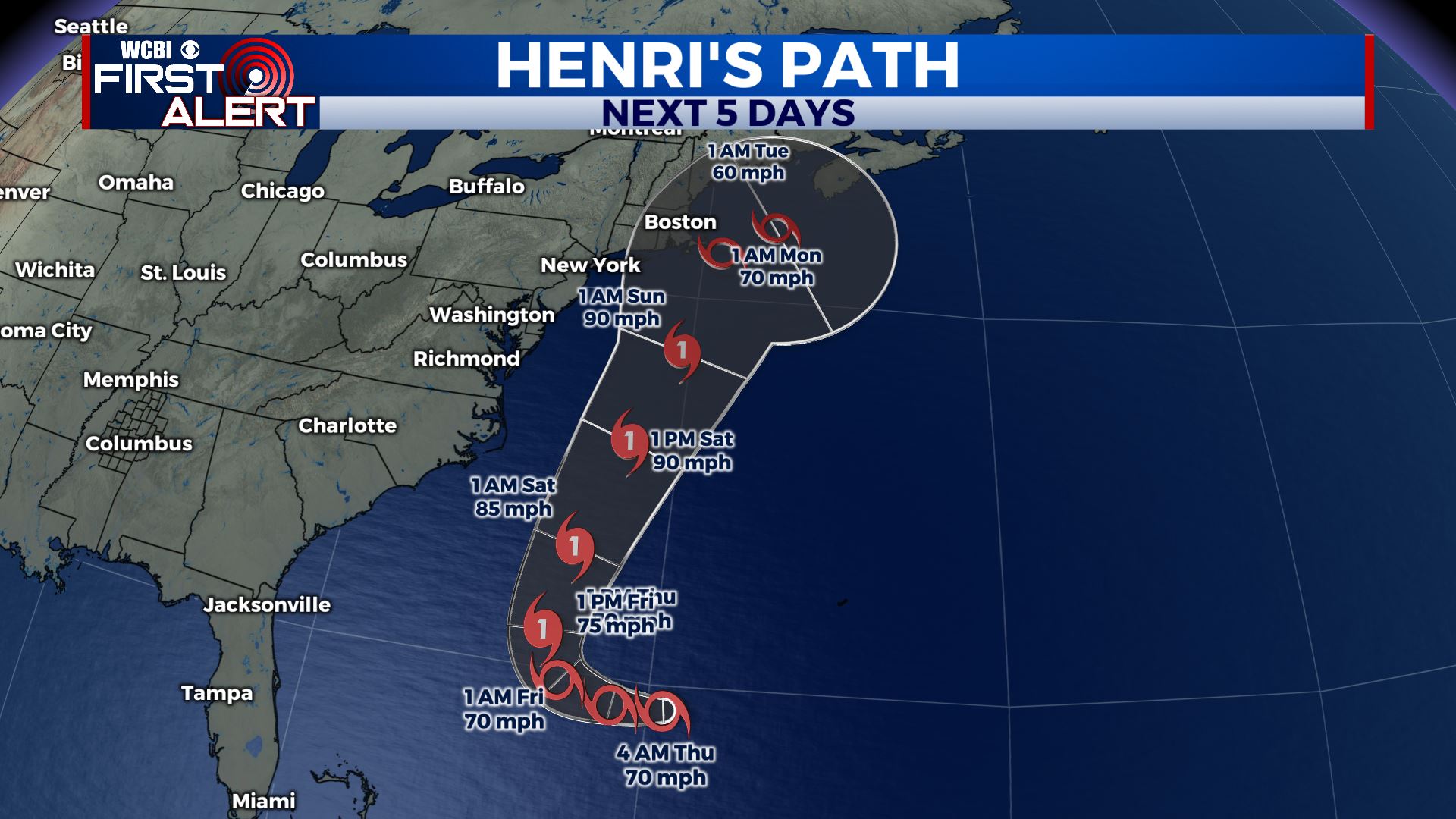
TROPICS: Hurricane Grace made landfall this morning in Mexico’s Yucatan Peninsula as a Category 1 storm. It’s expected to make another landfall in Mexico Saturday. Henri still looking to become a hurricane & could cause some issues on the New England coastline early next week.
Stay connected with @WCBIWEATHER on Facebook, Twitter, Instagram and the WCBI News App