Approaching cold front
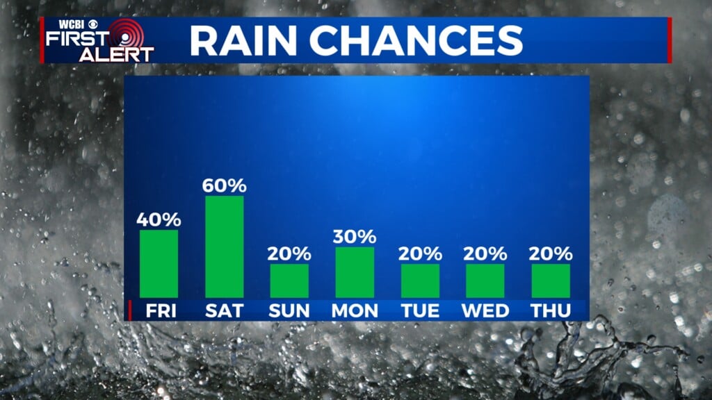
COLUMBUS, Mississippi (WCBI) – A cold front will be approaching from the NW for the end of the week. This will be bringing in cooler air for the weekend, with a continued chance for scattered showers.
THURSDAY NIGHT: A few storms could make their way into northwestern MS late. Overall, severe weather concerns remain quite low. With heavier clouds maintaining, temperatures tonight will be continuing in the middle 60s.
FRIDAY: Thursday night’s front makes a slow pass through the region, thankfully with limited rain! Very isolated, if any at all. Highs will be split across the region, lower 70s along our northern border to middle 80s towards central Mississippi.
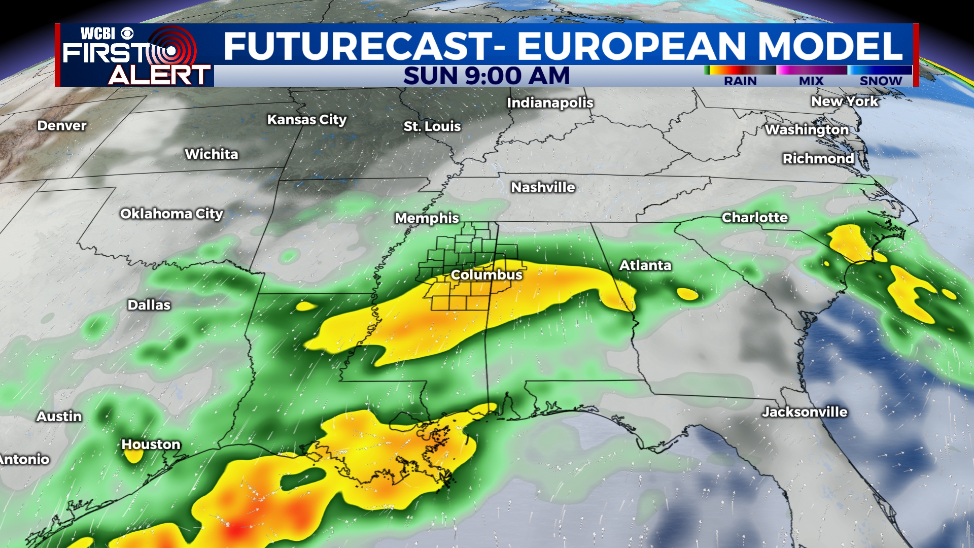
WEEKEND: Big drops in temperature, Saturday upper 60s to Sunday in the upper 50s. Behind the front, moisture will slowly work “over” the front and bring back an increased rain chance. Scattered showers are likely much of the day Saturday. Heavier, steadier rain is expected to move in late Saturday into Sunday morning. Through the day Sunday, rain should steadily shift east…but a good chunk of the day will be soggy and much cooler!
NEXT WEEK: Gradual clearing is expected Monday with warmer weather building back into mid-week.