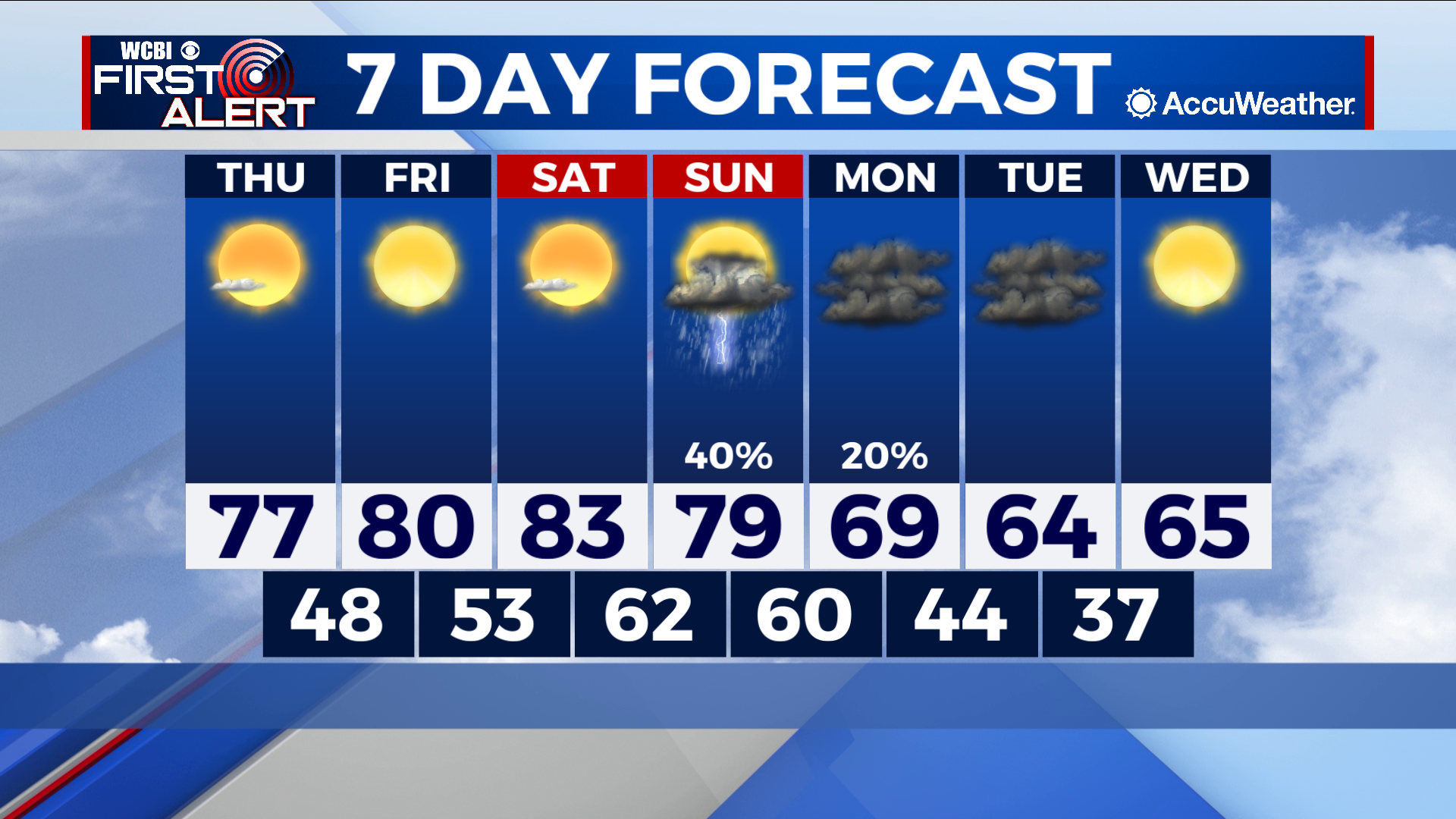
Back to normal over weekend before second round of storms and cold fronts
COLUMBUS – SUMMARY: Highs rebound into the low 80s by Saturday before storms and another cold front strikes. Lows get knocked down from the low 60s Monday to the upper 30s Wednesday.

THURSDAY: Highs top out in the upper 70s Thursday off the back of a cold front that moved through in the overnight hours. Plenty of sunshine and lack of rain chances make for stable conditions. Lows bottom out in the upper 40s overnight.
FRIDAY: The cooling trend does not last long as highs climb back to 80s Friday. Yet more sunshine awaits and no rain is expected. Lows sit in the low 50s overnight.
REST OF THE WEEK: Another chance for showers and storms awaits Sunday before a more robust cold front moves through the region Monday. Highs will drop from the low 80s Saturday to the mid 60s by Tuesday afternoon. Lows likewise will take a huge hit, dropping from the low 60s overnight Sunday into the upper 30s by overnight Tuesday.