Beautiful Friday ahead of unsettled Easter weekend
COLUMBUS, Mississippi (WCBI) – Sunny, quiet weather continues through Friday. Periods of rain and storms are likely throughout the weekend.
FRIDAY: High pressure slides east today, giving us a southerly breeze and a warmer day. Afternoon highs top out near 80 degrees with plenty of sunshine.
FRIDAY NIGHT: Showers and storms arrive after midnight, weakening as they move across north Mississippi. Still, some small hail and gusty winds are possible in the strongest activity. Lows will only drop into the 60s.
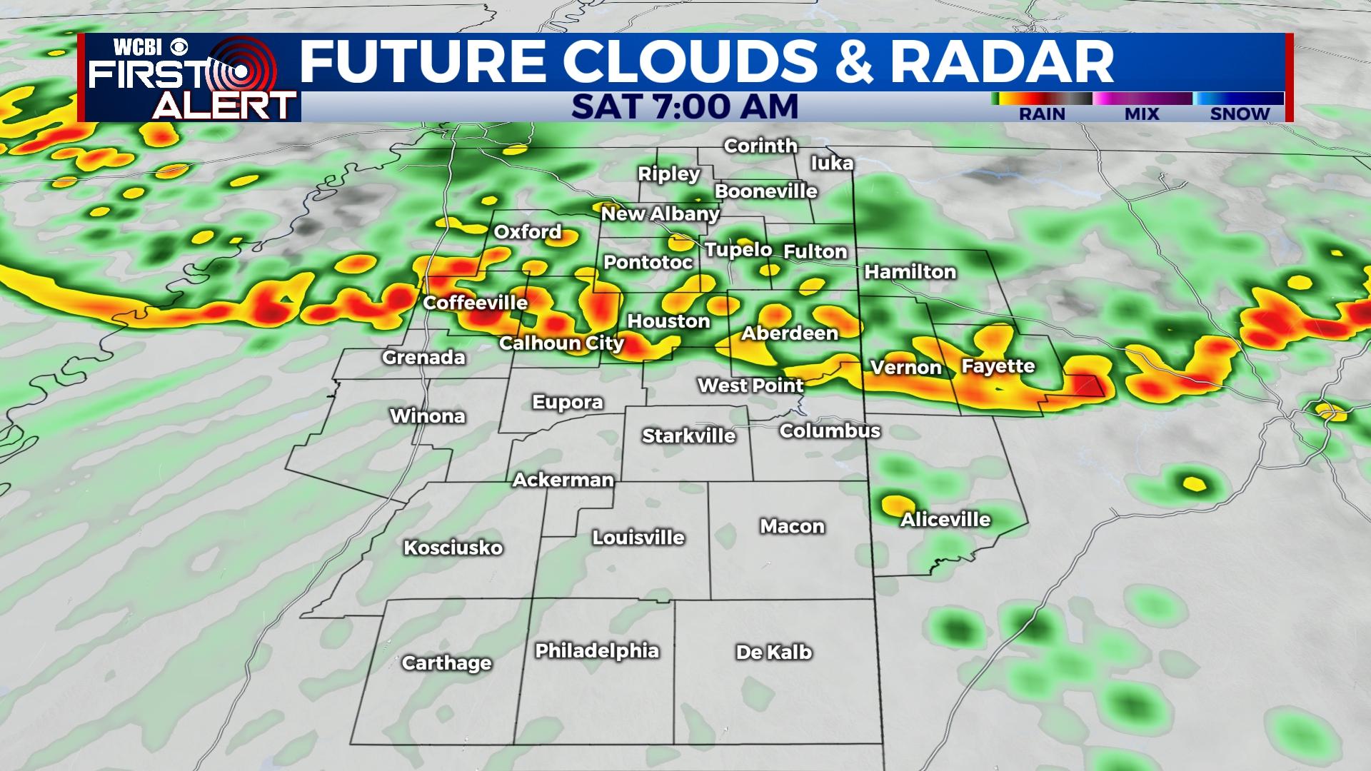
SATURDAY: Showers and isolated storms will move out by late morning, but additional showers and storms could develop in the mid to late afternoon hours. Some of these could become locally strong as well, but no major severe weather concerns are anticipated.
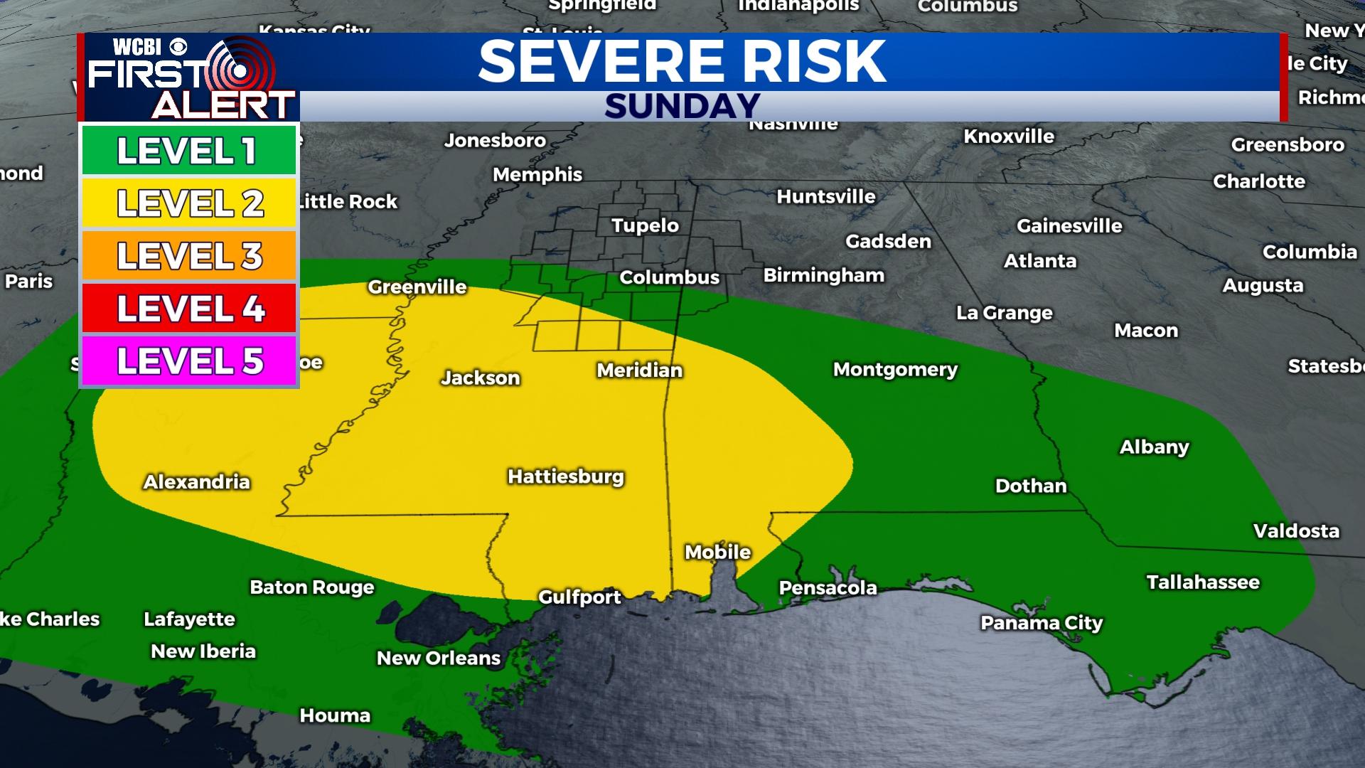
EASTER SUNDAY: Showers and storms appear likely in the morning hours, but there is little to no severe risk. The primary front should sag south of US 82 during the day, pushing any appreciable severe weather risk toward central and southern MS where a level 2 “slight” risk of severe weather exists. Rain stays possible into the afternoon, but there should be some breaks at times as well.
BOTTOM LINE: A few severe t-storm warnings are possible through the weekend. Make sure to stay in tune to the forecast, and be ready to head indoors should rain or storms threaten outdoor plans.
NEXT WEEK: Dry weather returns to start next week with plenty of sunshine. Seasonal mid to late April temperatures are expected with highs in the 70s and lows in the 40s and 50s.


