Beautiful Friday, Picture-Perfect Weekend
Perfect weather has finally arrived to Northeast Mississippi and West Alabama as we’ll be mostly sunny today and into the weekend. More rain and storms are possible by next week as temperatures climb above average.
FRIDAY: A picture perfect day! Nothing but blue sky and sunshine with highs in the upper 50s to near 60. Winds will be breezy out of the north, gusting upwards of 25 mph at times.
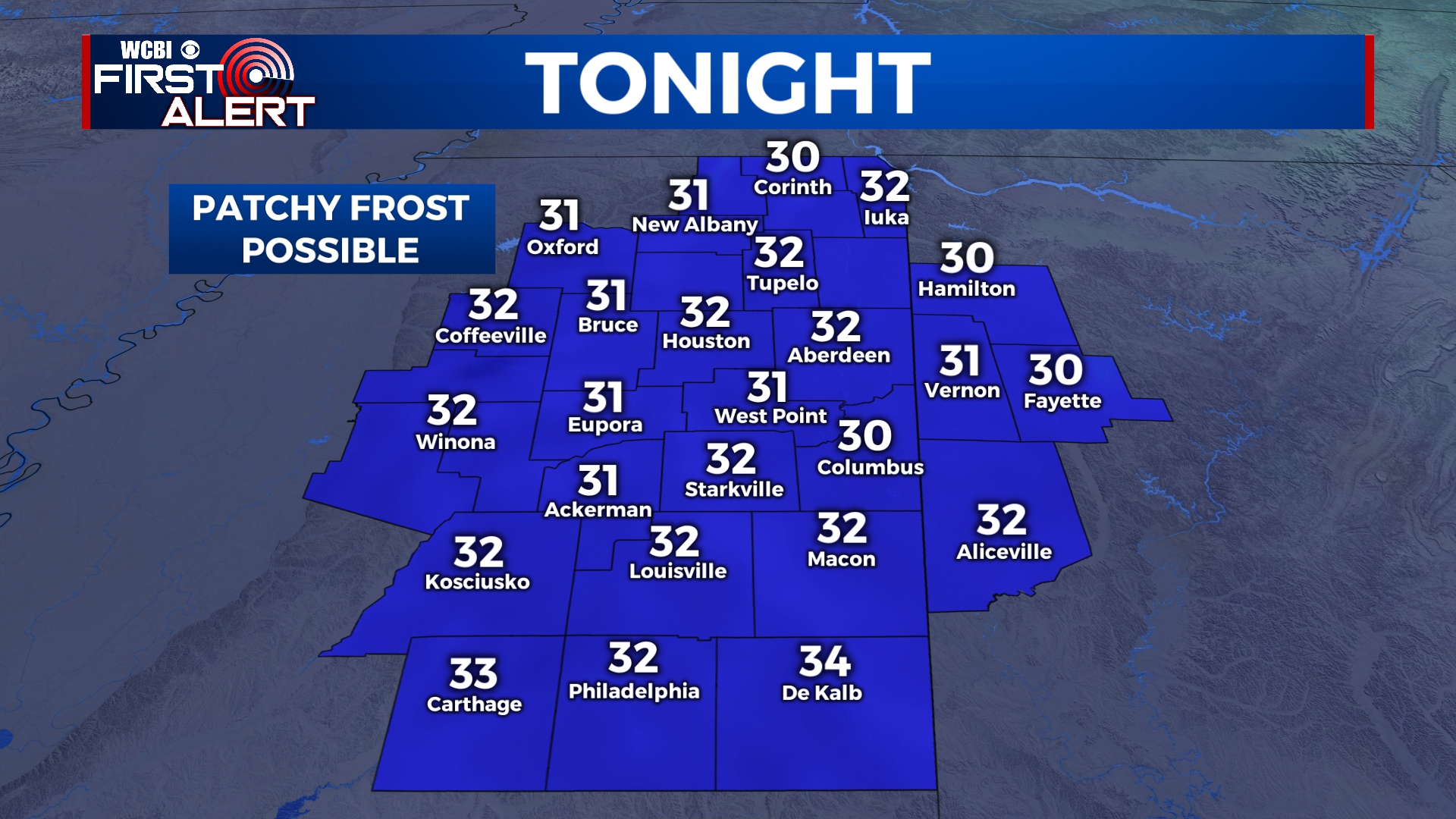
FRIDAY NIGHT: Clear and cold. Lows will be just below freezing for many areas, which will lead to some patchy frost in areas.
SATURDAY-SUNDAY: The weekend is looking nice as well, but there will be a clouds start to filter in, especially on Sunday. Highs will be in the low to mid 60s with overnight lows in the 30s.
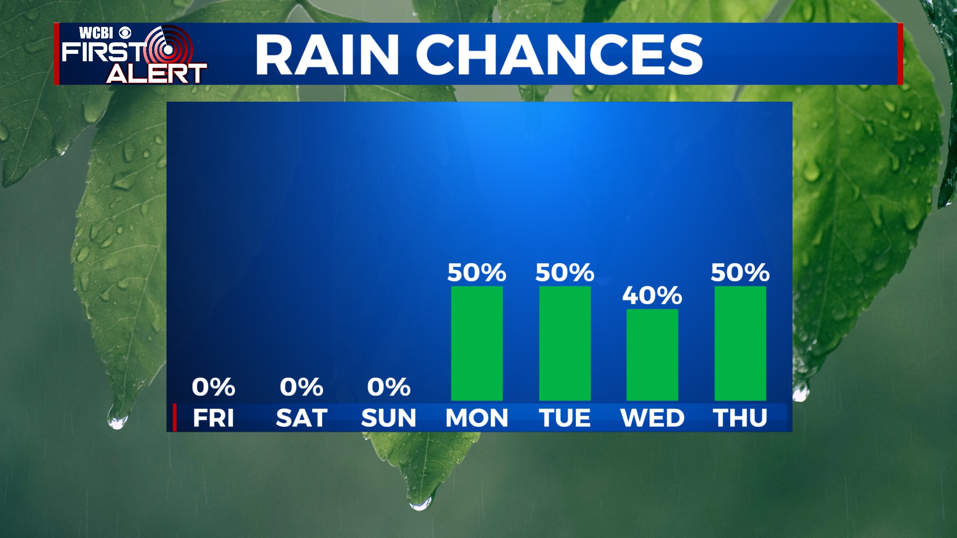
MONDAY: Another round of showers and storms will approach the area late in the day on Monday. Highs will be in the mid 60s. Rainfall amounts will generally be around an inch.
TUESDAY-THURSDAY: Our active weather pattern will continue through the middle portion of the week with a 50/50 chance for showers and some storms each day. Highs will warm into the low to mid 70s with overnight lows in the 50s.


Leave a Reply