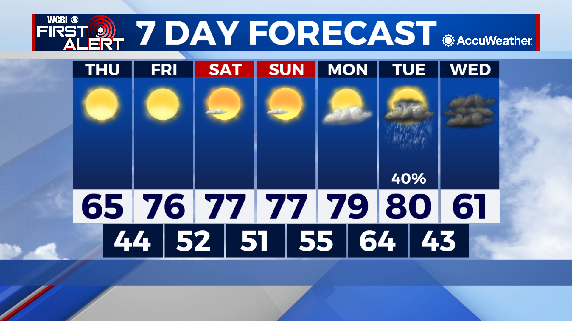
Big shift into 80s before next cold front knocks us back down
COLUMBUS – SUMMARY: A period of warming beginning Thursday brings our highs from the 60s to the 80s by Tuesday. A cold front Tuesday will bring shower and storm chances to the region, while at the same time dropping highs into the low 60s.
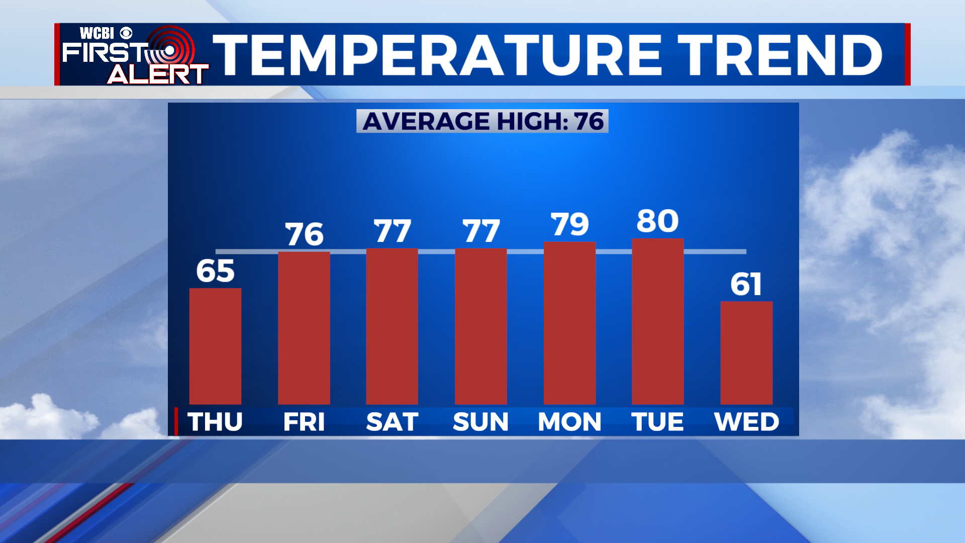
THURSDAY: A high in the mid 60s makes for yet another cool and mild day, despite temperatures close to or at freezing heading out the door. Plenty of sunshine is at play with no chance for rain. Lows drop into the mid to low 40s overnight.
FRIDAY: More sunshine Friday is on tap Friday as the real warmup begins. A big jump into the mid to upper 70s awaits the afternoon while lows climb into the low 50s. No rain is expected.
REST OF THE WEEK: Afternoon temperatures will continue to climb into next week, culminating in highs in the 80s by Tuesday. A cold front Tuesday will brings highs back down into the low 60s as well as a chance for some showers and storms. Lows drop from the mid to low 60s overnight Monday into the low 40s by overnight Tuesday.