Big system brings significant possibility of severe weather Thursday
COLUMBUS – SUMMARY: Another chance for severe weather awaits next week as a strong mid-latitude cyclone takes aim at the eastern United States. Temperatures remain in the mid 70s before Thursday’s system and cold front brings highs back into the 50s and lows in the 30s.
MONDAY: Afternoon temperatures climb into the low 70s as the chance for showers returns to the forecast. Scattered showers will be possible throughout the day before the skies clear out in the evening. Lows drop into the mid 50s overnight.
TUESDAY: Increased sunshine Tuesday will add a few degrees to the afternoon temperature, but overall a high in the mid 70s once again leaves us with mild weather. No rain is anticipated Tuesday. Lows drop into the mid to upper 50s overnight.
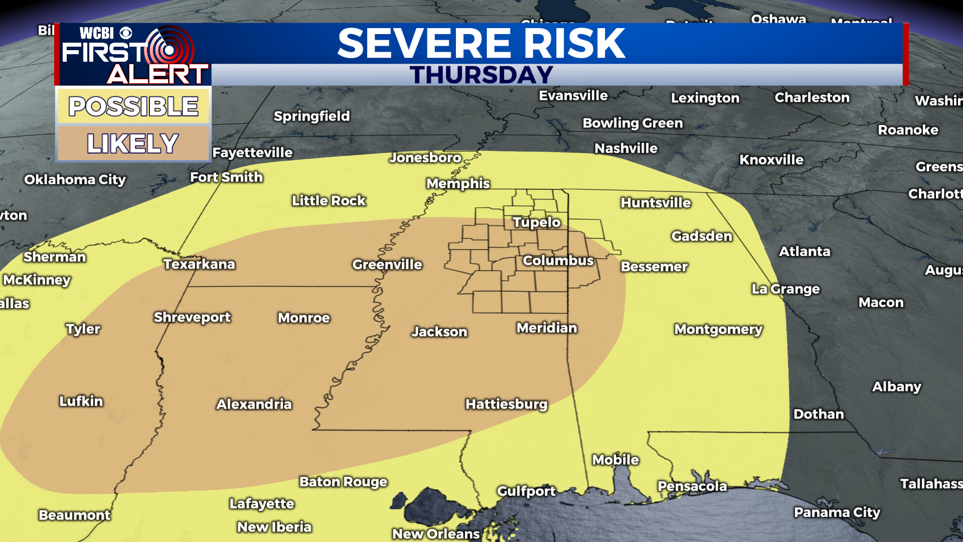
REST OF THE WEEK: Highs remain in the 70s up until Thursday, when a robust system and accompanying cold front will send highs back into the 50s and lows into the 30s. More importantly for many, however, will be the elevated risk for severe weather come Thursday. Just 4 days out Storm Prediction Center (SPC) has decided on a 30% probability for severe weather across much of our viewing area. Further still, initial output from models show a very robust structure to the system moving through our area. We will continue to keep you updated on Wednesday/Thursday’s severe weather threat as it evolves.