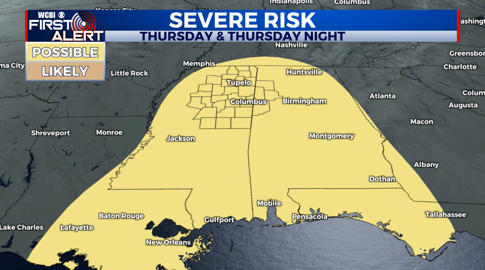
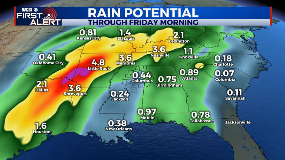
Big system on track for New Year’s Eve
SUMMARY: Relatively mild air will continue through the last few days of 2020. Our next big system will swirl through the region Thursday & Friday, giving us the chance of more heavy rain and even strong to severe storms. The best chance of severe weather, including a wind and tornado threat, looks to be Thursday afternoon through Thursday evening.
MONDAY NIGHT: Mostly cloudy. Lows ranging from the upper 30s to lower 40s. Winds NNE 2-6 mph.
TUESDAY: Clouds & sun. Highs in the upper 50s to around 60. Winds SE 5-10 mph.
TUESDAY NIGHT: Mostly cloudy and milder. Lows in the upper 40s to around 50.
WEDNESDAY: Mostly cloudy with a 20% chance of showers. Mild highs in the mid 60s. Increasing SE winds 10-20 mph.
WEDNESDAY NIGHT: Mostly cloudy with rain possible. Lows in the mid to upper 50s.
THURSDAY: Mostly cloudy. Areas of rain and storms developing during the day. Heavier rain and some strong storm activity will become more likely in the late afternoon and evening. Mild highs in the upper 60s.
THURSDAY NIGHT: Areas of rain and storms. Some storms could be severe with gusty winds, perhaps an isolated tornado, and locally heavy rain. Lows in the mid to upper 50s.
NEW YEAR’S DAY: Clouds and rain during the morning. Becoming mostly sunny to partly cloudy in the afternoon. Highs in the low 60s.
SATURDAY: A mix of sun and clouds. Just a slight chance of some late evening and overnight rain going into early Sunday morning. Highs in the low to mid 50s.
Follow @WCBIWEATHER on Facebook, Twitter, Instagram, and the WCBI News App


Leave a Reply