Breezy next couple days ahead of Thursday severe risk
COLUMBUS, Mississippi (WCBI) – Increasingly humid and warm air will lead to a severe weather risk on Thursday with a strong front moving through the region.
WEDNESDAY: Clouds gradually increase through the day, but the weather stays warm and breezy with highs reaching the low 70s for most spots. Where clouds are more prevalent, temperatures may hold in the upper 60s. Expect wind gusts over 25 mph at times, but recovering humidity values should greatly reduce recent fire risks.
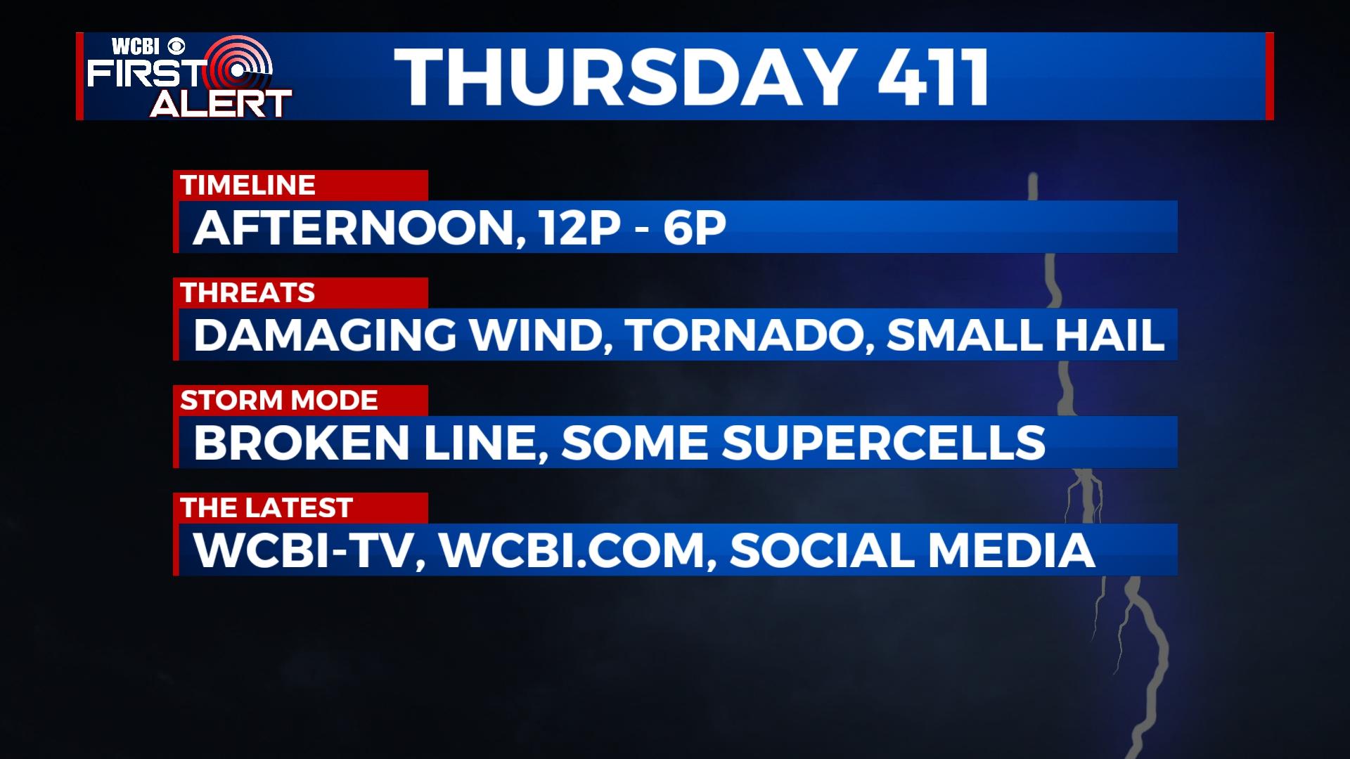
THURSDAY: The day starts mostly dry with sporadic showers with temperatures near 60 degrees. While clouds hang tough through the day, persistent and gusty southerly winds will continue to bring in warmer, more humid air into northeast Mississippi. This will set the stage for afternoon storm development as a cold front nears from the west. We expect a broken line of strengthening storms to develop into northeast MS after 1pm. Plentiful wind shear should allow strengthening storms to be capable of producing damaging winds and as well as a tornado threat. Potential limiting factors include too much shear and not quite enough instability to “match” it; however, enough overlap between the two is expected to produce a threat for severe weather between 12p-6p.
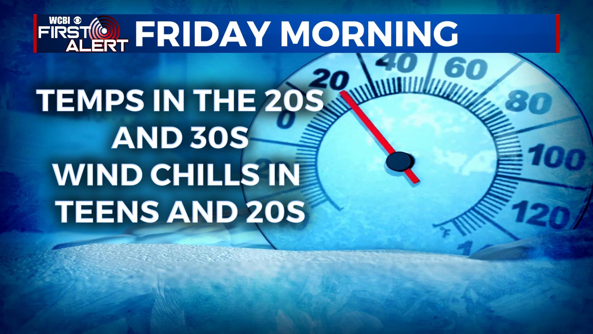
FRIDAY: Thursday’s storms will clear out before daybreak, and much, much colder air will be in place Morning temperatures will start in the 30s to upper 20s. Despite a decent amount of sunshine, highs will struggle into the upper 40s.
WEEKEND: Even though the weather starts cold in the 20s, stunning weather is expected Saturday with highs near 60 degrees. Clouds increase late Sunday, but the day should be dry and warm with highs in the middle 60s.
NEXT WEEK: Another active stretch of weather is expected with several disturbances moving through the Deep South. Expect scattered showers and storms Monday and Tuesday.


Leave a Reply