Breezy Thursday, some rain and storms Thursday PM
COLUMBUS, Mississippi (WCBI) – Mild, breezy weather continues ahead of a cold frontal passage Thursday night. Into the weekend, we’ll finally have some nice weather!
THURSDAY: Clouds increase through the day, holding highs in the 60s to low 70s across northern MS. An even stronger breeze is expected, with gusts over 25 mph at times through the afternoon. A late-day shower or two is also possible.
THURSDAY NIGHT: Scattered showers and storms are likely to move/develop into northern MS after sunset ahead of a cold front. Some pockets of gusty wind are possible, but the severe risk remains quite low. Winds will shift out of the northwest after midnight behind the cold front.
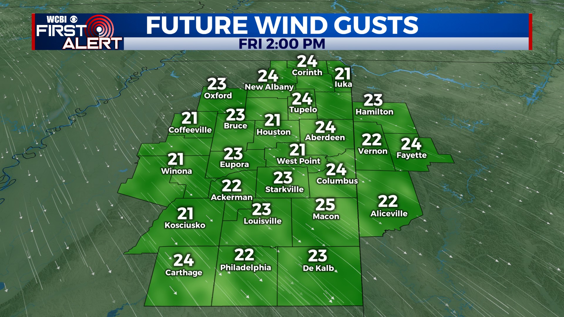
FRIDAY: Expect plenty of sunshine with a refreshing northwest breeze. Highs will top out in the middle to upper 60s.
WEEKEND: Cool mornings and mild afternoons will be the story with plenty of sun! Sunday will be the warmer day in the mid 70s.
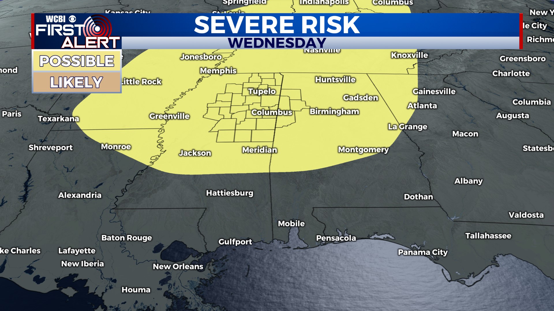
NEXT WEEK: We’ll start off with quiet weather, but there are signs of a strong cold front moving through the Deep South Wednesday. Showers and storms look likely, but the scope of any severe risk still remains in question. Climatology would certainly favor a severe risk around these parts, but we’ll need a few more days of studying/assessing weather models before pinning down any specifics.