Calm end to the week before a rainy Saturday and possible snow Sunday
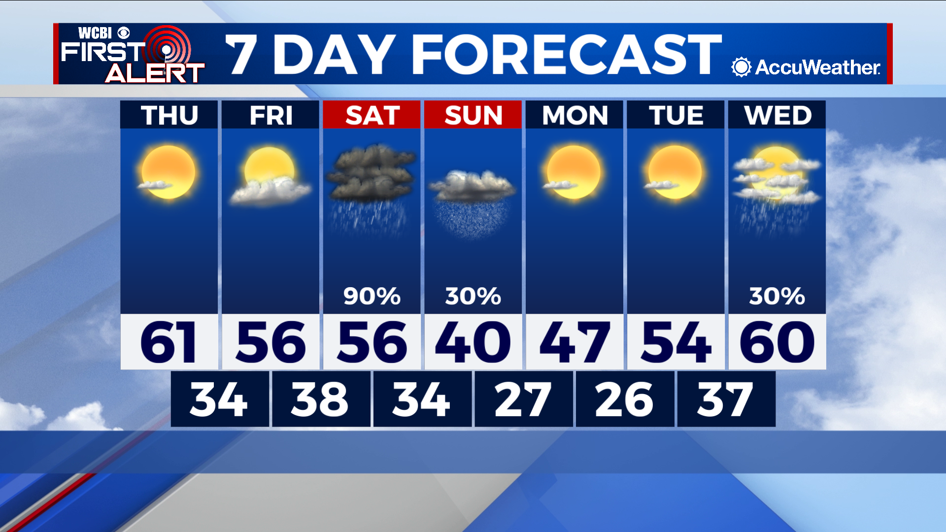
COLUMBUS, Mississippi (WCBI) – SUMMARY: Near average temperatures remain in the forecast the next few days, then rain and possibly snow return to the region this weekend.
TONIGHT: Few clouds after midnight with lows in the mid-30s. Calm wind.
THURSDAY: A few afternoon clouds with highs in the low-60s. West wind 3-5 mph.
THURSDAY NIGHT: Mostly clear. Lows in the mid-30s. Calm wind.
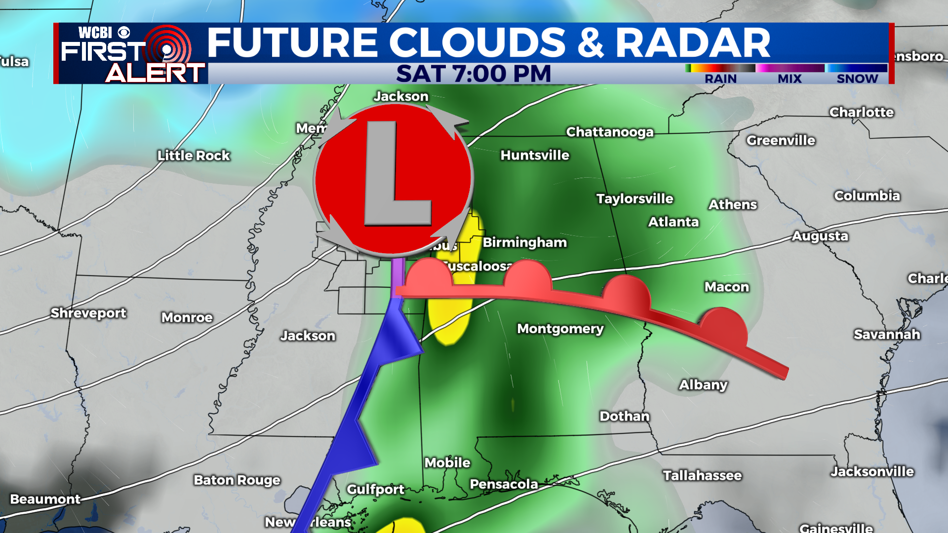
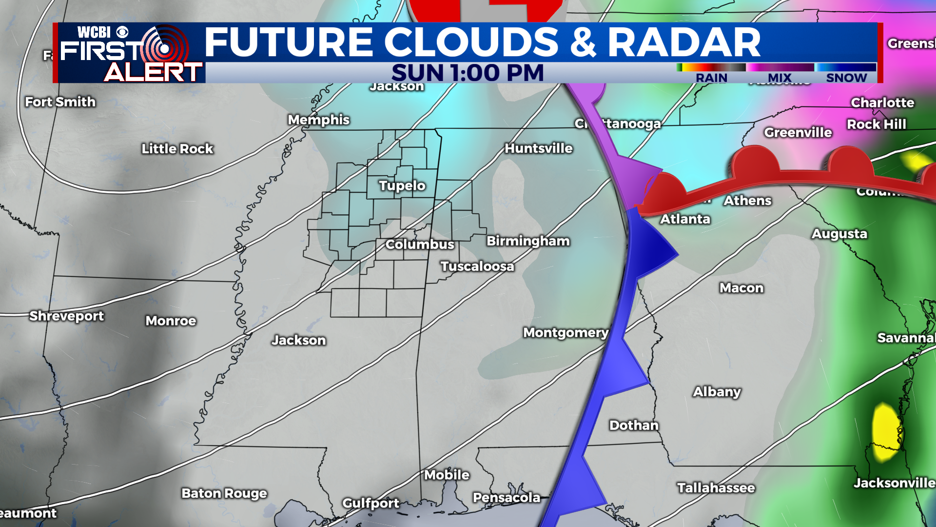
EXTENDED FORECAST: Another weekend of active weather returns to the forecast for our region. A low pressure system will push across Northern Mississippi Saturday, producing occasional showers. An associated cold front will usher in much colder temperatures as well, and may result in some mixed precipitation Saturday night. There is still a lot of uncertainty with the forecast, and changes to the low pressure track and its overall intensity will have impacts on what type of precipitation we see with this system as it moves across our area. Once the system is to our east on Sunday, wrap around moisture will produce isolated snow showers through the morning and afternoon. This part of the forecast is higher confidence. As of now, travel impacts are not expected for most of the area, except for our far northern Mississippi counties. This will continue to evolve so check in for additional updates. Next week will feature moderating temperatures with highs starting out in the mid-40s Monday then low-60s by Wednesday ahead of our next system.