Calm end to the week before weekend storms
COLUMBUS, Mississippi (WCBI) – Overall calm conditions for the end of the week, as clouds begin to fill back in from the South. A stormy system is expected for Saturday, with a severe weather threat for the whole viewing area. The conditions will calm again into next week.
THURSDAY NIGHT: The early arrival of cloud coverage will help keep temperatures a little warmer tonight. Overnight low temperatures are expected to sit in the upper 30s to lower 40s.

FRIDAY: Clouds will continue to fill in more, becoming mostly cloudy. High temperatures will increase again, reaching into the middle 60s. There will be a light chance for rain Friday evening to overnight, very scattered. Low temperatures will be the warmest Friday night. Staying mild, overnight lows will be in the upper 50s.
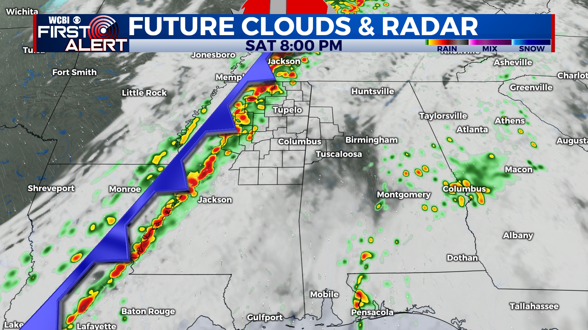
WEEKEND: Warm, humid, and unstable air will build in from the Gulf Saturday morning. High temperatures will reach into the lower 70s, ahead of the stormy system. With all ingredients set in place, there is going to be potential for strong to severe storms late Saturday afternoon and into the evening. The timeline has updated a little more, as models begin to agree. The main line of storms is expected from 4pm to midnight. Cold air will rush in behind the passing front, dropping low temps into the middle 40s and Sunday high temps reaching only into the lower 50s. A few leftover showers may be possible Sunday morning, drying out the rest of the day.


