Calm through Thursday, severe storms possible again Friday PM
COLUMBUS, Mississippi (WCBI – Tranquil weather continues through Thursday before another active day sets up Friday. Strong to severe storms are possible Friday evening.
WEDNESDAY – High pressure controls the weather today, so that means lots of sunshine and a pleasant afternoon! Highs will reach the upper 60s with light and variable winds.
WEDNESDAY NIGHT: Patchy frost is again possible as lows dip into the upper 30s.
THURSDAY: Lots of sunshine will continue as highs return to the 70s thanks to redeveloping southerly winds.
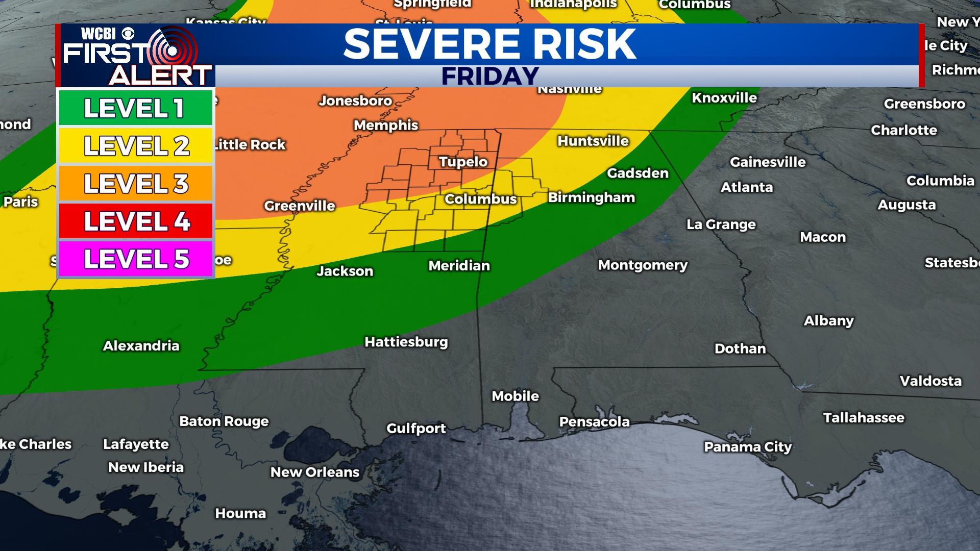
FRIDAY: The day is likely to start cloudy with spotty showers. Through the day, at least partial clearing is expected, allowing highs to reach 80 degrees by mid to late afternoon. Then, scattered showers and storms could begin developing as early as 4-5p across parts of the state. These will likely have a limited (but not zero risk of severe weather. After 6p, additional storms developing into the state from Arkansas will have a higher chance of producing severe weather, including damaging winds, hail, and tornadoes. This severe threat will likely continue past midnight as storms potentially coalesce into a line. While specifics of the threat remain a little unclear, signs are pointing to another significant threat of severe weather – stay tuned for further updates.
WEEKEND: Any storms should clear by daybreak Saturday, leaving a mostly sunny and increasingly warm & breezy day. Highs will likely top out in the lower 80s. Sunday looks fantastic as well – expect lots of sun with highs back in the upper 70s.
NEXT WEEK: The active pattern shows no signs of letting up; in fact, showers and storms are likely again Monday. Moisture and instability will be on the climb, so these will have potential severe concerns. Next up, a strong front Tuesday or Wednesday could bring more showers and storms to the region. Stay tuned!