Calmer for now, severe storms possible again New Year’s Day
COLUMBUS, Mississippi (WCBI) – After several rounds of heavy rain and severe storms Wednesday, another round of storms could move in Saturday.
THURSDAY: Any lingering showers and storms this morning will move out before lunch, leaving a mostly cloudy and dry rest of the day. Temperatures may hold in the upper 60s for most spots, but a few pockets of clearing could allow for some low 70s.
FRIDAY: Variably cloudy and warmer again with highs in the middle to upper 70s. Some late evening showers or storms could form in far northern MS, likely after midnight. These storms could grow locally strong.
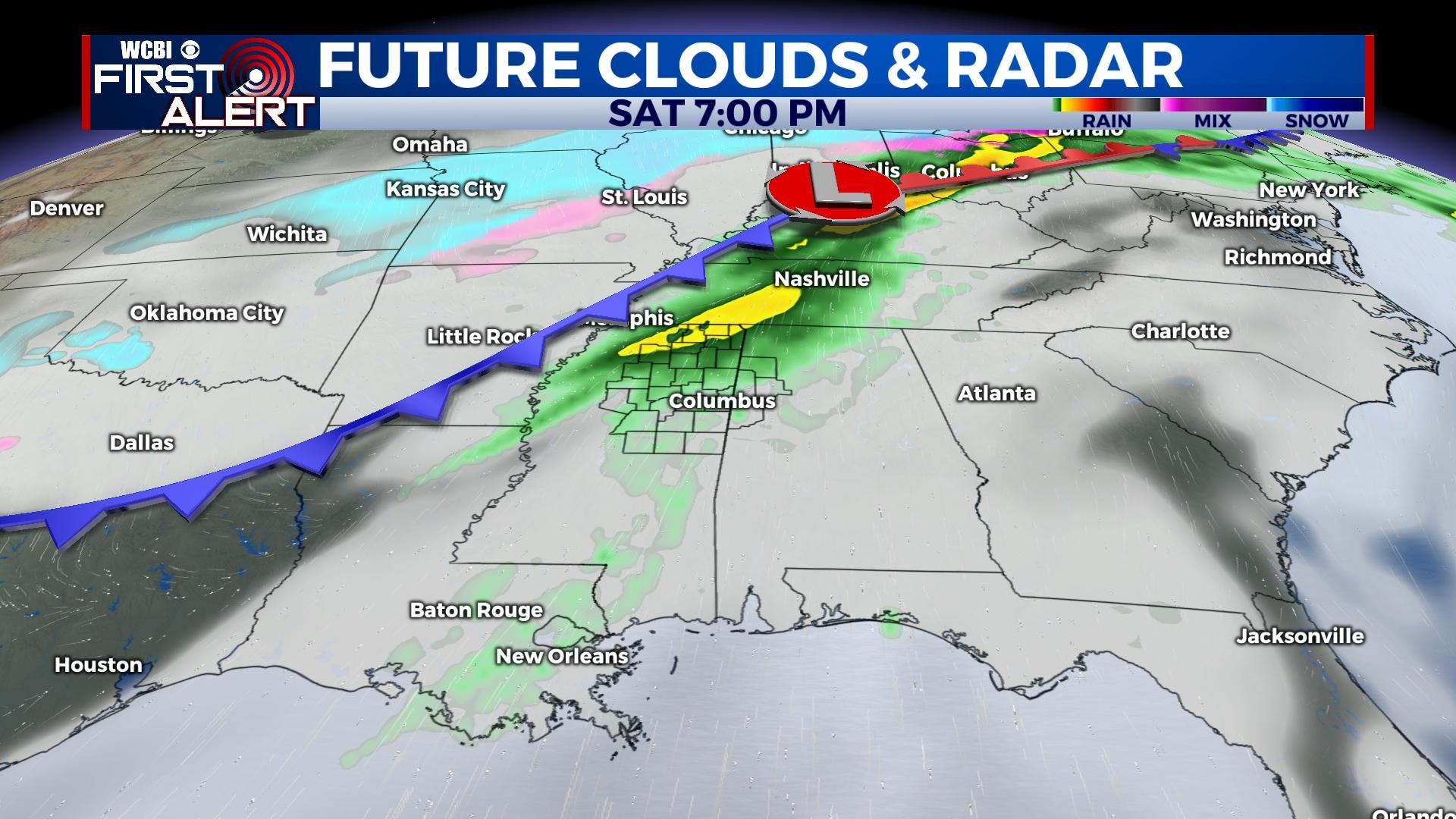
SATURDAY: Yet another round of potentially strong to severe weather could occur in the afternoon and evening. A strong cold front is expected to sweep in from the west, generating showers and storms in a favorable environment for additional severe concerns. At this time, all modes of severe weather (hail, wind, tornado) are on the table.
SUNDAY: Behind Saturday’s front, sharply colder air is slated to arrive during the day. Temperatures are expected to rapidly fall into the 30s by afternoon. Any lingering moisture should exit before cold air arrives, so wintry precip. still looks very unlikely.
MONDAY: COLD. Temperatures will start in the lower to middle 20s. Sunshine will only warm the afternoon into the 40s.
TUES/WEDS: Steady warming is expected with highs nearing 60 degrees by Wednesday. Dry weather is also expected.