Chilly and cloudy through Tuesday, heating up towards Christmas
SUMMARY: We start off the week of Christmas on a chilly note, with cloudy skies and highs in the 40s and low 50s. We’ll see a low chance for a few showers Monday night. The sun comes back out by Wednesday, and temperatures begin to climb as we get closer to Christmas. We’ll see dry weather through the holiday, with highs reaching the mid 70s on Christmas afternoon! We stay warm for the day after Christmas, with a chance for some showers.
SUNDAY NIGHT: Going to be a chilly night for all of us, with lows falling into the upper 20s and low 30s. Clouds will move in late in the night, setting the stage for a cloudy Monday.
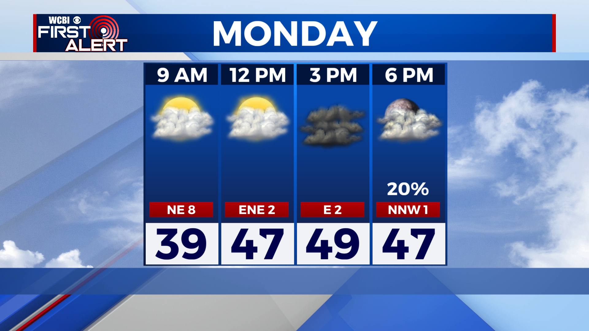
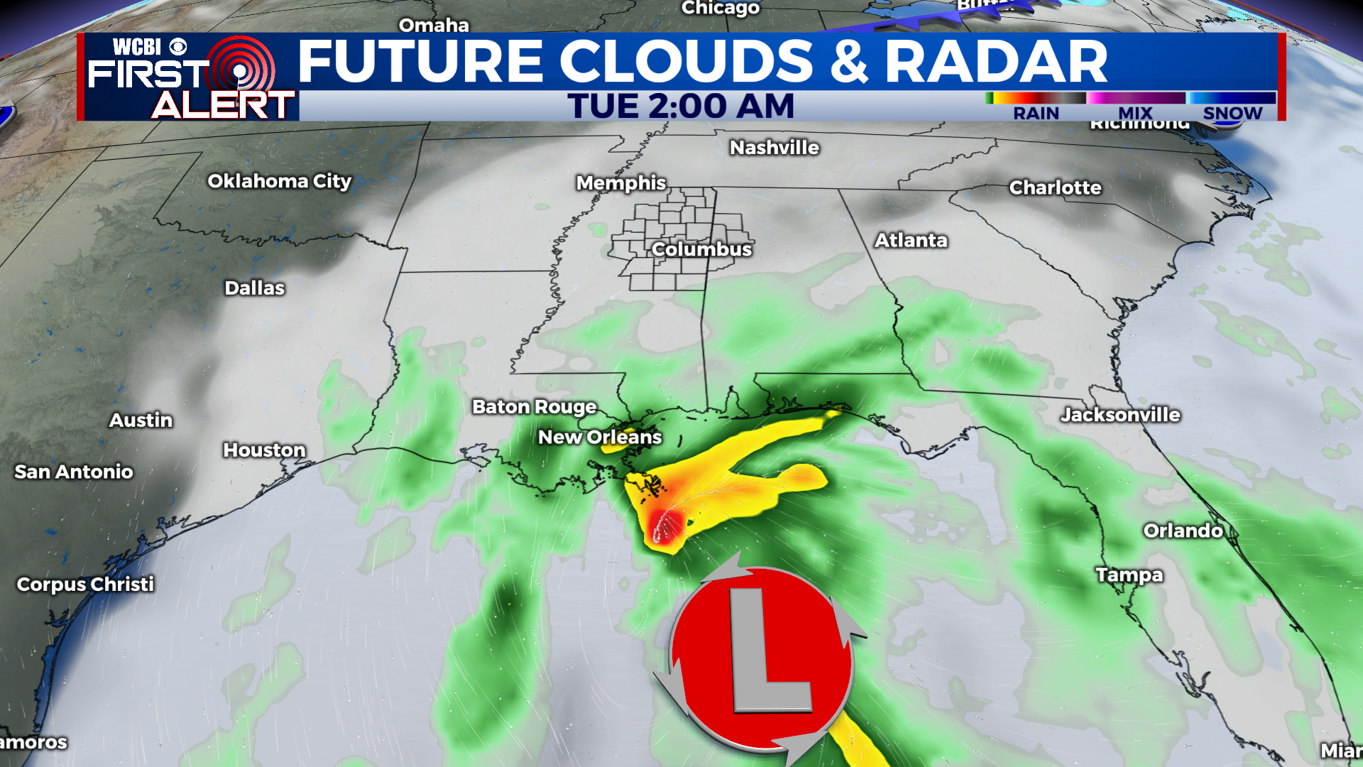
MONDAY: A chilly and cloudy day in store as an area of low pressure in the Gulf spreads clouds over the region. Most of us only top out in the upper 40s.
MONDAY NIGHT: As the low pressure moves by well to the south, it will through a few showers into the region Monday night. Most of us will stay dry and cloudy, with a low in the low 40s.
TUESDAY: Clouds will linger through Tuesday, with a sprinkle or 2 possible early in the day. Highs will stay cool in the upper 40s to low 50s.
WEDNESDAY TO CHRISTMAS EVE: The sun comes back out for Wednesday, and it will be a beautiful winter day with a high in the mid to upper 50s. We return to the 60s on Thursday, with a mix of sun and clouds. Christmas Eve has been looking warmer and warmer over the past few days, with a high in the upper 60s to around 70 with partly cloudy skies.
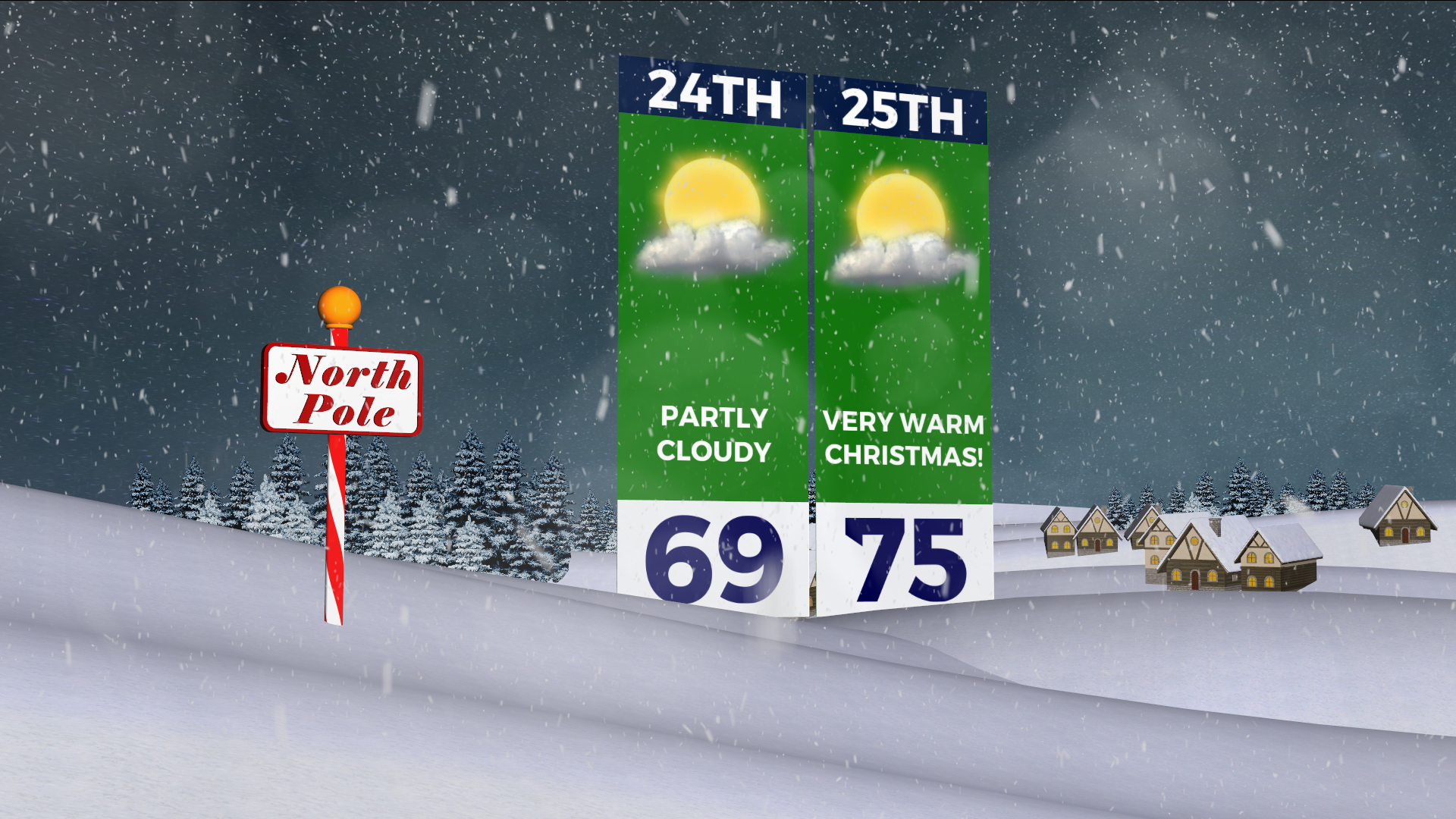
CHRISTMAS DAY AND SUNDAY: Christmas day will be VERY warm, possibly even record breaking in spots! Highs will top out in the mid to even upper 70s with partly cloudy skies. Hope Santa brings some shorts! We stay warm for the day after Christmas with a high once again in the mid 70s. A few showers will be possible as well.
Happy Holidays everyone!
CONNECT WITH @WCBIWEATHER ON TWITTER, FACEBOOK AND INSTAGRAM