Chilly, breezy Tuesday…storm chances by Friday
COLUMBUS, Mississippi (WCBI) – After Monday night’s rain, we’ll dry out into mid-week. Storm chances move in by Friday.
TUESDAY: Clouds generally linger much of the day, with gradually falling temperatures into the afternoon. 3 PM temperatures are likely to be in the lower 40s or even upper 30s north with spotty showers or even brief flurries in the northeast corner of the state. Breezy southwest to west winds will continue as well, gusting over 30 mph at times.
TUESDAY NIGHT: Winds will relax late, leaving a mostly cloudy overnight and temperatures near or just below freezing.
WED/THU: Still our better days of the week. The sky will become mostly sunny Wednesday with highs in the low 50s, but Thursday looks much milder into the lower or middle 60s! Clouds will increase late Thursday, and some showers and even a storm or two will become possible late Thursday.
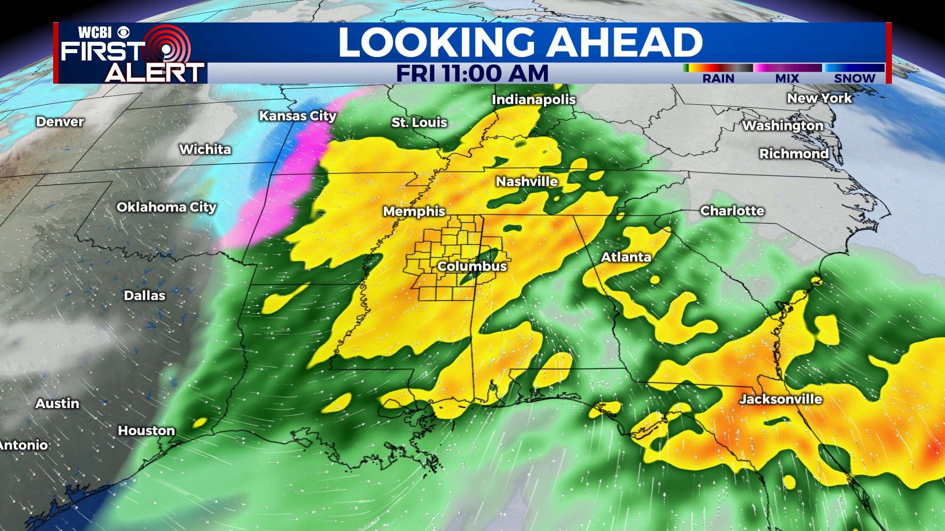
FRIDAY: Yet another dynamic system will swing through the Mid-South, bringing unstable air/moisture farther north. We expect showers and storms for the first half of Friday, and these could become strong to severe. Stay tuned for updates!
WEEKEND: Much colder! The sky briefly becomes mostly sunny Saturday, but clouds quickly return Sunday afternoon w/both days seeing highs in the 40s.
NEXT WEEK: Addressing the elephant in the room, there’s a chance of wintry precipitation Monday into Tuesday. Several model runs have shown rain changing to freezing rain or even snow across parts of north MS. It’s still 5+ days away, so we’ll continue watching trends. Regardless, the coldest air of the season is set to blow in here by next Tuesday.


