Chilly weekend, warmer for the work week
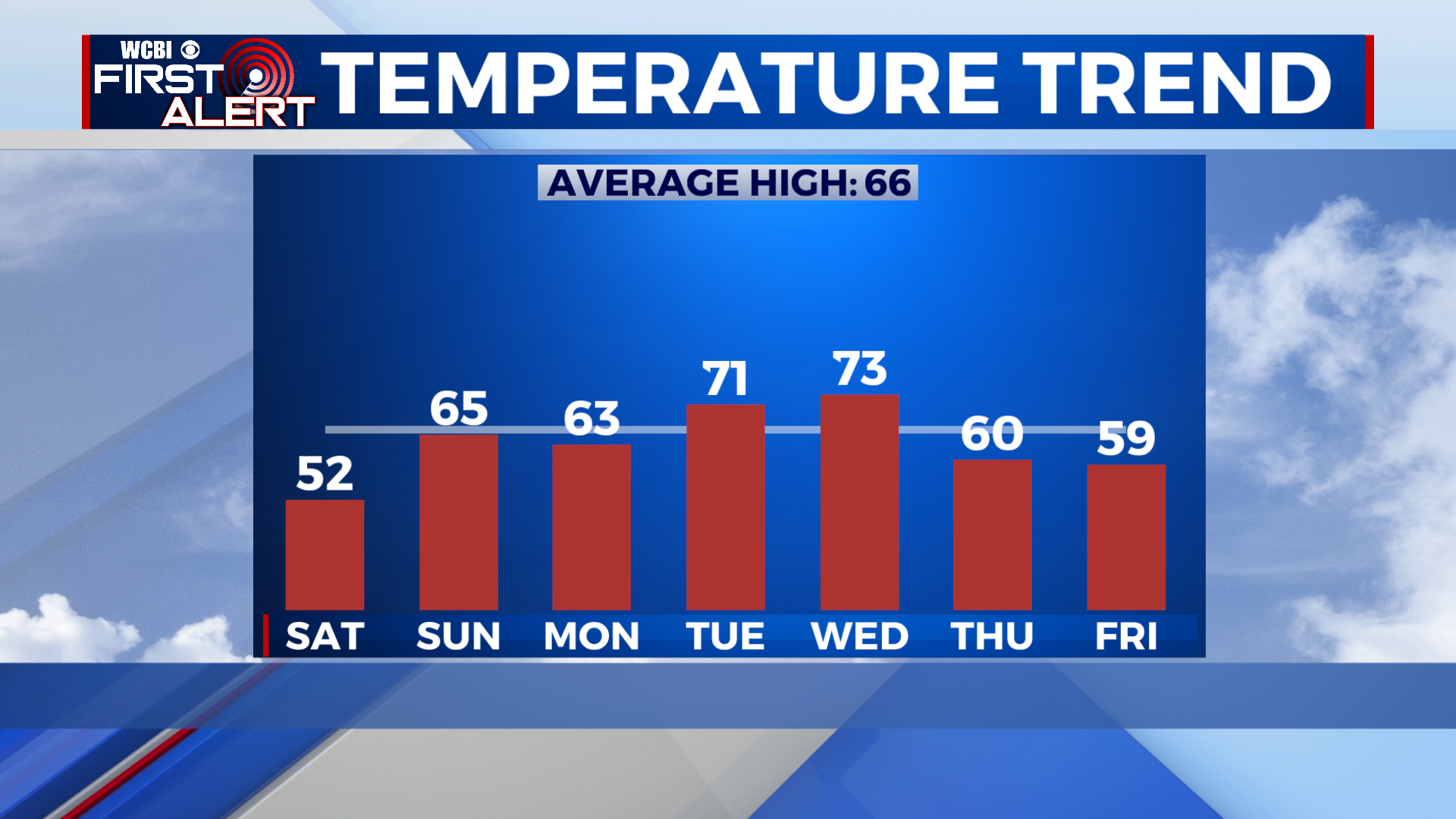
SUMMARY: Chilly and sunny weather will stick around for the weekend, with a frost/freeze likely Saturday night. Things moderate as we start the new work week, with temperatures gradually warming into the 70s by Wednesday. A late week cold front will bring rain chances for Thursday and cooler weather to finish out the week.
SATURDAY: A very cool day in store with lots of sunshine. Highs will top out in the upper 40s to near 50 north, with low 50s along US-82 and south. Winds from the NW at 5-10mph.
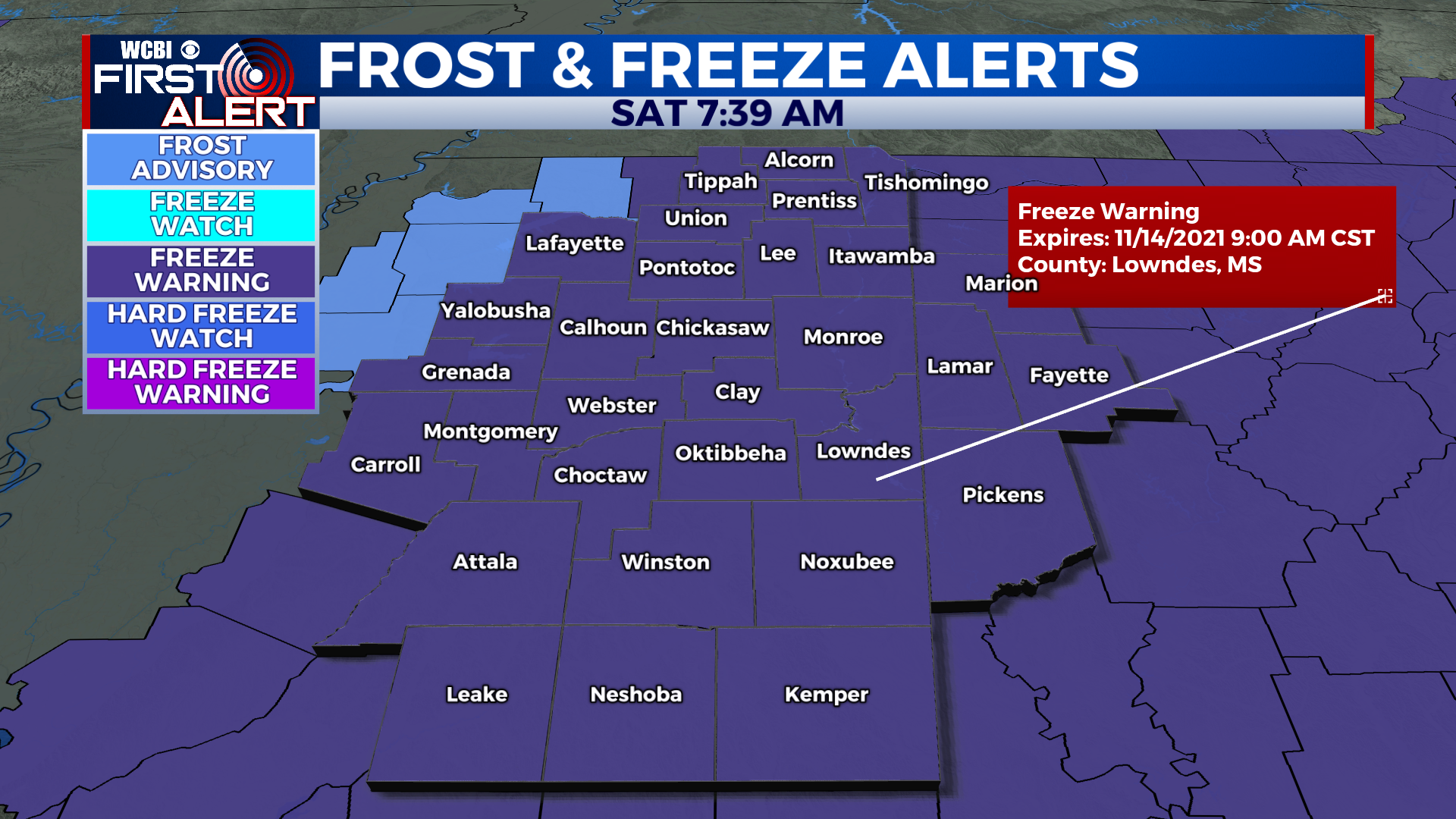
SATURDAY NIGHT: Dry air, clear skies, and light winds will allow our temps to plummet for Saturday night. The first widespread freeze of the season is likely, with freeze warnings in effect for our entire area. Lows will drop to 28-32 degrees, and widespread frost is expected. This will likely end the growing season for many locations, so bring in any sensitive plants tonight!
SUNDAY: A nice recovery for Sunday afternoon, with sunny skies and highs reaching the low to mid 60s.
SUNDAY NIGHT: Chilly once again for Sunday night, but a freeze is not expected. Lows will be in the mid to upper 30s, with only a patchy light frost possible in very sheltered locations. Skies remain clear.
MONDAY TO FRIDAY: More clouds on Monday will keep us a bit cooler, in the low 60s for the afternoon. Lows warm into the 40s Monday night. 70s make a comeback for Tuesday, as mild air is brought into the region ahead of a cold front. By Wednesday, clouds will be on the increase, and it looks mostly cloudy by Wednesday afternoon with temps in the 70s. The front brings scattered showers on Thursday with temperatures falling from around 60 in the morning to the 40s by the afternoon. Friday looks much cooler, with lows in the 30s and highs in the 50s with lingering cloud cover.
CONNECT WITH @WCBIWEATHER ON TWITTER, FACEBOOK AND INSTAGRAM