Clearing for weekend, more storms next week
COLUMBUS, Mississippi (WCBI) – Friday morning storms clear out, and the spring season will begin quietly over the weekend.
FRIDAY: Showers and storms in the morning move out gradually before midday, leaving a clearing sky and increasing southwest breezes. There remains a small risk of a few storms along the front near the MS/AL line after 4p, but this potential remains conditional. Even if storms form, there’s only a brief window of opportunity to reach severe limits in the WCBI coverage area. Daytime highs should reach the 70s by afternoon as the sky remains partially to mostly sunny.
WEEKEND: Any clouds Saturday should gradually clear up before lunch, leaving a mostly sunny and breezy afternoon with highs in the 60s. Sunday starts chilly in the 30s with patchy frost possible, but highs rebound into the low 70s with full sun.
MONDAY: Clouds slowly increase through the day, but the weather stays dry with highs in the 70s.
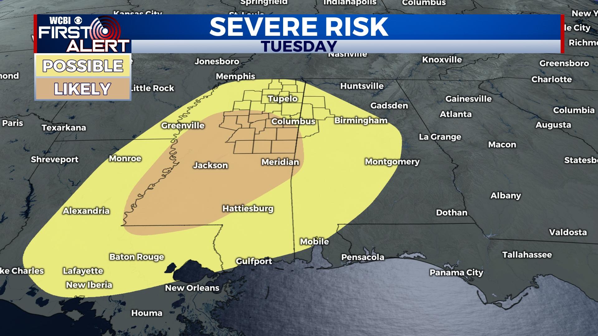
TUESDAY: While much of the day should be cloudy, warm and increasingly unstable air will build across the state through the day. Showers and storms become likely in the afternoon and evening hours, with some storms likely reaching severe limits with all hazards possible. While many smaller scale factors could increase or inhibit the threat, this system still should be monitored for significant severe potential.
WEDNESDAY: Clouds will be slow to clear behind Tuesday’s rain and storms, but temperatures stay near normal in the lower 70s.