Clouds depart and somewhat warmer temperatures arrive this weekend
COLUMBUS, Mississippi (WCBI) – SUMMARY: We had a mix of sun and clouds today, but we were at least somewhat warmer than yesterday afternoon. Today’s highs reached the upper-50s.
TONIGHT: Partly cloudy and seasonably cool with lows in the upper-30s. Isolated frost possible north. North wind 3-5 mph.
SATURDAY: Sunny and warmer with highs in the low-60s. North wind 3-5 mph.
SATURDAY NIGHT: Clear and seasonable with lows in the upper-30s. Areas of frost possible. North wind 3-5 mph, becoming calm overnight.
SUNDAY: Sunny and warmer with highs in the upper-60s. North wind 3-5 mph.
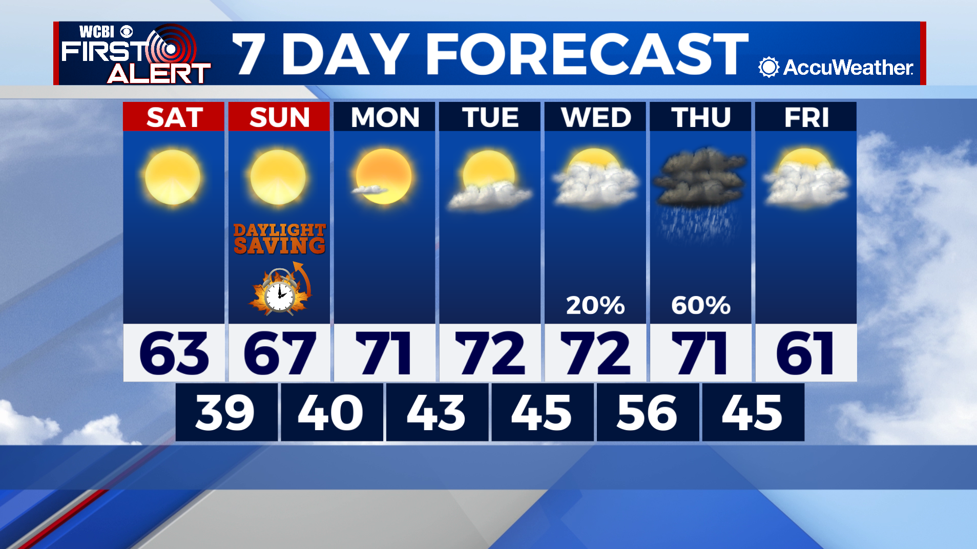
NEXT WEEK: Monday will start off the week sunny and warmer with highs in the low-70s. Forecast models are in relatively high agreement that our next chance of rain will arrive Thursday with scattered showers likely. A few rumbles of thunder will also be possible, but this will not be a severe weather producer. Much cooler air arrives behind this system with highs likely in the 50s once again next weekend.

COLLEGE FOOTBALL: Our gameday forecast features pleasant weather for all of our regional games. Temperatures will likely be cool at times, so prepare accordingly.
TROPICS: Tropical Storm Wanda continues in the North Atlantic, but is expected to dissipate soon. Elsewhere across the Atlantic and Gulf of Mexico, all is quiet and tropical storm formation is not expected through this weekend.