Cloudy skies and rain chances for Monday
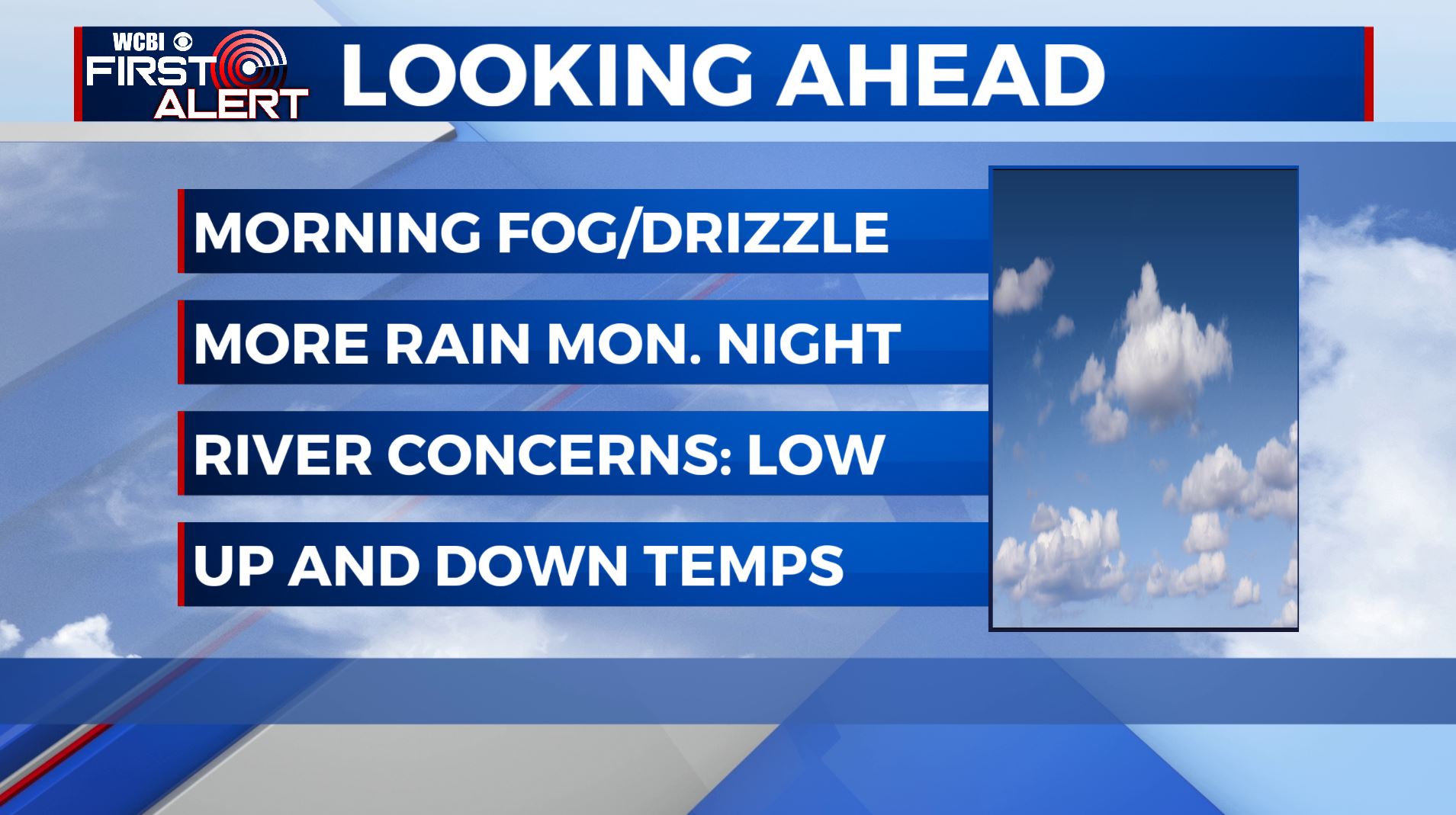
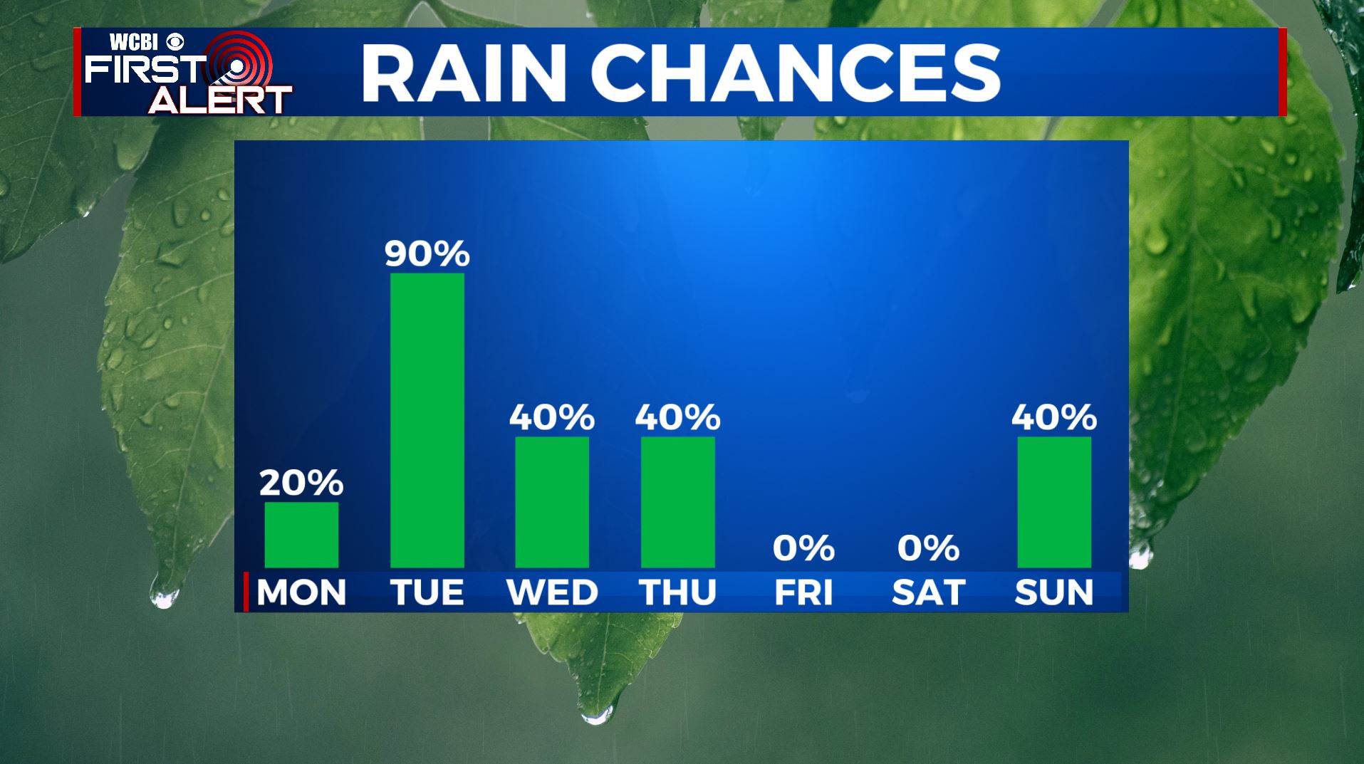
MONDAY: Look for highs in the lower 60s with a mostly cloudy sky after some morning drizzle and fog. SE winds 5-10 mph.
MONDAY NIGHT: Scattered showers and a few storms move in again Monday evening into Monday night. Overnight lows are in the upper 50s. S winds 5-10 mph.
TUESDAY: Scattered to numerous showers and storms will push through the area throughout the day. Temperatures climb into the 60s with some spots into the low 70s possible. Expect a mostly cloudy to cloudy sky with rain possible region-wide. May hear a few rumbles of thunder but no severe weather is expected.
TUESDAY NIGHT: By the time the rain ends late Tuesday night into Wednesday morning, we’ll have between a quarter of an inch to half an inch in rain amounts. Overnight lows in the 40s.
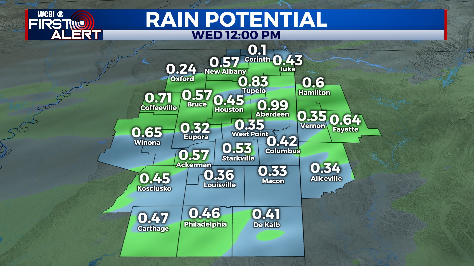
WEDNESDAY– THURSDAY: There may be some lingering showers Wednesday morning south of US-82, but the day overall trends drier. Wednesday evening more rain moves in, becoming widespread Wednesday night. Widespread rain showers continue into Thursday. Flooding is not an immediate concern, and rivers will not be overly burdened by this round of rain. Look for highs in the 40s and perhaps low 50s. Lows at night are in the 30s. Showers may add up to an additional inch of rain in the region, but most spots will see less.
FRIDAY –SATURDAY: Things trend dry with sunshine Friday and Saturday. Highs in the 50s. Chilly overnight lows in the 30s.
SUNDAY: By Sunday odds are in our favor for another rain event to move in. We’ll watch closely and keep you updated. Highs in the upper 50s.


Leave a Reply