Cold front brings rain chances then nice weather for long holiday weekend
SUMMARY: A cold front will bring a few showers and storms for our Friday as it pushes through. The front will usher in behind it sunny, nice and less humid weather for the long Labor Day holiday weekend.
FRIDAY: A mix of sun & clouds with a chance of a few showers and storms as a cold front pushes through. Most of the activity should be on the way out heading into the evening and that bodes well for the high school football games. Highs ahead of the front are going to be in the lower 90s with heat index values near 100.
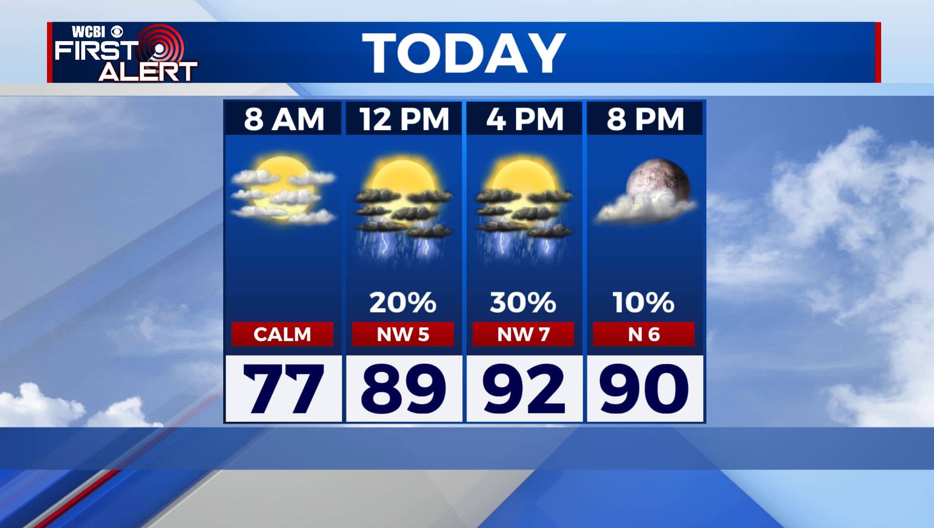
FRIDAY NIGHT: Partly cloud skies and quiet weather overnight. Much cooler overnight/early morning lows in the 60s.
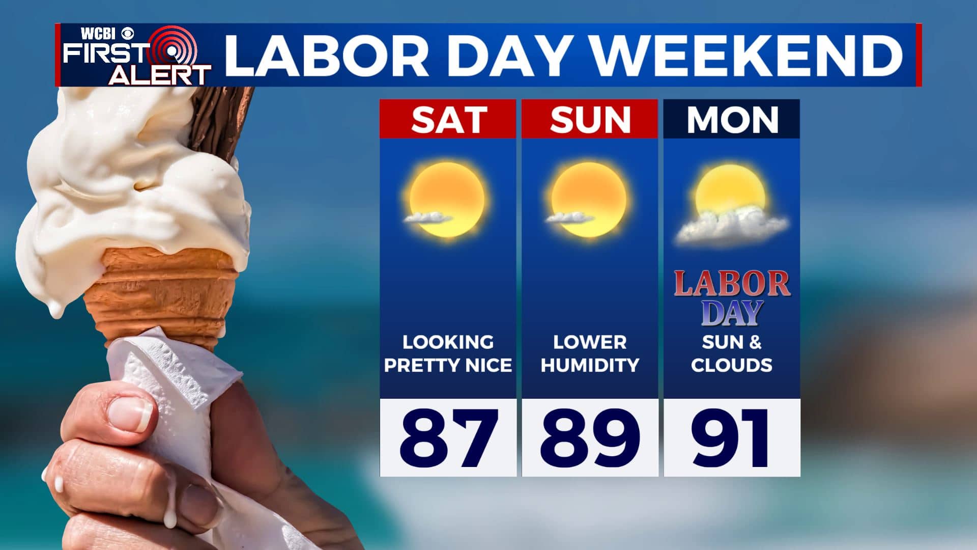
SATURDAY: Mostly sunny skies and very pleasant. Warm with highs in the mid to upper 80s, but the lower humidity level will make it feel pretty good outside.
SATURDAY NIGHT: Clear skies and very cool. Overnight lows in the lower 60s. Some spots could get down to the upper 50s by Sunday morning.
SUNDAY: Still very nice with a mix of sun & clouds. Still warm with highs in the upper 80s to near 90.
SUNDAY NIGHT: Staying quiet and comfortable. Overnight lows in the upper 60s.
LABOR DAY: Sunshine with some clouds at times and warm. Highs in the lower 90s. A few isolated storms are possible.
TUESDAY-THURSDAY: Various forecast models suggest that there could be some rain & storms coming our way followed by a bit of a cool down for the end of the week. Data is still very uncertain so it’s hard to tell what will pan out. Stay tuned!
Stay connected with @WCBIWEATHER on Facebook, Twitter, Instagram, and the WCBI News App


Leave a Reply