Cold front brings rain for Friday then a cooler weekend
SUMMARY: A cold front will be bringing in a chance of rain for our Friday. Looking ahead to the weekend, Saturday may end up cloudy and cool with highs only in the upper 60s. Warmer air starts moving back in Sunday as we rebound to the 70s with a mix of sun & clouds. Another cold front could give the region more rain and storms by the middle of next week along with another possible shot of cooler fall temperatures, but details remain unclear at this time.
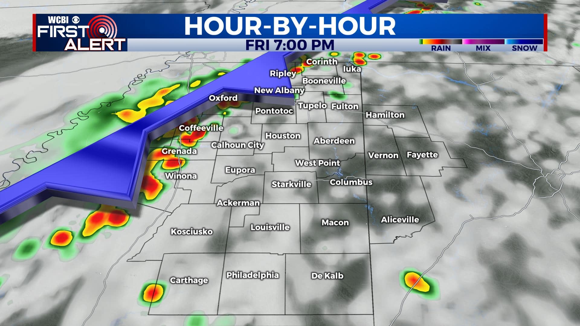
FRIDAY: After a week of sunny skies & very warm temperatures, some changes are on the way as we end the workweek as a cold front will be pushing through later on today. Expect rain chances & then some cooler temperatures. Winds SE 5-10 mph.
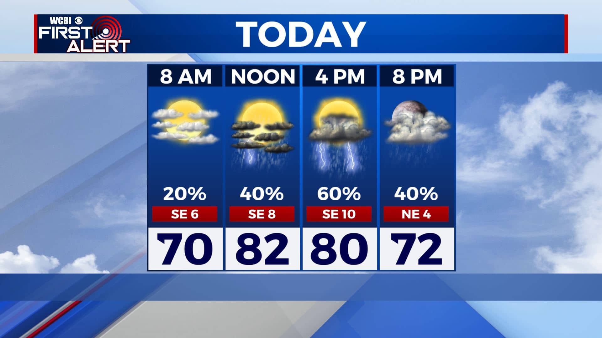
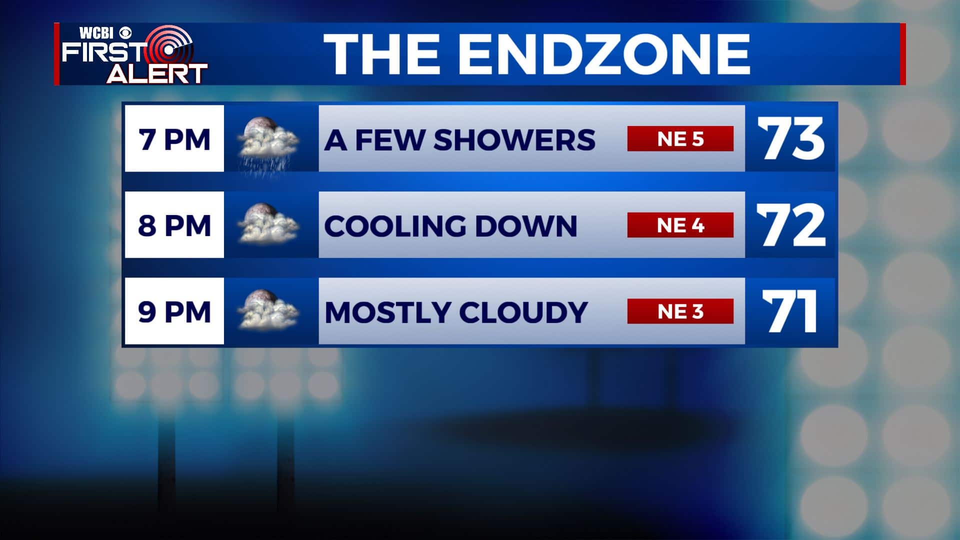
FRIDAY NIGHT: Our cold front will be pushing through late afternoon into the evening hours. Expect some rain chances & some rumbles of thunder. Keep the rain poncho handy just in case you’re heading out for the football games or any Friday evening plans. Mostly cloudy with some lingering showers possible overnight. Lows near 60.
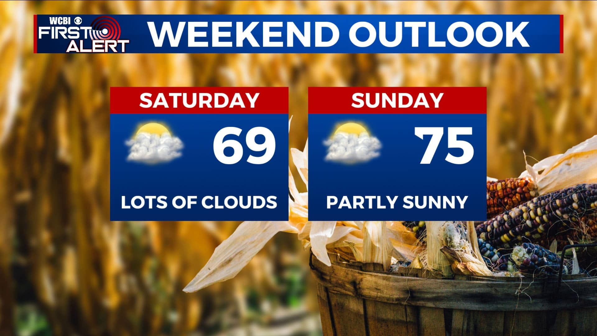
SATURDAY: A few spotty showers or areas of drizzle are possible early morning. Cloudy overcast skies throughout the day. Much cooler with highs in the upper 60s.
SATURDAY NIGHT: Mostly cloudy skies. Lows in the upper 50s to lower 60s.
SUNDAY: Morning clouds with more sunshine by the afternoon. Highs rebound back into the mid 70s.
NEXT WEEK: Confidence is remaining low due to data being all over the place with a possible pattern shift depending on a strong cold front that could push through midweek. We’re going to keep mild air in the forecast along with the chance of some rain. Temperatures could trend colder but this forecast remains subject to change. Stay tuned!
Stay connected with @WCBIWEATHER on Facebook, Twitter, Instagram, and the WCBI News App


Leave a Reply