Cold front brings rain & storm chances for Monday
SUMMARY: Rain and storms are likely as we begin a new week as a cold front pushes through the region. Slightly cooler & drier air builds in for the middle of the workweek before the humidity and storm chances returns for the weekend.
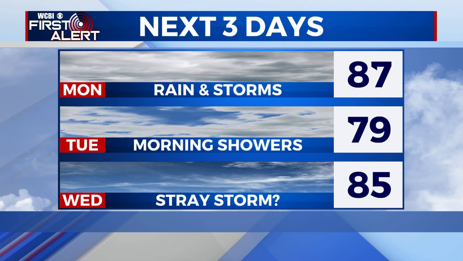
MONDAY: Rain and storm chances are likely for the rest of our Monday as our cold front moves through the region. Some storms could be on the strong side at times producing gusty winds and heavy downpours. Highs in the mid to upper 80s. Winds SW 10-15 mph.
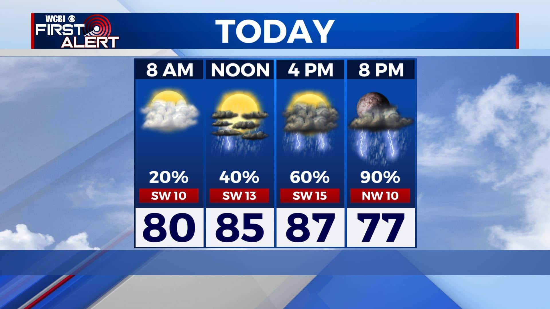
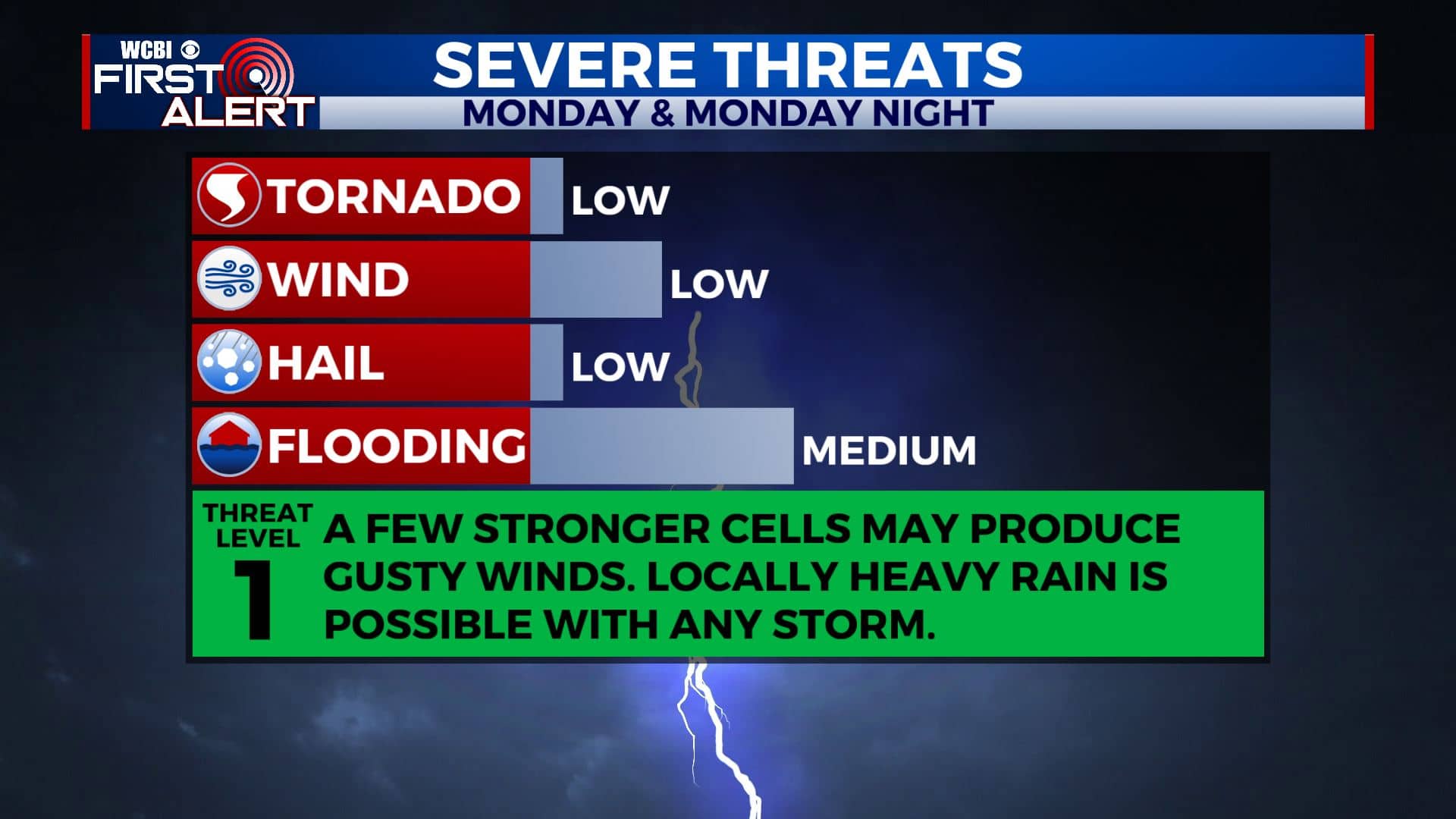
MONDAY NIGHT: Areas of rain and storms. Lows in the mid 60s. Winds will switch up to the NW 5-15 mph behind the cold front.
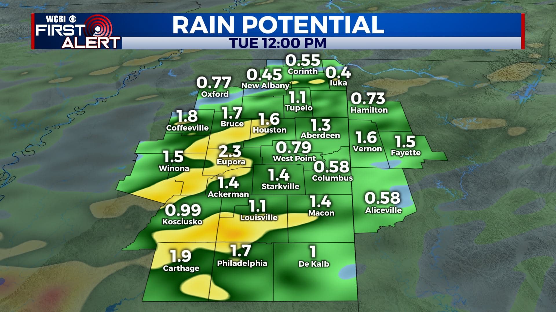
TUESDAY: Mostly cloudy with lingering showers during the morning. Gradual clearing and drying out into the afternoon. Highs slightly cooler in the upper 70s to around 80.
TUESDAY NIGHT: Mainly clear and quiet. Overnight lows in the lower 60s.
WEDNESDAY & THURSDAY: Mostly sunny and drier. A stray shower or storm is possible. Highs in the upper 80s. Lows around 70 degrees.
FRIDAY – SUNDAY: Partly cloudy with a chance of summertime afternoon showers and storms each day. Highs near 90. Overnight lows in the lower 70s.
Stay connected with @WCBIWEATHER on Facebook, Twitter, Instagram and the WCBI News App


Leave a Reply