Colder Air & Rain Arrives Tonight
COLUMBUS, Mississippi (WCBI) – A cold front will move through tonight and cause temperatures to drop significantly.
TONIGHT: Windy and chilly! The cold front will drift in, but another small disturbance will also approach our area. This disturbance will cause a complex of showers to move in from the southwest by 10 PM. Light to moderate rainfall is possible overnight. Temperatures will be much cooler. Low near 42°.
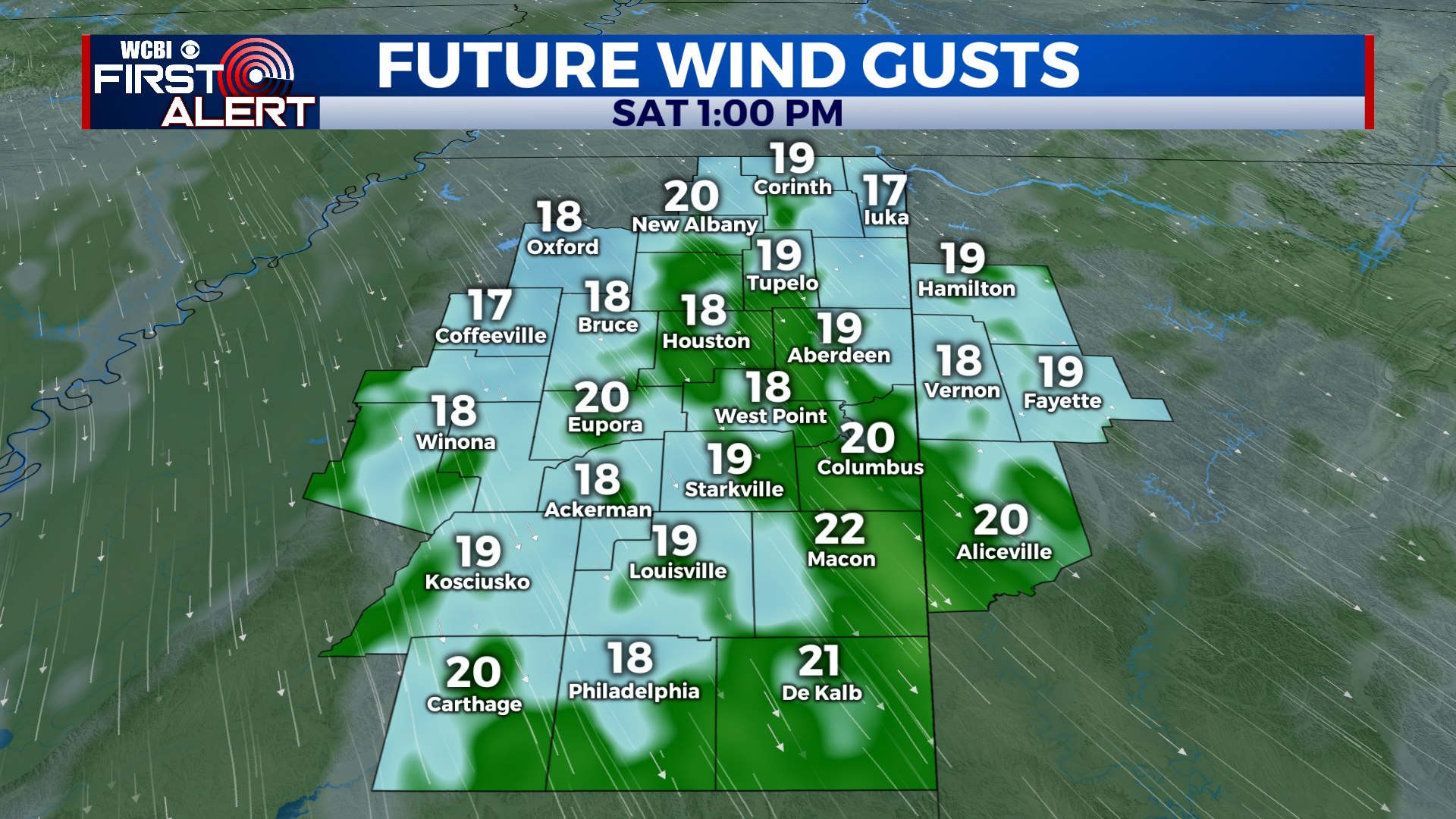
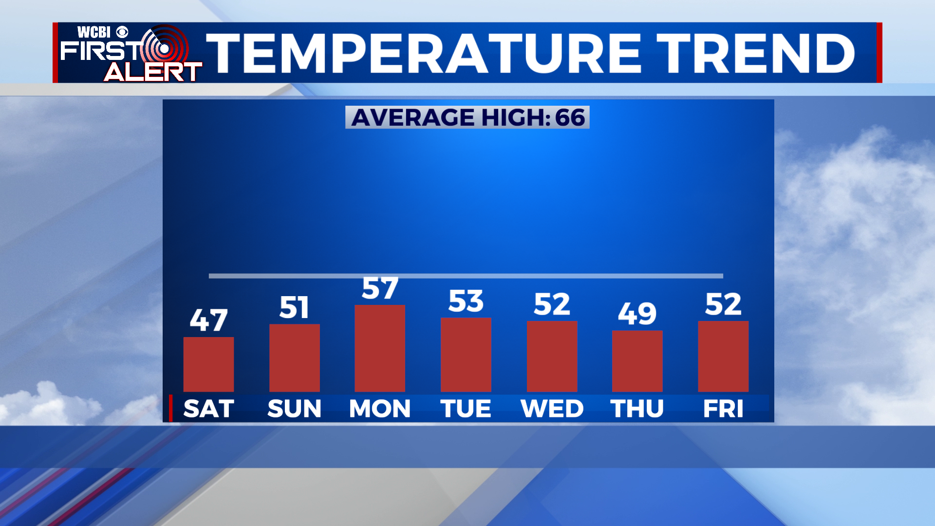
SATURDAY: Windy and chilly! The last of the showers should exit the region by 8 AM. Cloud cover will hang around for a little bit longer, though. The good news is, skies are expected to clear by mid-afternoon and we’ll be dry for the rest of the day. Temperatures will be MUCH colder though. We’ll only reach a high near 47°!
SUNDAY: Frost is likely in the morning. After that, we’ll see clear skies and lots of sunshine. Temperatures will still be chilly, though. High near 51°.
NEXT WEEK: Cooler weather continues! Our next chance for rain will be Monday night and into Tuesday morning as another system arrives. High temperatures will generally stay in the low 50s, with overnight lows in the 30s and 40s.
Have a great night!