Cooler air arrives, more rain by Sunday
COLUMBUS, Mississippi (WCBI) – SUMMARY: Thursday’s cold front will bring scattered rain and much cooler air to the region. The next chance of rain arrives Sunday afternoon.
THURSDAY: Temperatures will sharply fall behind a cold front later this morning. Along and just behind the front, scattered showers are possible. Afternoon temperatures may very well be in the 40s to lower 50s for the Golden Triangle. In areas seeing faster clearing northwest of the Natchez Trace, temperatures may recover into the middle 50s.
THURSDAY NIGHT: The sky will clear out for everyone as temperatures drop into the 30s, nearing freezing for some.

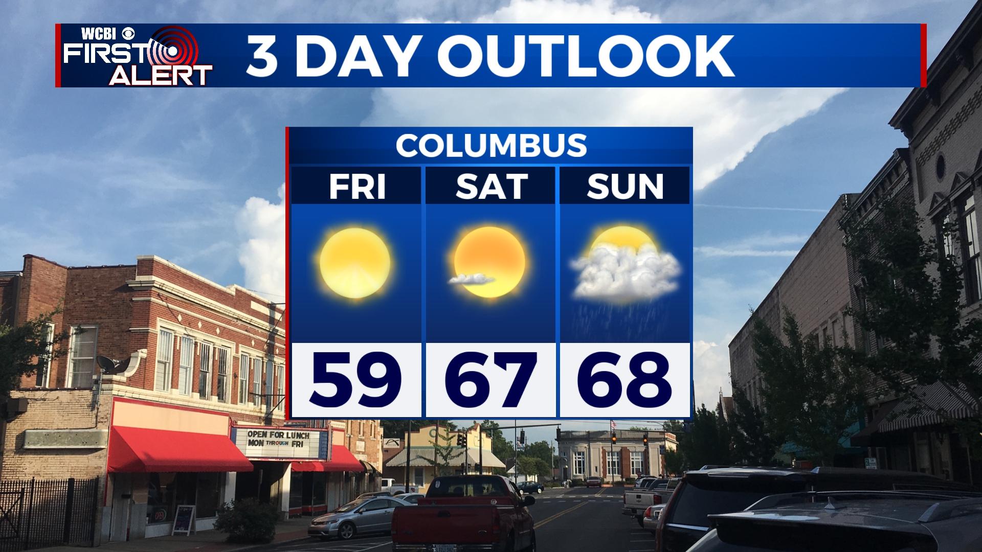
FRIDAY: Mainly sunny and pleasant with highs in the upper 50s.
WEEKEND: Saturday looks absolutely fantastic with highs in the mid to upper 60s and sunshine. Sunday starts dry, but showers become likely in the afternoon and evening hours with another cold front.
NEXT WEEK: Any showers will clear out early Monday, leaving a clearing sky and MUCH colder air. Highs will struggle into the lower 50s. By Tuesday morning, a harder freeze is expected as lows drop into the 26-30 degree range. Once again, highs will struggle to reach the low 50s Tuesday afternoon. A gradual warm-up is expected into the middle of the week, but Thanksgiving’s forecast still remains uncertain.