Cooler but clearer end to the week
COLUMBUS, Mississippi (WCBI) – Colder air rushed in behind yesterday’s cold front, making a noticeably cooler difference in temperatures for the second half of the week. There will be a weekend warm up, leading into an active week.
WEDNESDAY NIGHT: Cooler and remaining breezy. That cold breeze will maintain overnight, as temperatures fall into the lower 40s. Throw on an extra layer if planning on going out late tonight or early tomorrow morning.
THURS/FRI: High temperatures in the middle 60s will continue. Sky conditions will be staying mostly clear and definitely dry to finish out the week. Looking to drop overnight temps into the 30s for Friday and Saturday morning. Be aware of patchy frost both mornings.
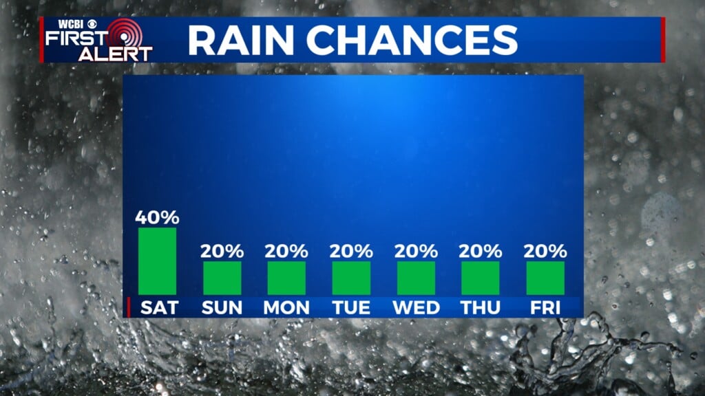
WEEKEND: Saturday will start to warm up some, reaching highs into the upper 60s/lower 70s. By late Saturday, a few clouds may start to fill in overnight. Sunday morning temps will be chilly, in the middle 40s. By the afternoon, Sunday’s high temp hopes to reach back into the middle 70s. There will be a chance for showers and potentially a few thunderstorms overnight Sunday and continuing into next week.